Fultondale, Alabama
Fultondale: City in Jefferson County, Alabama
About
Fultondale is a city located in the county of Jefferson in the U.S. state of Alabama. Its population at the 2010 census was 8,380. After 10 years in 2020 city had an estimated population of 9,269 inhabitants.
The city was created 79 years ago in 1946.

Quick Facts about Fultondale
| Population | 9,269 (2020) |
| Country | United States of America |
| State | Alabama (United States) |
| County | Jefferson County |
| Postal code | 35068 |
| Phone Area Codes | 205 |
| Water as percent of area | 0% |
| Land as percent of area | 100% |
| Latitude & Longitude | 33.6048,-86.7939 |
| Altitude | 610 feet / 186 meters |
| Establishment | January 01, 1947 (79 years ago) |
| Time Zone | America/Chicago |
| Local time | 08:53:21 (14th July 2026) |
| Population growth | 9.59% (2010-2020) |
| Weather | 86℉ Slight Chance Showers And Thunderstorms then Chance Showers And Thunderstorms 7-days weather |
Geography
Fultondale is located at 33°36'17"N 86°47'38"W (33.6048300, -86.7938800).
Fultondale map
Weather
A slight chance of showers and thunderstorms before 7am, then a chance of showers and thunderstorms between 7am and 1pm, then showers and thunderstorm...
7-Day ForecastOfficial website of Fultondale
Official WebsiteDemographics
The population of Fultondale increased by 9.59% in 10 years.
| Year | Population | % Change | Method |
|---|---|---|---|
| 2010 | 8,380 | - | census |
| 2011 | 8,435 | 0.65% | estimation process |
| 2012 | 8,550 | 1.35% | estimation process |
| 2013 | 8,757 | 2.36% | estimation process |
| 2014 | 8,907 | 1.68% | estimation process |
| 2015 | 9,059 | 1.68% | estimation process |
| 2016 | 9,115 | 0.61% | estimation process |
| 2017 | 9,183 | 0.74% | estimation process |
| 2018 | 9,229 | 0.5% | estimation process |
| 2019 | 9,284 | 0.59% | estimation process |
| 2020 | 9,269 | -0.16% | estimation process |
Demographic Facts
| Estimated population as of July 1, 2019 : | 9,284 |
| Based on demographic estimates as of April 1, 2010 : | 8,372 |
| Based on demographic estimates as of 1 April 2010 : | 10.9% |
| April 1, 2020 Population : | 9,876 |
| April 1, 2010 Population : | 8,380 |
| People under 5 years old, percentage : | 7.5% |
| People under 18 years old, percentage : | 20.0% |
| People over 65 (%) : | 14.3% |
| Female persons, % : | 49.6% |
| White only, percent : | 67.4% |
| Black or African American alone, percent : | 18.0% |
| American Indian and Alaska Native only, % : | 0.8% |
| Asians alone % : | 4.1% |
| Only Native Hawaiians and Other Pacific Islanders, % : | 0.1% |
| % of people who have participated in two or more races : | 1.6% |
| % of Hispanic or Latino : | 10.2% |
| White people, not Hispanic or Latino people, make up the majority of the population. : | 64.9% |
| 2015-2019 Veterans : | 520 |
| Percentage of foreign-born people, 2015-2019 : | 9.3% |
| Rate of owner-occupied housing units, 2015-2019 : | 68.4% |
Economic Facts
| Rate of owner-occupied housing units, 2015-2019 : | 68.4% |
| Owner-occupied housing unit median value, 2015-2019 : | $147,700 |
| From 2015 to 2019, the median selected monthly owner costs - with a mortgage : | $1,224 |
| Monthly owner costs, without a mortgage, at the median, 2015-2019 : | $374 |
| 2015-2019 median gross rent : | $993 |
| 2015-2019 Households : | 3,879 |
| Population per household, 2015-2019 : | 2.37 |
| Living in the same house a year ago, percentage of people aged one year and up, 2015-2019 : | 90.5% |
| Languages other than English spoken at home, as a percentage of people aged 5 and up, 2015-2019 : | 14.3% |
| Households with computers, %, 2015-2019 : | 93.9% |
| Percentage of households with a broadband Internet subscription, 2015-2019 : | 88.2% |
| Percentage of people aged 25 and up with a high school diploma or higher, 2015-2019 : | 87.3% |
| Bachelor's degree or higher, proportion of people aged 25 and up, 2015-2019 : | 23.4% |
| Percentage of people under the age of 65 who have a disability, 2015-2019 : | 6.4% |
| Persons under the age of 65 who do not have health insurance, as a percentage : | 14.1% |
| Total civilian labor force, percent of population aged 16 and up, 2015-2019 : | 65.3% |
| Female labor force participation in the civilian labor force, as a percentage of the population aged 16 and up, 2015-2019 : | 59.3% |
| Total receipts/revenue for health care and social assistance in 2012 ($1,000) : | 11,332 |
| Manufacturers' total shipments in 2012 ($1,000) : | 7,336 |
| 2012 total retail sales ($1,000) : | 186,595 |
| 2012 total retail sales per capita : | $21,773 |
| Mean commute time to work (in minutes), workers aged 16 and up, 2015-2019 : | 23.7 |
| 2015-2019 median household income (in 2019 dollars) : | $62,825 |
| Income per capita in the previous 12 months (in 2019 dollars), 2015-2019 : | $29,445 |
| Percentage of people living in poverty : | 10.6% |
| Total number of businesses in 2012 : | 877 |
| Men-owned businesses in 2012 : | 527 |
| Women-owned businesses in 2012 : | 274 |
| Minority-owned businesses in 2012 : | 159 |
| Non-minority-owned businesses in 2012 : | 680 |
| Veteran-owned businesses in 2012 : | 85 |
| Nonveteran-owned businesses in 2012 : | 723 |
| 2010 population per square mile : | 687.1 |
| 2010 land area in square miles : | 12.20 |
Best Things to Do in Fultondale
1Children's Park
2408 Stouts Rd, Fultondale, AL 35068, United States View details
Phone: +12058414481 | Website available

2Black Creek Park
777 Yarbrough Rd, Fultondale, AL 35068, United States View details
Phone: +12058414481 | Website available

Where to Eat in Fultondale
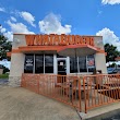
1Whataburger
1601 Main St, Fultondale, AL 35068, United States View details
Phone: +12058492933 | Website available
2Full Moon Bar-B-Que
1428 Old Walker Chapel Rd, Fultondale, AL 35068, United States View details
Phone: +12058494422 | Website available

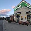
3O'Charley’s Restaurant & Bar
1709 Fulton Rd, Fultondale, AL 35068, United States View details
Phone: +12058496401 | Website available
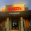
4Outback Steakhouse
1725 Fulton Rd, Fultondale, AL 35068, United States View details
Phone: +12058490155 | Website available
5Logan's Roadhouse
3387 Lowery Pkwy, Fultondale, AL 35068, United States View details
Phone: +12058490313 | Website available

Where to Stay in Fultondale
1Days Inn by Wyndham Fultondale
616 Decatur Hwy, Fultondale, AL 35068, United States View details
Phone: +12058490111 | Website available

2Fairfield Inn & Suites by Marriott Birmingham Fultondale/I-65
1795 Morris Ave, Fultondale, AL 35068, United States View details
Phone: +12058498484 | Website available

3Holiday Inn Express & Suites Birmingham North - Fultondale, an IHG Hotel
1701 Main St, Fultondale, AL 35068, United States View details
Phone: +12058490047 | Website available

4La Quinta Inn & Suites by Wyndham Fultondale Birmingham N
1207 Boots Blvd, Fultondale, AL 35068, United States View details
Phone: +12059498700 | Website available

5Econo Lodge
624 Decatur Hwy, Fultondale, AL 35068, United States View details
Phone: +12058749689 | Website available

Services and Civic Places in Fultondale
1Fultondale City Hall
1210 Old Walker Chapel Rd, Fultondale, AL 35068 View details
Phone: +12058414481 | Website available

People born in Fultondale (1)
American-football player (1993-) ArDarius Stewart was born in Fultondale
Nearby Schools and Colleges
Schools and campuses linked to Fultondale, AL. Select a name to open its map and contact details.
| Code | Name | City | ZIP |
|---|---|---|---|
| 371034 | Alabama State College of Barber Styling | Gardendale (AL) | 35071 |
Nearby Transit Stations (5)
Rail and bus stations connected to Fultondale, AL. Select a station to open its map and address details.
| Code | Name | Address | Type |
|---|---|---|---|
| BHM | Birmingham | 1819 Morris Ave. | RAIL |
| BRR | Brent, AL | 10393 Alabama Highway 5 | BUS |
| TCL | Tuscaloosa | 2105 Greensboro Ave | RAIL |
| ATN | Anniston | 126 West 4th St | RAIL |
| MAA | Marion, AL | 26400 Alabama Highway 14 | BUS |
Closest post offices linked to Fultondale.
| Post Office Name | City | ZIP |
|---|---|---|
| Fultondal Post Office | Fultondale (AL) | 35068 |
Other cities in Jefferson County
Cities, towns, neighborhoods & other populated places in Jefferson County , AL. (more)
| City Name | Population | Title |
|---|---|---|
| Birmingham | 206,950 | The most populous city in Alabama. |
| Hoover | 85,959 | The most populous city in Jefferson County, Alabama. |
| Vestavia Hills | 34,317 | City in Jefferson and Shelby counties, Alabama, United States |
| Bessemer | 26,043 | City in Jefferson County, Alabama, United States |
| Homewood | 25,174 | City in Jefferson County, Alabama, United States |
| Trussville | 23,048 | City in Jefferson and St. |
| Mountain Brook | 20,413 | City in southeastern Jefferson County, Alabama |
| Center Point | 16,864 | City in Jefferson County, Alabama, United States |
| Hueytown | 15,202 | City in Jefferson County, Alabama, United States |
| Gardendale | 14,113 | City in Jefferson County, Alabama, United States |
| Irondale | 13,226 | Town in Alabama, United States |
| Leeds | 12,026 | City in Jefferson, St. |
| Pleasant Grove | 10,260 | City in western Jefferson County, Alabama |
| Forestdale | 10,162 | Unincorporated community in Alabama |
| Clay | 10,042 | City in Alabama, United States |
| Pinson | 7,060 | City in Jefferson County, Alabama, United States |
Distance to Other Cities
Fultondale distances to largest Alabama cities