How far is Winnsboro, SC from Myrtle Beach, SC?
The driving distance from Winnsboro, SC to Myrtle Beach, SC is about 171.1 miles (275.4 km), with a travel time of about 02h 51m by car.
- The straight-line flight distance is about 134.7 miles (216.8 km).
- For a round trip, plan for roughly 05h 42m of driving time before adding stops, traffic, or weather delays.
- A comfortable departure window is usually 8:00 AM to 10:00 AM EDT.
Reverse, save, or send this route
This route works well as a day trip with time at the destination. Copy the route link, send it to another device, or print a clean version before you head out.
This route works well as a day trip with time at the destination.
Flight Distance
Driving Distance
Gas Cost Calculator
Leave and Arrive Planner
Pick a departure time to see your estimated arrival and same-day return window.
Drive time stays fixed at 02h 51m.
A morning start gives you useful time at the destination and keeps the return out of the late evening.
You are leaving earlier than the recommended window, which gives you extra margin for breaks and traffic.
Halfway Point
A useful midpoint for breaks, coffee, or meeting in the middle.
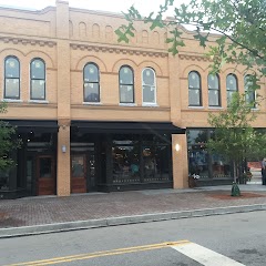
Town in South Carolina
Route Weather Snapshot
Check the forecast at both ends before you head out.
Mostly Sunny then Slight Chance Showers And Thunderstorms
Driving Route Map
The map below follows the saved road route between Winnsboro and Myrtle Beach.
Turn-by-Turn Driving Directions
Step-by-step road directions between Winnsboro and Myrtle Beach.
-
1
Start on North Congress Street
1.3 km · 1 min · North Congress Street
-
2
Continue on Columbia Road
1.5 mi · 2 min · Columbia Road
-
3
Continue on Columbia Road
137 m · 13 sec · Columbia Road
-
4
Turn left onto US Highway 321 South Bypass
1515 ft · 31 sec · US Highway 321 South Bypass
-
5
Turn left
6.1 mi · 8 min
-
6
Take the ramp straight
2071 ft · 51 sec
-
7
Merge slight left
14.8 mi · 16 min
-
8
Keep slight left to continue on Charles F Bolden Freeway
3 mi · 4 min · Charles F Bolden Freeway
-
9
Take the exit slight right toward I 20 East: Florence
3218 ft · 1 min
-
10
Keep slight left to continue on I 20 East: Florence
3087 ft · 1 min
-
11
Merge slight left
66.9 mi · 1 hr 14 min
-
12
Turn left onto West Palmetto Street
22.6 mi · 33 min · West Palmetto Street
-
13
Continue straight
3.1 mi · 4 min
-
14
Continue straight
41.9 mi · 55 min
-
15
Turn straight
2 mi · 4 min
-
16
Turn slight right onto 8th Avenue North
76 m · 15 sec · 8th Avenue North
-
17
Turn right onto North Kings Highway
1443 ft · 41 sec · North Kings Highway
-
18
Turn left onto 5th Avenue North
61 m · 11 sec · 5th Avenue North
-
19
Turn right
60 m · 14 sec
-
20
Arrive at your destination
0 m · 1 sec
Car Route Details
A richer read on the saved driving route between Winnsboro and Myrtle Beach.
Straightforward drive
The saved road route has a manageable number of maneuvers and should be easy to follow with normal attention to signs.
I 20 East
Merge slight left
66.9 mi · 01h 14m
Route Summary
A quick read on whether this route feels easy, ambitious, or worth planning around.
A comfortable day-trip route
This route works well as a day trip. You can leave in the morning, spend meaningful time at the destination, and still return the same day.
Mostly Sunny leaving Winnsboro and Mostly Sunny then Slight Chance Showers And Thunderstorms near Myrtle Beach.
Trip Questions
Direct answers travelers usually want before committing to the drive.
How long does it take to drive from Winnsboro to Myrtle Beach?
The road trip is about 171.1 miles (275.4 km) and usually takes 02h 51m in normal driving conditions.
Is this a same-day trip or an overnight route?
This route works well as a day trip. You can leave in the morning, spend meaningful time at the destination, and still return the same day.
What is the halfway point on this route?
Lamar is a useful midpoint, sitting about 82.5 miles from Winnsboro and 88.6 miles from Myrtle Beach.
How much longer is the road route than the straight-line distance?
The direct path is about 134.7 miles (216.8 km), while the road route adds roughly 36.4 extra miles because roads do not follow the straight air line.
When is the best time to leave for this route?
A good departure window is usually 8:00 AM to 10:00 AM EDT. If you want a more comfortable same-day return, try to leave by 12:48 PM EDT.
How much will gas cost for this route?
Using about 28.3 MPG, regular gas is estimated at $23.92 one way or $47.85 round trip. Estimated CO2 is about 53.7 kg one way.
What should you check before leaving?
Before you leave, expect Mostly Sunny around Winnsboro and Mostly Sunny then Slight Chance Showers And Thunderstorms near Myrtle Beach.
Stop Ideas Near Lamar
Useful break, food, and waypoint ideas within about 15 miles of the route midpoint.
Town Hall
Florence City Manager
Bishopville City Hall
Transit and Meeting Points
Useful pickup, handoff, or rendezvous points close to Lamar.
Florence
Camden
Kingstree
Dillon
Flight Path Map
This map shows the direct air route between Winnsboro and Myrtle Beach. Straight-line distance: 134.71 mi (216.8 km).

#1 Winnsboro
Town in South Carolina
| Population | 3,130 |
| Coordinates | 34.3807000, -81.0864800 |
| Altitude | 163 |
| Country | United States |

#2 Myrtle Beach
Coastal city in South Carolina, United States
| Population | 35,555 |
| Coordinates | 33.6890600, -78.8866900 |
| Altitude | 8 |
| Country | United States |
End: North Kings Highway (-78.887105, 33.689329)
Estimated Travel Time
Distance: 275 km by road
| Speed | Time |
|---|---|
| 30 mph (48.3 km/h) | 05h 42m |
| 40 mph (64.37 km/h) | 04h 16m |
| 50 mph (80.47 km/h) | 03h 25m |
| 60 mph (96.56 km/h) | 02h 51m |
| 70 mph (112.65 km/h) | 02h 26m |
| 80 mph (129 km/h) | 02h 08m |
Fuel, Round Trip and CO2
Estimated fuel cost and emissions for this route.
| Fuel | $/gal | One way | Round trip |
|---|---|---|---|
| Regular gas | $3.96 | $23.92 | $47.85 |
| Mid-grade | $4.43 | $26.75 | $53.50 |
| Premium | $4.78 | $28.86 | $57.72 |
| Diesel | $5.62 | $33.97 | $67.94 |
Assumes 8.3 L/100 km (about 28.3 MPG). CO2 is an estimate and varies by vehicle, fuel blend, traffic, and terrain.
Prices in South Carolina · Jul 27, 2026
Distance to Other Cities
Planning a road trip? See the full trip guide on Trip.ovh — stops, fuel costs, weather, and departure timing.