How far is Wilton, CT from Danbury, CT?
Fastest route
The distance from Wilton, Connecticut, to Danbury, Connecticut is approximately 17.1 miles (27.5 kilometers). The fastest route, considering traffic conditions, will take around 28 minutes.
Directions
- 🚗 Head south on Lovers Ln toward CT-33 N.
- 🔄 Turn left onto CT-33 S/Ridgefield Rd.
- 🛣️ Continue on US-7 N to Danbury. Take exit 5 from I-84 E/US-7 N.
- 🚦 Use the left 2 lanes to turn left onto US-7 N.
- 🏢 Pass by Bruce Bennett Nissan (on the right in 4.6 mi) and keep right at the fork, following signs for US-7 N/I-84 E/New Milford/Waterbury, and merge onto I-84 E/US-7 N.
- 🔄 Take exit 5 toward CT-37/CT-39/CT-53/Downtown Danbury/Bethel.
- 🚙 Turn right onto Farview Ave, then left onto Robinson Ave, and finally right onto Library Pl. Turn left onto Danbury Ct to reach your destination.
Tips & Suggestions
- 🚦 Check the real-time traffic conditions to ensure the fastest route.
- ⛽ Make sure to have enough fuel for the journey.
- 🗺️ Familiarize yourself with the route beforehand to avoid confusion.
- 🚗 Observe speed limits and traffic rules for a safe trip.
- ☕ Consider bringing some snacks and drinks for the journey.
- 🚙 Take breaks if the journey is long to stay refreshed and alert.
- 📱 Keep your phone charged in case you need to use navigation apps during the trip.
Reverse, save, or send this route
This is an easy same-day return drive. Copy the route link, send it to another device, or print a clean version before you head out.
This is an easy same-day return drive.
Flight Distance
Driving Distance
Gas Cost Calculator
Leave and Arrive Planner
Pick a departure time to see your estimated arrival and same-day return window.
Drive time stays fixed at 00h 29m.
This is a short drive, so your comfort window is wide. Traffic and current weather matter more than the clock.
You are leaving earlier than the recommended window, which gives you extra margin for breaks and traffic.
Halfway Point
A useful midpoint for breaks, coffee, or meeting in the middle.
Route Weather Snapshot
Check the forecast at both ends before you head out.
Chance Showers And Thunderstorms
Chance Rain Showers
Driving Route Map
The map below follows the saved road route between Wilton and Danbury.
Turn-by-Turn Driving Directions
Step-by-step road directions between Wilton and Danbury.
-
1
Start on Lovers Lane
27 m · 13 sec · Lovers Lane
-
2
Turn sharp left onto Ridgefield Road
2010 ft · 58 sec · Ridgefield Road
-
3
Turn left onto Danbury Road
5 mi · 9 min · Danbury Road
-
4
Continue on Ethan Allen Highway
4.5 mi · 8 min · Ethan Allen Highway
-
5
Continue on Danbury Road
1.3 km · 2 min · Danbury Road
-
6
Continue on Sugar Hollow Road
3.1 mi · 5 min · Sugar Hollow Road
-
7
Take the exit slight right toward Park Avenue
1794 ft · 54 sec
-
8
Turn right onto Park Avenue
1.2 mi · 2 min · Park Avenue
-
9
At the end of the road, turn left onto Division Street
612 ft · 18 sec · Division Street
-
10
At the end of the road, turn right onto West Street
1676 ft · 36 sec · West Street
-
11
Turn left onto Terrace Place
782 ft · 37 sec · Terrace Place
-
12
Turn right onto Library Place
71 m · 10 sec · Library Place
-
13
Arrive at your destination
0 m · 1 sec · Library Place
Car Route Details
A richer read on the saved driving route between Wilton and Danbury.
Turn-heavy local drive
The route has frequent decision points for its length, so lane choice and turn timing will matter more than cruising speed.
Danbury Road
Turn left onto Danbury Road
5.04 mi · 00h 09m
Route Summary
A quick read on whether this route feels easy, ambitious, or worth planning around.
A short regional drive
This route is short enough to handle as a quick errand, commute, or easy same-day return without much planning overhead.
Chance Showers And Thunderstorms leaving Wilton and Chance Rain Showers near Danbury.
Trip Questions
Direct answers travelers usually want before committing to the drive.
How long does it take to drive from Wilton to Danbury?
The road trip is about 17.1 miles (27.6 km) and usually takes 00h 29m in normal driving conditions.
Is this a same-day trip or an overnight route?
This route is short enough to handle as a quick errand, commute, or easy same-day return without much planning overhead.
What is the halfway point on this route?
Ridgefield is a useful midpoint, sitting about 8 miles from Wilton and 9.1 miles from Danbury.
How much longer is the road route than the straight-line distance?
The direct path is about 13.8 miles (22.2 km), while the road route adds roughly 3.3 extra miles because roads do not follow the straight air line.
When is the best time to leave for this route?
A good departure window is usually 7:00 AM to 7:00 PM EDT. If you want a more comfortable same-day return, try to leave by 7:30 PM EDT.
How much will gas cost for this route?
Using about 28.3 MPG, regular gas is estimated at $2.37 one way or $4.73 round trip. Estimated CO2 is about 5.3 kg one way.
What should you check before leaving?
Before you leave, expect Chance Showers And Thunderstorms around Wilton and Chance Rain Showers near Danbury.
Stop Ideas Near Ridgefield
Useful break, food, and waypoint ideas within about 15 miles of the route midpoint.

Danbury Fair

Norwalk City Hall parking
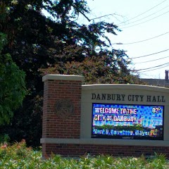
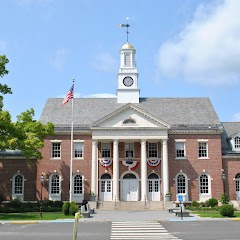
Danbury City Hall
Edmond Town Hall
Transit and Meeting Points
Useful pickup, handoff, or rendezvous points close to Ridgefield.
Stamford Transportation Center
Bridgeport
Croton–Harmon station
New Rochelle station
Flight Path Map
This map shows the direct air route between Wilton and Danbury. Straight-line distance: 13.81 mi (22.22 km).

#1 Wilton
Town in Connecticut, USA
| Population | 18,219 |
| Coordinates | 41.1953700, -73.4379000 |
| Altitude | 76 |
| Country | United States |

#2 Danbury
The most populous city in Fairfield County, Connecticut.
| Population | 84,317 |
| Coordinates | 41.3948200, -73.4540100 |
| Altitude | 121 |
| Country | United States |
End: Library Place (-73.45414, 41.394951)
Estimated Travel Time
Distance: 28 km by road
| Speed | Time |
|---|---|
| 30 mph (48.3 km/h) | 00h 34m |
| 40 mph (64.37 km/h) | 00h 25m |
| 50 mph (80.47 km/h) | 00h 20m |
| 60 mph (96.56 km/h) | 00h 17m |
| 70 mph (112.65 km/h) | 00h 14m |
| 80 mph (129 km/h) | 00h 12m |
Fuel, Round Trip and CO2
Estimated fuel cost and emissions for this route.
| Fuel | $/gal | One way | Round trip |
|---|---|---|---|
| Regular gas | $3.95 | $2.37 | $4.73 |
| Mid-grade | $4.46 | $2.67 | $5.35 |
| Premium | $4.86 | $2.91 | $5.83 |
| Diesel | $6.00 | $3.60 | $7.20 |
Assumes 8.3 L/100 km (about 28.3 MPG). CO2 is an estimate and varies by vehicle, fuel blend, traffic, and terrain.
Prices in Connecticut · Jun 10, 2026
Distance to Other Cities
Planning a road trip? See the full trip guide on Trip.ovh — stops, fuel costs, weather, and departure timing.