How far is Waterloo, IA from Lake Park, IA?
The driving distance from Waterloo, IA to Lake Park, IA is about 211.6 miles (340.6 km), with a travel time of about 04h 38m by car.
- The straight-line flight distance is about 164.5 miles (264.8 km).
- For a round trip, plan for roughly 09h 17m of driving time before adding stops, traffic, or weather delays.
- A comfortable departure window is usually 6:00 AM to 8:00 AM CDT.
Reverse, save, or send this route
This drive is better planned with a longer stop or an overnight stay. Copy the route link, send it to another device, or print a clean version before you head out.
This drive is better planned with a longer stop or an overnight stay.
Flight Distance
Driving Distance
Gas Cost Calculator
Leave and Arrive Planner
Pick a departure time to see your estimated arrival and same-day return window.
Drive time stays fixed at 04h 38m.
An early departure helps you fit a real stop into the day without turning the return into a late-night drive.
This departure sits inside the recommended comfort window for the route.
Halfway Point
A useful midpoint for breaks, coffee, or meeting in the middle.
City in Worth County, Iowa, United States
Route Weather Snapshot
Check the forecast at both ends before you head out.
Driving Route Map
The map below follows the saved road route between Waterloo and Lake Park.
Turn-by-Turn Driving Directions
Step-by-step road directions between Waterloo and Lake Park.
-
1
Start on West 4th Street
23 m · 6 sec · West 4th Street
-
2
Turn right onto Washington Street
1910 ft · 44 sec · Washington Street
-
3
Continue straight
6.3 mi · 8 min
-
4
Take the exit slight right
1309 ft · 32 sec
-
5
Keep slight right to continue on US 218 North, IA 27 North: Waverly
2382 ft · 58 sec
-
6
Merge slight left onto Avenue of the Saints
92.9 mi · 1 hr 46 min · Avenue of the Saints
-
7
Take the exit slight right
2004 ft · 56 sec
-
8
Turn left onto State Highway 9
1.1 mi · 2 min · State Highway 9
-
9
Continue on North Street
2493 ft · 39 sec · North Street
-
10
Continue on 360th Street
2631 ft · 41 sec · 360th Street
-
11
Continue on Evergreen Avenue
2.3 mi · 3 min · Evergreen Avenue
-
12
Continue on State Highway 9
5 mi · 7 min · State Highway 9
-
13
Turn right onto 230th Avenue
5.2 mi · 7 min · 230th Avenue
-
14
Turn left onto 400th Street
5.7 mi · 8 min · 400th Street
-
15
At the end of the road, turn right onto 170th Avenue
2 mi · 3 min · 170th Avenue
-
16
Turn left onto State Highway 9
16 mi · 23 min · State Highway 9
-
17
Continue on 1st Avenue East
2648 ft · 1 min · 1st Avenue East
-
18
Continue on State Highway 9
6.8 mi · 9 min · State Highway 9
-
19
Keep slight left to continue on State Highway 9
117 m · 6 sec · State Highway 9
-
20
Continue on US Highway 169
6.4 mi · 9 min · US Highway 169
-
21
Continue on State Highway 9
4.6 mi · 6 min · State Highway 9
-
22
Continue on 4th Avenue West
1.1 km · 59 sec · 4th Avenue West
-
23
Continue on 430th Street
6.1 mi · 9 min · 430th Street
-
24
Continue on 4th Avenue
3.1 mi · 5 min · 4th Avenue
-
25
Continue on State Highway 9
15.2 mi · 23 min · State Highway 9
-
26
Continue on East Central Avenue
2.9 mi · 5 min · East Central Avenue
-
27
Continue on State Highway 9
3.3 mi · 5 min · State Highway 9
-
28
Continue on Highway 9
1.4 mi · 2 min · Highway 9
-
29
Continue on 1st Avenue
1.2 km · 1 min · 1st Avenue
-
30
Continue on 150th Street
2 mi · 3 min · 150th Street
-
31
Continue on US Highway 71
5.5 mi · 8 min · US Highway 71
-
32
Continue on 18th Street
2 mi · 4 min · 18th Street
-
33
Continue on 150th Street
9.6 mi · 13 min · 150th Street
-
34
Turn right onto 135th Avenue
1.6 km · 2 min · 135th Avenue
-
35
Continue on South Market Street
1.2 km · 2 min · South Market Street
-
36
Arrive at your destination
0 m · 1 sec · North Market Street
Car Route Details
A richer read on the saved driving route between Waterloo and Lake Park.
Straightforward drive
The saved road route has a manageable number of maneuvers and should be easy to follow with normal attention to signs.
Avenue of the Saints
Merge slight left onto Avenue of the Saints
92.9 mi · 01h 46m
Route Summary
A quick read on whether this route feels easy, ambitious, or worth planning around.
A longer out-and-back drive
This is still possible in one day, but it becomes a long driving day. Leaving early and planning your stop window matters more here.
Sunny leaving Waterloo and Sunny near Lake Park.
Trip Questions
Direct answers travelers usually want before committing to the drive.
How long does it take to drive from Waterloo to Lake Park?
The road trip is about 211.6 miles (340.6 km) and usually takes 04h 38m in normal driving conditions.
Is this a same-day trip or an overnight route?
This is still possible in one day, but it becomes a long driving day. Leaving early and planning your stop window matters more here.
What is the halfway point on this route?
Fertile is a useful midpoint, sitting about 105.6 miles from Waterloo and 106 miles from Lake Park.
How much longer is the road route than the straight-line distance?
The direct path is about 164.5 miles (264.8 km), while the road route adds roughly 47.1 extra miles because roads do not follow the straight air line.
When is the best time to leave for this route?
A good departure window is usually 6:00 AM to 8:00 AM CDT. If you want a more comfortable same-day return, try to leave by 7:42 AM CDT.
How much will gas cost for this route?
Using about 28.3 MPG, regular gas is estimated at $28.17 one way or $56.34 round trip. Estimated CO2 is about 66.4 kg one way.
What should you check before leaving?
Before you leave, expect Sunny around Waterloo and Sunny near Lake Park.
Stop Ideas Near Fertile
Useful break, food, and waypoint ideas within about 15 miles of the route midpoint.
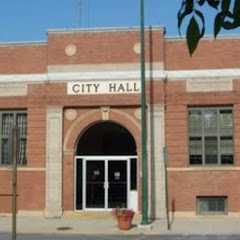
Forest City - City Hall - Municipal Services
Clear Lake City Hall
Transit and Meeting Points
Useful pickup, handoff, or rendezvous points close to Fertile.
Flight Path Map
This map shows the direct air route between Waterloo and Lake Park. Straight-line distance: 164.57 mi (264.85 km).

#1 Waterloo
The most populous city in Black Hawk County, Iowa.
| Population | 67,292 |
| Coordinates | 42.4927600, -92.3429600 |
| Altitude | 261 |
| Country | United States |
#2 Lake Park
City in Dickinson County, Iowa, United States of America
| Population | 1,132 |
| Coordinates | 43.4555200, -95.3208300 |
| Altitude | 454 |
| Country | United States |
End: Lake Park (-95.32083, 43.45552)
Estimated Travel Time
Distance: 341 km by road
| Speed | Time |
|---|---|
| 30 mph (48.3 km/h) | 07h 03m |
| 40 mph (64.37 km/h) | 05h 17m |
| 50 mph (80.47 km/h) | 04h 13m |
| 60 mph (96.56 km/h) | 03h 31m |
| 70 mph (112.65 km/h) | 03h 01m |
| 80 mph (129 km/h) | 02h 38m |
Fuel, Round Trip and CO2
Estimated fuel cost and emissions for this route.
| Fuel | $/gal | One way | Round trip |
|---|---|---|---|
| Regular gas | $3.77 | $28.17 | $56.34 |
| Mid-grade | $4.25 | $31.77 | $63.54 |
| Premium | $4.65 | $34.77 | $69.53 |
| Diesel | $5.30 | $39.62 | $79.24 |
Assumes 8.3 L/100 km (about 28.3 MPG). CO2 is an estimate and varies by vehicle, fuel blend, traffic, and terrain.
Prices in Iowa · Jul 18, 2026
Distance to Other Cities
Planning a road trip? See the full trip guide on Trip.ovh — stops, fuel costs, weather, and departure timing.