How far is Soldier, KS from Pittsburg, KS?
The driving distance from Soldier, KS to Pittsburg, KS is about 215 miles (346 km), with a travel time of about 03h 24m by car.
- The straight-line flight distance is about 161.9 miles (260.5 km).
- For a round trip, plan for roughly 06h 49m of driving time before adding stops, traffic, or weather delays.
- A comfortable departure window is usually 6:00 AM to 8:00 AM CDT.
Reverse, save, or send this route
This drive is better planned with a longer stop or an overnight stay. Copy the route link, send it to another device, or print a clean version before you head out.
This drive is better planned with a longer stop or an overnight stay.
Flight Distance
Driving Distance
Gas Cost Calculator
Leave and Arrive Planner
Pick a departure time to see your estimated arrival and same-day return window.
Drive time stays fixed at 03h 24m.
An early departure helps you fit a real stop into the day without turning the return into a late-night drive.
You are leaving earlier than the recommended window, which gives you extra margin for breaks and traffic.
Halfway Point
A useful midpoint for breaks, coffee, or meeting in the middle.
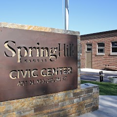
The most populous city in Johnson County, Kansas.
Route Weather Snapshot
Check the forecast at both ends before you head out.
Mostly Sunny then Slight Chance Showers And Thunderstorms
Sunny
Driving Route Map
The map below follows the saved road route between Soldier and Pittsburg.
Turn-by-Turn Driving Directions
Step-by-step road directions between Soldier and Pittsburg.
-
1
Start on Jackson Street
121 m · 8 sec · Jackson Street
-
2
Turn slight right onto 1st Street
1116 ft · 22 sec · 1st Street
-
3
Continue on E Road
4.8 mi · 9 min · E Road
-
4
Turn left onto 230 Road
10.9 mi · 14 min · 230 Road
-
5
Continue on West 4th Street
2647 ft · 1 min · West 4th Street
-
6
Turn right onto Arizona Avenue
27.7 mi · 30 min · Arizona Avenue
-
7
Keep slight left to continue on I 70 East, US 40 East, KS 4 East: Kansas City, Gage Boulevard
1621 ft · 36 sec
-
8
Keep slight left to continue on I-70 East, Kansas City
1046 ft · 25 sec
-
9
Merge slight left onto Truman/Eisenhower Presidential Highway
7.3 mi · 9 min · Truman/Eisenhower Presidential Highway
-
10
Keep slight left to continue on Truman/Eisenhower Presidential Highway
1.2 km · 52 sec · Truman/Eisenhower Presidential Highway
-
11
Continue on Kansas Turnpike
14 mi · 14 min · Kansas Turnpike
-
12
Take the exit slight right toward KS 10: Lecompton, Lawrence
2307 ft · 1 min
-
13
Turn right onto South Lawrence Trafficway
36.5 mi · 40 min · South Lawrence Trafficway
-
14
Keep slight left to continue on I 435 East
1484 ft · 36 sec
-
15
Merge slight left
2.2 mi · 3 min
-
16
Take the exit slight right toward US 69
3250 ft · 1 min
-
17
Keep slight right to continue on US 69 South: College Boulevard
1028 ft · 25 sec
-
18
Keep slight right to continue on US 69 South
1.6 km · 2 min
-
19
Keep slight left to continue on US 69 South
1188 ft · 29 sec
-
20
Merge slight left onto Overland Parkway
104.3 mi · 1 hr 53 min · Overland Parkway
-
21
Take the exit slight right
97 m · 9 sec
-
22
Merge slight left onto West Atkinson Road
2.3 mi · 3 min · West Atkinson Road
-
23
Turn left onto West 4th Street
1 mi · 2 min · West 4th Street
-
24
Turn right onto North Broadway Street
20 m · 3 sec · North Broadway Street
-
25
Arrive at your destination
0 m · 1 sec · North Broadway Street
Car Route Details
A richer read on the saved driving route between Soldier and Pittsburg.
Highway-focused drive
Most of the mileage stays on named highways, so the important moments are ramps, exits, merges, and the final local approach.
Overland Parkway
Merge slight left onto Overland Parkway
104 mi · 01h 53m
Route Summary
A quick read on whether this route feels easy, ambitious, or worth planning around.
A longer out-and-back drive
This is still possible in one day, but it becomes a long driving day. Leaving early and planning your stop window matters more here.
Mostly Sunny then Slight Chance Showers And Thunderstorms leaving Soldier and Sunny near Pittsburg.
Trip Questions
Direct answers travelers usually want before committing to the drive.
How long does it take to drive from Soldier to Pittsburg?
The road trip is about 215 miles (346 km) and usually takes 03h 24m in normal driving conditions.
Is this a same-day trip or an overnight route?
This is still possible in one day, but it becomes a long driving day. Leaving early and planning your stop window matters more here.
What is the halfway point on this route?
Lenexa is a useful midpoint, sitting about 108.1 miles from Soldier and 106.9 miles from Pittsburg.
How much longer is the road route than the straight-line distance?
The direct path is about 161.9 miles (260.5 km), while the road route adds roughly 53.1 extra miles because roads do not follow the straight air line.
When is the best time to leave for this route?
A good departure window is usually 6:00 AM to 8:00 AM CDT. If you want a more comfortable same-day return, try to leave by 10:10 AM CDT.
How much will gas cost for this route?
Using about 28.3 MPG, regular gas is estimated at $28.62 one way or $57.24 round trip. Estimated CO2 is about 67.5 kg one way.
What should you check before leaving?
Before you leave, expect Mostly Sunny then Slight Chance Showers And Thunderstorms around Soldier and Sunny near Pittsburg.
Stop Ideas Near Lenexa
Useful break, food, and waypoint ideas within about 15 miles of the route midpoint.

Negro Leagues Baseball Museum
Spring Hill City Hall

Country Club Plaza
Shawnee Town
Transit and Meeting Points
Useful pickup, handoff, or rendezvous points close to Lenexa.
Union Station
Independence
Lee's Summit
Lawrence
Flight Path Map
This map shows the direct air route between Soldier and Pittsburg. Straight-line distance: 161.86 mi (260.49 km).

#1 Soldier
City in Kansas, USA
| Population | 15,086 |
| Coordinates | 39.5361100, -95.9641600 |
| Altitude | 371 |
| Country | United States |

#2 Pittsburg
City in Crawford County, in southeastern Kansas, United States
| Population | 19,968 |
| Coordinates | 37.4108800, -94.7049600 |
| Altitude | 287 |
| Country | United States |
End: North Broadway Street (-94.704831, 37.410882)
Estimated Travel Time
Distance: 346 km by road
| Speed | Time |
|---|---|
| 30 mph (48.3 km/h) | 07h 09m |
| 40 mph (64.37 km/h) | 05h 22m |
| 50 mph (80.47 km/h) | 04h 17m |
| 60 mph (96.56 km/h) | 03h 34m |
| 70 mph (112.65 km/h) | 03h 04m |
| 80 mph (129 km/h) | 02h 40m |
Fuel, Round Trip and CO2
Estimated fuel cost and emissions for this route.
| Fuel | $/gal | One way | Round trip |
|---|---|---|---|
| Regular gas | $3.77 | $28.62 | $57.24 |
| Mid-grade | $4.25 | $32.28 | $64.56 |
| Premium | $4.65 | $35.32 | $70.65 |
| Diesel | $5.30 | $40.26 | $80.51 |
Assumes 8.3 L/100 km (about 28.3 MPG). CO2 is an estimate and varies by vehicle, fuel blend, traffic, and terrain.
Prices in Kansas · Jul 19, 2026
Distance to Other Cities
Planning a road trip? See the full trip guide on Trip.ovh — stops, fuel costs, weather, and departure timing.