How far is San Francisco, CA from Oroville, CA?
The driving distance from San Francisco, CA to Oroville, CA is about 151.4 miles (243.6 km), with a travel time of about 03h 04m by car.
- The straight-line flight distance is about 128.8 miles (207.3 km).
- For a round trip, plan for roughly 06h 08m of driving time before adding stops, traffic, or weather delays.
- A comfortable departure window is usually 6:00 AM to 8:00 AM PDT.
Reverse, save, or send this route
This drive is better planned with a longer stop or an overnight stay. Copy the route link, send it to another device, or print a clean version before you head out.
This drive is better planned with a longer stop or an overnight stay.
Flight Distance
Driving Distance
Gas Cost Calculator
Leave and Arrive Planner
Pick a departure time to see your estimated arrival and same-day return window.
Drive time stays fixed at 03h 04m.
An early departure helps you fit a real stop into the day without turning the return into a late-night drive.
You are leaving earlier than the recommended window, which gives you extra margin for breaks and traffic.
Halfway Point
A useful midpoint for breaks, coffee, or meeting in the middle.
The most populous city in Yolo County, California.
Route Weather Snapshot
Check the forecast at both ends before you head out.
Sunny
Mostly Sunny
Driving Route Map
The map below follows the saved road route between San Francisco and Oroville.
Turn-by-Turn Driving Directions
Step-by-step road directions between San Francisco and Oroville.
-
1
Start on Market Street
95 m · 8 sec · Market Street
-
2
Turn right onto 11th Street
3173 ft · 2 min · 11th Street
-
3
Turn left onto Bryant Street
1724 ft · 1 min · Bryant Street
-
4
Take the ramp left toward I 80 East: Oakland
1538 ft · 26 sec
-
5
Merge slight right onto Route 80
1.5 km · 1 min · Route 80
-
6
Continue on Dwight D. Eisenhower Highway
6.4 mi · 10 min · Dwight D. Eisenhower Highway
-
7
Take the exit slight left toward I 80 East
2949 ft · 45 sec
-
8
Merge slight right onto Nimitz Freeway
124 m · 6 sec · Nimitz Freeway
-
9
Continue on Eastshore Freeway
3.3 mi · 4 min · Eastshore Freeway
-
10
Keep slight left to continue on Eastshore Freeway
7.4 mi · 9 min · Eastshore Freeway
-
11
Continue on Eastshore Freeway
3.2 mi · 4 min · Eastshore Freeway
-
12
Continue on Linus F. Claeys Freeway
3.5 mi · 4 min · Linus F. Claeys Freeway
-
13
Continue on Eastshore Freeway
1718 ft · 27 sec · Eastshore Freeway
-
14
Continue on Carquinez Bridge
1.6 km · 1 min · Carquinez Bridge
-
15
Continue on Dwight D. Eisenhower Highway
14.5 mi · 17 min · Dwight D. Eisenhower Highway
-
16
Keep slight left to continue on Dwight D. Eisenhower Highway
27.3 mi · 31 min · Dwight D. Eisenhower Highway
-
17
Keep slight left to continue on Dwight D. Eisenhower Highway
8.4 mi · 10 min · Dwight D. Eisenhower Highway
-
18
Continue on Yolo Causeway
3.7 mi · 4 min · Yolo Causeway
-
19
Keep slight right to continue on North Sacramento Beltline Freeway
4.4 mi · 5 min · North Sacramento Beltline Freeway
-
20
Take the exit slight right toward I 5, CA 99: Redding, Los Angeles
832 ft · 20 sec
-
21
Keep slight left to continue on I 5 North, I 80 East: Redding
1639 ft · 40 sec
-
22
Keep slight right to continue on Redding
1293 ft · 31 sec
-
23
Keep slight left to continue on I 5 North
2323 ft · 57 sec
-
24
Merge slight left onto Westside Freeway
2.5 mi · 3 min · Westside Freeway
-
25
Keep slight right to continue on Golden State Highway
7.5 mi · 9 min · Golden State Highway
-
26
Continue on Bernie Richter Memorial Highway
5 mi · 6 min · Bernie Richter Memorial Highway
-
27
Keep slight right to continue on CA 70 North: Marysville, Oroville
21.7 mi · 26 min
-
28
Turn right onto 5th Street
1272 ft · 39 sec · 5th Street
-
29
Turn left onto B Street
1.5 mi · 3 min · B Street
-
30
Continue straight
24.5 mi · 29 min
-
31
Take the exit slight right toward Montgomery Street
1397 ft · 19 sec
-
32
Turn right onto Montgomery Street
1.4 km · 2 min · Montgomery Street
-
33
Turn left onto Lincoln Street
65 m · 9 sec · Lincoln Street
-
34
Arrive at your destination
0 m · 1 sec · Lincoln Street
Car Route Details
A richer read on the saved driving route between San Francisco and Oroville.
Highway-focused drive
Most of the mileage stays on named highways, so the important moments are ramps, exits, merges, and the final local approach.
Dwight D. Eisenhower Highway
Keep slight left to continue on Dwight D. Eisenhower Highway
27.3 mi · 00h 31m
Route Summary
A quick read on whether this route feels easy, ambitious, or worth planning around.
A longer out-and-back drive
This is still possible in one day, but it becomes a long driving day. Leaving early and planning your stop window matters more here.
Sunny leaving San Francisco and Mostly Sunny near Oroville.
Trip Questions
Direct answers travelers usually want before committing to the drive.
How long does it take to drive from San Francisco to Oroville?
The road trip is about 151.4 miles (243.6 km) and usually takes 03h 04m in normal driving conditions.
Is this a same-day trip or an overnight route?
This is still possible in one day, but it becomes a long driving day. Leaving early and planning your stop window matters more here.
What is the halfway point on this route?
Davis is a useful midpoint, sitting about 75.7 miles from San Francisco and 75.7 miles from Oroville.
How much longer is the road route than the straight-line distance?
The direct path is about 128.8 miles (207.3 km), while the road route adds roughly 22.6 extra miles because roads do not follow the straight air line.
When is the best time to leave for this route?
A good departure window is usually 6:00 AM to 8:00 AM PDT. If you want a more comfortable same-day return, try to leave by 10:52 AM PDT.
How much will gas cost for this route?
Using about 28.3 MPG, regular gas is estimated at $30.81 one way or $61.61 round trip. Estimated CO2 is about 47.5 kg one way.
What should you check before leaving?
Before you leave, expect Sunny around San Francisco and Mostly Sunny near Oroville.
Stop Ideas Near Davis
Useful break, food, and waypoint ideas within about 15 miles of the route midpoint.
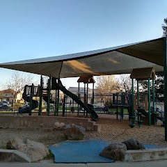
North Point Park
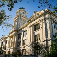
Sacramento City Hall
City of Refuge Sacramento

City of Sacramento
Transit and Meeting Points
Useful pickup, handoff, or rendezvous points close to Davis.
Davis station
Sacramento Valley Station
Sacramento (State Capitol), California
Elk Grove, California
Flight Path Map
This map shows the direct air route between San Francisco and Oroville. Straight-line distance: 128.84 mi (207.34 km).

#1 San Francisco
The seventeenth most populous city in the United States and the center of the San Francisco Bay Area.
| Population | 866,606 |
| Coordinates | 37.7749300, -122.4194200 |
| Altitude | 16 |
| Country | United States |

#2 Oroville
County seat of Butte County, California, USA
| Population | 20,237 |
| Coordinates | 39.5139400, -121.5577600 |
| Altitude | 51 |
| Country | United States |
End: Oroville (-121.55776, 39.51394)
Estimated Travel Time
Distance: 244 km by road
| Speed | Time |
|---|---|
| 30 mph (48.3 km/h) | 05h 02m |
| 40 mph (64.37 km/h) | 03h 47m |
| 50 mph (80.47 km/h) | 03h 01m |
| 60 mph (96.56 km/h) | 02h 31m |
| 70 mph (112.65 km/h) | 02h 09m |
| 80 mph (129 km/h) | 01h 53m |
Fuel, Round Trip and CO2
Estimated fuel cost and emissions for this route.
| Fuel | $/gal | One way | Round trip |
|---|---|---|---|
| Regular gas | $5.77 | $30.81 | $61.61 |
| Mid-grade | $6.07 | $32.39 | $64.78 |
| Premium | $6.24 | $33.34 | $66.68 |
| Diesel | $7.57 | $40.41 | $80.82 |
Assumes 8.3 L/100 km (about 28.3 MPG). CO2 is an estimate and varies by vehicle, fuel blend, traffic, and terrain.
Prices in California · Jun 27, 2026
Distance to Other Cities
Planning a road trip? See the full trip guide on Trip.ovh — stops, fuel costs, weather, and departure timing.