How far is Pinckney, MI from Clinton Township, MI?
The driving distance from Pinckney, MI to Clinton Township, MI is about 70.9 miles (114.1 km), with a travel time of about 01h 17m by car.
- The straight-line flight distance is about 53.1 miles (85.5 km).
- For a round trip, plan for roughly 02h 35m of driving time before adding stops, traffic, or weather delays.
- A comfortable departure window is usually 8:00 AM to 10:00 AM EDT.
Reverse, save, or send this route
This route works well as a day trip with time at the destination. Copy the route link, send it to another device, or print a clean version before you head out.
This route works well as a day trip with time at the destination.
Flight Distance
Driving Distance
Gas Cost Calculator
Leave and Arrive Planner
Pick a departure time to see your estimated arrival and same-day return window.
Drive time stays fixed at 01h 17m.
A morning start gives you useful time at the destination and keeps the return out of the late evening.
You are leaving earlier than the recommended window, which gives you extra margin for breaks and traffic.
Halfway Point
A useful midpoint for breaks, coffee, or meeting in the middle.
The second most populous city in Oakland County, Michigan.
Route Weather Snapshot
Check the forecast at both ends before you head out.
Slight Chance Showers And Thunderstorms
Showers And Thunderstorms Likely
Driving Route Map
The map below follows the saved road route between Pinckney and Clinton Township.
Turn-by-Turn Driving Directions
Step-by-step road directions between Pinckney and Clinton Township.
-
1
Start on the route
50 m · 17 sec
-
2
Turn left onto West Main Street
6.1 mi · 10 min · West Main Street
-
3
Continue straight
2 mi · 4 min
-
4
Continue on Hamburg Road
2597 ft · 49 sec · Hamburg Road
-
5
Enter the roundabout and take exit 1 toward Winans Lake Road
4 m · 1 sec · Winans Lake Road
-
6
Exit the roundabout onto Winans Lake Road
1.7 mi · 3 min · Winans Lake Road
-
7
Enter the roundabout and take exit 1 toward Winans Lake Road
36 m · 3 sec · Winans Lake Road
-
8
Exit the roundabout onto Winans Lake Road
2594 ft · 60 sec · Winans Lake Road
-
9
At the end of the road, turn left onto Whitmore Lake Road
844 ft · 13 sec · Whitmore Lake Road
-
10
Enter the roundabout and take exit 2 toward Silver Lake Road
27 m · 2 sec · Silver Lake Road
-
11
Exit the roundabout onto Silver Lake Road
148 m · 10 sec · Silver Lake Road
-
12
Enter the roundabout and take exit 4 toward US 23 North: Flint
112 m · 7 sec
-
13
Exit the roundabout onto US 23 North: Flint
918 ft · 11 sec
-
14
Merge slight left
3.5 mi · 4 min
-
15
Take the exit slight right toward I 96 East: Detroit
1.2 km · 1 min
-
16
Merge slight left
14.9 mi · 16 min
-
17
Continue on Walter P Reuther Freeway
8.9 mi · 10 min · Walter P Reuther Freeway
-
18
Merge slight left onto John C Lodge Freeway
2.5 mi · 3 min · John C Lodge Freeway
-
19
Take the exit slight right toward 10 Mile Road, Evergreen Road
848 ft · 21 sec
-
20
Turn straight onto Northwestern Highway
1190 ft · 28 sec · Northwestern Highway
-
21
Turn left onto West 10 Mile Road
6.6 mi · 13 min · West 10 Mile Road
-
22
Continue on South Chrysler Drive
893 ft · 23 sec · South Chrysler Drive
-
23
Turn left
91 m · 17 sec
-
24
Turn left onto North Chrysler Drive
614 ft · 13 sec · North Chrysler Drive
-
25
Keep slight right to continue on West 10 Mile Road
152 m · 11 sec · West 10 Mile Road
-
26
Continue on East Heights Drive
1.4 mi · 3 min · East Heights Drive
-
27
Continue on Walter P Reuther Drive
1053 ft · 23 sec · Walter P Reuther Drive
-
28
Take the ramp straight toward I 696 East
1494 ft · 36 sec
-
29
Merge slight left onto Walter P Reuther Freeway
5.1 mi · 5 min · Walter P Reuther Freeway
-
30
Take the exit slight right toward M 97: Groesbeck Highway
1244 ft · 30 sec
-
31
Turn straight onto East 11 Mile Road
2553 ft · 60 sec · East 11 Mile Road
-
32
Turn left onto Groesbeck Highway
7.4 mi · 12 min · Groesbeck Highway
-
33
Turn left onto Harrington Street
2930 ft · 1 min · Harrington Street
-
34
At the end of the road, turn left onto Moravian Drive
756 ft · 17 sec · Moravian Drive
-
35
Turn right onto White Oaks Drive
1165 ft · 53 sec · White Oaks Drive
-
36
Turn right onto Red Oaks Drive
88 m · 13 sec · Red Oaks Drive
-
37
Arrive at your destination
0 m · 1 sec · Red Oaks Drive
Car Route Details
A richer read on the saved driving route between Pinckney and Clinton Township.
Highway-focused drive
Most of the mileage stays on named highways, so the important moments are ramps, exits, merges, and the final local approach.
I 96 East
Merge slight left
14.9 mi · 00h 16m
Route Summary
A quick read on whether this route feels easy, ambitious, or worth planning around.
A comfortable day-trip route
This route works well as a day trip. You can leave in the morning, spend meaningful time at the destination, and still return the same day.
Slight Chance Showers And Thunderstorms leaving Pinckney and Showers And Thunderstorms Likely near Clinton Township.
Trip Questions
Direct answers travelers usually want before committing to the drive.
How long does it take to drive from Pinckney to Clinton Township?
The road trip is about 70.9 miles (114.1 km) and usually takes 01h 17m in normal driving conditions.
Is this a same-day trip or an overnight route?
This route works well as a day trip. You can leave in the morning, spend meaningful time at the destination, and still return the same day.
What is the halfway point on this route?
Farmington Hills is a useful midpoint, sitting about 32.7 miles from Pinckney and 38.2 miles from Clinton Township.
How much longer is the road route than the straight-line distance?
The direct path is about 53.1 miles (85.5 km), while the road route adds roughly 17.8 extra miles because roads do not follow the straight air line.
When is the best time to leave for this route?
A good departure window is usually 8:00 AM to 10:00 AM EDT. If you want a more comfortable same-day return, try to leave by 3:54 PM EDT.
How much will gas cost for this route?
Using about 28.3 MPG, regular gas is estimated at $9.43 one way or $18.86 round trip. Estimated CO2 is about 22.2 kg one way.
What should you check before leaving?
Before you leave, expect Slight Chance Showers And Thunderstorms around Pinckney and Showers And Thunderstorms Likely near Clinton Township.
Stop Ideas Near Farmington Hills
Useful break, food, and waypoint ideas within about 15 miles of the route midpoint.
City of Ferndale City Hall
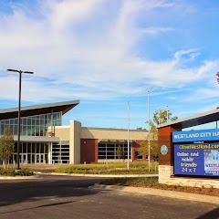
City of Westland
Dearborn Heights City Office
Transit and Meeting Points
Useful pickup, handoff, or rendezvous points close to Farmington Hills.
Birmingham, Michigan
Troy Transit Center
Pontiac Transportation Center
Royal Oak station
Flight Path Map
This map shows the direct air route between Pinckney and Clinton Township. Straight-line distance: 53.11 mi (85.48 km).

#1 Pinckney
City in Livingston County, Michigan, United States of America
| Population | 2,425 |
| Coordinates | 42.4570000, -83.9479100 |
| Altitude | 275 |
| Country | United States |

#2 Clinton Township
A city in Macomb County, Michigan.
| Population | 99,753 |
| Coordinates | 42.5869800, -82.9199200 |
| Altitude | 183 |
| Country | United States |
End: Red Oaks Drive (-82.919431, 42.586969)
Estimated Travel Time
Distance: 114 km by road
| Speed | Time |
|---|---|
| 30 mph (48.3 km/h) | 02h 21m |
| 40 mph (64.37 km/h) | 01h 46m |
| 50 mph (80.47 km/h) | 01h 25m |
| 60 mph (96.56 km/h) | 01h 10m |
| 70 mph (112.65 km/h) | 01h 00m |
| 80 mph (129 km/h) | 00h 53m |
Fuel, Round Trip and CO2
Estimated fuel cost and emissions for this route.
| Fuel | $/gal | One way | Round trip |
|---|---|---|---|
| Regular gas | $3.77 | $9.43 | $18.86 |
| Mid-grade | $4.25 | $10.63 | $21.27 |
| Premium | $4.65 | $11.64 | $23.27 |
| Diesel | $5.30 | $13.26 | $26.52 |
Assumes 8.3 L/100 km (about 28.3 MPG). CO2 is an estimate and varies by vehicle, fuel blend, traffic, and terrain.
Prices in Michigan · Jun 25, 2026
Distance to Other Cities
Planning a road trip? See the full trip guide on Trip.ovh — stops, fuel costs, weather, and departure timing.