How far is Palm Bay, FL from Carrollwood Village, FL?
The driving distance from Palm Bay, FL to Carrollwood Village, FL is about 141.5 miles (227.7 km), with a travel time of about 03h 00m by car.
- The straight-line flight distance is about 117.9 miles (189.7 km).
- For a round trip, plan for roughly 06h 00m of driving time before adding stops, traffic, or weather delays.
- A comfortable departure window is usually 8:00 AM to 10:00 AM EDT.
Reverse, save, or send this route
This route works well as a day trip with time at the destination. Copy the route link, send it to another device, or print a clean version before you head out.
This route works well as a day trip with time at the destination.
Flight Distance
Driving Distance
Gas Cost Calculator
Leave and Arrive Planner
Pick a departure time to see your estimated arrival and same-day return window.
Drive time stays fixed at 03h 00m.
A morning start gives you useful time at the destination and keeps the return out of the late evening.
You are leaving earlier than the recommended window, which gives you extra margin for breaks and traffic.
Halfway Point
A useful midpoint for breaks, coffee, or meeting in the middle.
Census-designated place in Osceola County, Florida, United States
Route Weather Snapshot
Check the forecast at both ends before you head out.
Sunny then Chance Showers And Thunderstorms
Scattered Showers And Thunderstorms
Driving Route Map
The map below follows the saved road route between Palm Bay and Carrollwood Village.
Turn-by-Turn Driving Directions
Step-by-step road directions between Palm Bay and Carrollwood Village.
-
1
Start on Palm Bay Road Northeast
4 mi · 8 min · Palm Bay Road Northeast
-
2
Take the ramp right toward I 95 North: Daytona Beach
2517 ft · 1 min
-
3
Merge slight left
3.6 mi · 4 min
-
4
Take the exit slight right toward US 192: West Melbourne, Melbourne
2565 ft · 1 min
-
5
Continue on New Haven Avenue
37 mi · 45 min · New Haven Avenue
-
6
Continue on East Irlo Bronson Memorial Highway
1.2 mi · 2 min · East Irlo Bronson Memorial Highway
-
7
Continue on 13th Street
2.6 mi · 5 min · 13th Street
-
8
Continue on East Irlo Bronson Memorial Highway
1140 ft · 22 sec · East Irlo Bronson Memorial Highway
-
9
Continue on Bronson Highway
3.3 mi · 5 min · Bronson Highway
-
10
Take the exit slight right toward Ocala, Miami, Florida's Turnpike Toll
848 ft · 21 sec
-
11
Keep slight left to continue on Florida's Turnpike North: Ocala
1 km · 1 min
-
12
Merge slight left onto Florida's Turnpike
5.5 mi · 6 min · Florida's Turnpike
-
13
Take the exit slight right toward FL 417 Toll: Tampa, Daytona Beach
1519 ft · 29 sec
-
14
Keep slight left to continue on FL 417 Toll South: Tampa, Disney World
1.4 km · 2 min
-
15
Merge slight left onto Central Florida GreeneWay
5.2 mi · 6 min · Central Florida GreeneWay
-
16
Keep slight left to continue on Southern Connector Extension
8.2 mi · 10 min · Southern Connector Extension
-
17
Merge slight left
51.8 mi · 56 min
-
18
Take the exit slight right toward I 75: Ocala, Naples
1759 ft · 43 sec
-
19
Keep slight right to continue on I 75 North: Ocala
1.6 km · 2 min
-
20
Merge slight left
2.4 mi · 3 min
-
21
Take the exit slight right toward FL 582: Fowler Avenue, Temple Terrace
2094 ft · 32 sec
-
22
Keep slight left to continue on FL 582 West: Fowler Avenue, Temple Terrace
1.4 km · 2 min
-
23
Turn straight onto East Fowler Avenue
5.7 mi · 10 min · East Fowler Avenue
-
24
Take the ramp slight right toward I 275 North: Ocala
1422 ft · 35 sec
-
25
Merge slight left
2739 ft · 39 sec
-
26
Take the exit slight right toward CR 582A: Fletcher Avenue
1238 ft · 37 sec
-
27
Turn left onto East Fletcher Avenue
1635 ft · 39 sec · East Fletcher Avenue
-
28
Continue on West Fletcher Avenue
2.9 mi · 5 min · West Fletcher Avenue
-
29
Continue on South Village Drive
1 km · 1 min · South Village Drive
-
30
Turn left onto Lowell Road
2236 ft · 1 min · Lowell Road
-
31
Turn right onto Glenside Circle
48 m · 12 sec · Glenside Circle
-
32
Continue on Glenside Circle
148 m · 21 sec · Glenside Circle
-
33
Arrive at your destination
0 m · 1 sec · Glenside Circle
Car Route Details
A richer read on the saved driving route between Palm Bay and Carrollwood Village.
Interchange-aware route
The drive includes several ramps, exits, or merges, so checking the next few maneuvers before busy interchanges is useful.
Southern Connector Extension
Merge slight left
51.8 mi · 00h 56m
Route Summary
A quick read on whether this route feels easy, ambitious, or worth planning around.
A comfortable day-trip route
This route works well as a day trip. You can leave in the morning, spend meaningful time at the destination, and still return the same day.
Sunny then Chance Showers And Thunderstorms leaving Palm Bay and Scattered Showers And Thunderstorms near Carrollwood Village.
Trip Questions
Direct answers travelers usually want before committing to the drive.
How long does it take to drive from Palm Bay to Carrollwood Village?
The road trip is about 141.5 miles (227.7 km) and usually takes 03h 00m in normal driving conditions.
Is this a same-day trip or an overnight route?
This route works well as a day trip. You can leave in the morning, spend meaningful time at the destination, and still return the same day.
What is the halfway point on this route?
Celebration is a useful midpoint, sitting about 70.7 miles from Palm Bay and 70.8 miles from Carrollwood Village.
How much longer is the road route than the straight-line distance?
The direct path is about 117.9 miles (189.7 km), while the road route adds roughly 23.6 extra miles because roads do not follow the straight air line.
When is the best time to leave for this route?
A good departure window is usually 8:00 AM to 10:00 AM EDT. If you want a more comfortable same-day return, try to leave by 12:30 PM EDT.
How much will gas cost for this route?
Using about 28.3 MPG, regular gas is estimated at $20.70 one way or $41.40 round trip. Estimated CO2 is about 44.3 kg one way.
What should you check before leaving?
Before you leave, expect Sunny then Chance Showers And Thunderstorms around Palm Bay and Scattered Showers And Thunderstorms near Carrollwood Village.
Stop Ideas Near Celebration
Useful break, food, and waypoint ideas within about 15 miles of the route midpoint.

Windermere Town Hall
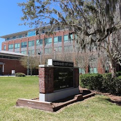
Kissimmee City Hall
Celebration Town Hall

City Hall
Transit and Meeting Points
Useful pickup, handoff, or rendezvous points close to Celebration.
Kissimmee
Orlando Health/Amtrak
Winter Park
Winter Haven
Flight Path Map
This map shows the direct air route between Palm Bay and Carrollwood Village. Straight-line distance: 117.84 mi (189.65 km).

#1 Palm Bay
The most populous city in Brevard County, Florida.
| Population | 116,932 |
| Coordinates | 28.0344600, -80.5886600 |
| Altitude | 5 |
| Country | United States |
#2 Carrollwood Village
An unincorporated community in Hillsborough County, Florida.
| Population | 40,949 |
| Coordinates | 28.0675200, -82.5209300 |
| Altitude | 14 |
| Country | United States |
End: Carrollwood Village (-82.52093, 28.06752)
Estimated Travel Time
Distance: 228 km by road
| Speed | Time |
|---|---|
| 30 mph (48.3 km/h) | 04h 42m |
| 40 mph (64.37 km/h) | 03h 32m |
| 50 mph (80.47 km/h) | 02h 49m |
| 60 mph (96.56 km/h) | 02h 21m |
| 70 mph (112.65 km/h) | 02h 01m |
| 80 mph (129 km/h) | 01h 45m |
Fuel, Round Trip and CO2
Estimated fuel cost and emissions for this route.
| Fuel | $/gal | One way | Round trip |
|---|---|---|---|
| Regular gas | $4.15 | $20.70 | $41.40 |
| Mid-grade | $4.60 | $22.93 | $45.87 |
| Premium | $4.90 | $24.43 | $48.86 |
| Diesel | $4.35 | $21.71 | $43.41 |
Assumes 8.3 L/100 km (about 28.3 MPG). CO2 is an estimate and varies by vehicle, fuel blend, traffic, and terrain.
Prices in Florida · Jul 19, 2026
Distance to Other Cities
Planning a road trip? See the full trip guide on Trip.ovh — stops, fuel costs, weather, and departure timing.