How far is Meeme, WI from Kenosha, WI?
Fastest route
Here are some tips and suggestions for your journey from Meeme, Wisconsin 53063 to Kenosha, Wisconsin, covering a distance of approximately 107 miles (about 172 kilometers) via I-43 S. The estimated travel time is 1 hour and 47 minutes.
Directions
- Start your journey by heading north on WI-42 N/WI-42 Trunk toward County Rd Xx/North Ave in Centerville.
- Turn right onto County Rd Xx/North Ave, then merge onto I-43 S.
- Continue on I-43 S and merge onto I-94 E.
- Take exit 342 from I-94 E toward WI-158 E/52nd St in Paris.
- Keep left at the fork and follow signs for I-41 S/Chicago, then continue on I-94 E.
- Take exit 342 toward Kenosha.
- Finally, use any lane to turn left onto WI-158 E/52nd St, and then turn right onto Sheridan Rd to reach your destination in Kenosha.
Tips & Suggestions
- 🚗 Plan for Traffic: Be prepared for potential traffic conditions along the way, especially on busy highways like I-94 E. Use real-time navigation apps to find the fastest route.
- ⛽ Fuel Up: Ensure your vehicle has enough fuel before starting the journey, as you'll be covering a considerable distance.
- 🍔 Food and Rest Stops: Consider making stops along the way for meals and to rest if needed. There are likely several gas stations and restaurants available along the route.
- 🚓 Obey Speed Limits: Stay within the speed limits to ensure a safe and smooth journey. Keep an eye out for any road signs indicating changes in speed limits.
- 🚧 Road Construction: Be aware that road construction and maintenance may be ongoing, so exercise caution in work zones and follow any detour signs if necessary.
- 📱 GPS or Navigation: Utilize a GPS or navigation app on your phone to stay on track and avoid getting lost, especially in unfamiliar areas.
- 🕑 Time Management: Keep track of your estimated arrival time and plan accordingly, especially if you have appointments or commitments upon reaching your destination.
Reverse, save, or send this route
This route works well as a day trip with time at the destination. Copy the route link, send it to another device, or print a clean version before you head out.
This route works well as a day trip with time at the destination.
Flight Distance
Driving Distance
Gas Cost Calculator
Leave and Arrive Planner
Pick a departure time to see your estimated arrival and same-day return window.
Drive time stays fixed at 01h 48m.
A morning start gives you useful time at the destination and keeps the return out of the late evening.
You are leaving earlier than the recommended window, which gives you extra margin for breaks and traffic.
Halfway Point
A useful midpoint for breaks, coffee, or meeting in the middle.
Village in Ozaukee County, Wisconsin, United States
Route Weather Snapshot
Check the forecast at both ends before you head out.
Showers And Thunderstorms Likely
Patchy Fog
Driving Route Map
The map below follows the saved road route between Meeme and Kenosha.
Turn-by-Turn Driving Directions
Step-by-step road directions between Meeme and Kenosha.
-
1
Start on State Highway 42
5.5 mi · 10 min · State Highway 42
-
2
Continue on North Wisconsin Drive
2718 ft · 55 sec · North Wisconsin Drive
-
3
Turn slight left onto Madison Avenue
1.1 km · 59 sec · Madison Avenue
-
4
Continue on State Highway 42
1.5 km · 1 min · State Highway 42
-
5
Enter the roundabout and take exit 2 toward State Highway 42
30 m · 2 sec · State Highway 42
-
6
Exit the roundabout onto State Highway 42
1.2 mi · 2 min · State Highway 42
-
7
Enter the roundabout and take exit 2 toward State Highway 42
34 m · 2 sec · State Highway 42
-
8
Exit the roundabout onto State Highway 42
1.5 km · 1 min · State Highway 42
-
9
Enter the roundabout and take exit 2 toward State Highway 42
41 m · 2 sec · State Highway 42
-
10
Exit the roundabout onto State Highway 42
1224 ft · 21 sec · State Highway 42
-
11
Enter the roundabout and take exit 1 toward the route
8 m · 1 sec
-
12
Exit the roundabout
1407 ft · 34 sec
-
13
Merge slight left
61.5 mi · 1 hr 11 min
-
14
Keep slight left to continue on North-South Freeway
939 ft · 16 sec · North-South Freeway
-
15
Continue on North-South Freeway
24.3 mi · 27 min · North-South Freeway
-
16
Take the exit slight right toward WI 142, CTH S: Kenosha, Burlington
1246 ft · 30 sec
-
17
Keep slight left to continue on CTH S East: Gateway Technical College, Kenosha
61 m · 7 sec
-
18
Turn left onto Burlington Road
3.6 mi · 6 min · Burlington Road
-
19
Continue on Washington Road
3.3 mi · 7 min · Washington Road
-
20
Turn right onto Sheridan Road
1.4 km · 2 min · Sheridan Road
-
21
Turn left onto 54th Street
93 m · 14 sec · 54th Street
-
22
Turn right onto 8th Avenue
669 ft · 31 sec · 8th Avenue
-
23
Turn right onto 56th Street
13 m · 1 sec · 56th Street
-
24
Arrive at your destination
0 m · 1 sec · 56th Street
Car Route Details
A richer read on the saved driving route between Meeme and Kenosha.
Highway-focused drive
Most of the mileage stays on named highways, so the important moments are ramps, exits, merges, and the final local approach.
State Highway 42
Merge slight left
61.5 mi · 01h 11m
Route Summary
A quick read on whether this route feels easy, ambitious, or worth planning around.
A comfortable day-trip route
This route works well as a day trip. You can leave in the morning, spend meaningful time at the destination, and still return the same day.
Showers And Thunderstorms Likely leaving Meeme and Patchy Fog near Kenosha.
Trip Questions
Direct answers travelers usually want before committing to the drive.
How long does it take to drive from Meeme to Kenosha?
The road trip is about 107.6 miles (173.1 km) and usually takes 01h 48m in normal driving conditions.
Is this a same-day trip or an overnight route?
This route works well as a day trip. You can leave in the morning, spend meaningful time at the destination, and still return the same day.
What is the halfway point on this route?
Thiensville is a useful midpoint, sitting about 52.3 miles from Meeme and 55.2 miles from Kenosha.
How much longer is the road route than the straight-line distance?
The direct path is about 92.3 miles (148.5 km), while the road route adds roughly 15.3 extra miles because roads do not follow the straight air line.
When is the best time to leave for this route?
A good departure window is usually 8:00 AM to 10:00 AM CDT. If you want a more comfortable same-day return, try to leave by 2:54 PM CDT.
How much will gas cost for this route?
Using about 28.3 MPG, regular gas is estimated at $14.29 one way or $28.58 round trip. Estimated CO2 is about 33.7 kg one way.
What should you check before leaving?
Before you leave, expect Showers And Thunderstorms Likely around Meeme and Patchy Fog near Kenosha.
Stop Ideas Near Thiensville
Useful break, food, and waypoint ideas within about 15 miles of the route midpoint.
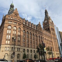
Milwaukee City Hall

Cedarburg City Hall

City Hall Square Apartments
Transit and Meeting Points
Useful pickup, handoff, or rendezvous points close to Thiensville.
Milwaukee Intermodal Station
Milwaukee Airport Railroad Station
Sturtevant station
Sheboygan, Wisconsin
Flight Path Map
This map shows the direct air route between Meeme and Kenosha. Straight-line distance: 92.3 mi (148.54 km).
#1 Meeme
Human settlement in Manitowoc County, Wisconsin, United States of America
| Population | 1,427 |
| Coordinates | 43.9205500, -87.8314800 |
| Altitude | 238 |
| Country | United States |

#2 Kenosha
The second most populous city in Kenosha County, Wisconsin.
| Population | 99,570 |
| Coordinates | 42.5847400, -87.8211900 |
| Altitude | 184 |
| Country | United States |
End: 56th Street (-87.821195, 42.584763)
Estimated Travel Time
Distance: 173 km by road
| Speed | Time |
|---|---|
| 30 mph (48.3 km/h) | 03h 34m |
| 40 mph (64.37 km/h) | 02h 41m |
| 50 mph (80.47 km/h) | 02h 09m |
| 60 mph (96.56 km/h) | 01h 47m |
| 70 mph (112.65 km/h) | 01h 32m |
| 80 mph (129 km/h) | 01h 20m |
Fuel, Round Trip and CO2
Estimated fuel cost and emissions for this route.
| Fuel | $/gal | One way | Round trip |
|---|---|---|---|
| Regular gas | $3.77 | $14.29 | $28.58 |
| Mid-grade | $4.25 | $16.12 | $32.24 |
| Premium | $4.65 | $17.64 | $35.28 |
| Diesel | $5.30 | $20.10 | $40.20 |
Assumes 8.3 L/100 km (about 28.3 MPG). CO2 is an estimate and varies by vehicle, fuel blend, traffic, and terrain.
Prices in Wisconsin · Jun 10, 2026
Distance to Other Cities
Planning a road trip? See the full trip guide on Trip.ovh — stops, fuel costs, weather, and departure timing.