How far is Houston, TX from Beach City, TX?
The driving distance from Houston, TX to Beach City, TX is about 36.2 miles (58.2 km), with a travel time of about 00h 52m by car.
- The straight-line flight distance is about 29.3 miles (47.1 km).
- For a round trip, plan for roughly 01h 45m of driving time before adding stops, traffic, or weather delays.
- A comfortable departure window is usually 8:00 AM to 10:00 AM CDT.
Reverse, save, or send this route
This route works well as a day trip with time at the destination. Copy the route link, send it to another device, or print a clean version before you head out.
This route works well as a day trip with time at the destination.
Flight Distance
Driving Distance
Gas Cost Calculator
Leave and Arrive Planner
Pick a departure time to see your estimated arrival and same-day return window.
Drive time stays fixed at 00h 52m.
A morning start gives you useful time at the destination and keeps the return out of the late evening.
You are leaving earlier than the recommended window, which gives you extra margin for breaks and traffic.
Halfway Point
A useful midpoint for breaks, coffee, or meeting in the middle.
Census designated place
Route Weather Snapshot
Check the forecast at both ends before you head out.
Partly Sunny
Partly Sunny
Driving Route Map
The map below follows the saved road route between Houston and Beach City.
Turn-by-Turn Driving Directions
Step-by-step road directions between Houston and Beach City.
-
1
Start on Louisiana Street
145 m · 20 sec · Louisiana Street
-
2
Turn right onto Franklin Street
1678 ft · 1 min · Franklin Street
-
3
Turn left onto San Jacinto Street
2319 ft · 49 sec · San Jacinto Street
-
4
Turn straight onto Rothwell Street
106 m · 7 sec · Rothwell Street
-
5
Take the ramp straight toward US 59 East, I 10 East
792 ft · 19 sec
-
6
Merge slight left onto East Freeway
5.2 mi · 7 min · East Freeway
-
7
Keep slight left to continue on East Freeway
13.4 mi · 16 min · East Freeway
-
8
Keep slight right to continue on Decker Drive
4.5 mi · 5 min · Decker Drive
-
9
Take the exit slight right toward Spur 330
1410 ft · 35 sec
-
10
Continue on Decker Drive
1.3 mi · 2 min · Decker Drive
-
11
Turn left onto West Defee Street
1.2 mi · 2 min · West Defee Street
-
12
Turn right onto North Alexander Drive
1537 ft · 28 sec · North Alexander Drive
-
13
Keep slight left to continue on South State Highway 146
1948 ft · 43 sec · South State Highway 146
-
14
At the end of the road, turn left onto East Grand Parkway South
2561 ft · 53 sec · East Grand Parkway South
-
15
Take the ramp straight toward TX 99 Toll East
1144 ft · 28 sec
-
16
Merge slight left onto East Grand Parkway South
3210 ft · 39 sec · East Grand Parkway South
-
17
Take the exit slight right toward FM 1405
1575 ft · 38 sec
-
18
Turn straight onto East Grand Parkway South
1.2 mi · 2 min · East Grand Parkway South
-
19
Turn right
3.9 mi · 7 min
-
20
Turn left onto Tri City Beach Road
1.5 mi · 3 min · Tri City Beach Road
-
21
Turn right onto Seacrest Park Road
626 ft · 32 sec · Seacrest Park Road
-
22
Turn left onto Ocean Drive
709 ft · 33 sec · Ocean Drive
-
23
Turn right
82 m · 20 sec
-
24
Arrive at your destination
0 m · 1 sec
Car Route Details
A richer read on the saved driving route between Houston and Beach City.
Highway-focused drive
Most of the mileage stays on named highways, so the important moments are ramps, exits, merges, and the final local approach.
East Freeway
Keep slight left to continue on East Freeway
13.4 mi · 00h 16m
Route Summary
A quick read on whether this route feels easy, ambitious, or worth planning around.
A comfortable day-trip route
This route works well as a day trip. You can leave in the morning, spend meaningful time at the destination, and still return the same day.
Partly Sunny leaving Houston and Partly Sunny near Beach City.
Trip Questions
Direct answers travelers usually want before committing to the drive.
How long does it take to drive from Houston to Beach City?
The road trip is about 36.2 miles (58.2 km) and usually takes 00h 52m in normal driving conditions.
Is this a same-day trip or an overnight route?
This route works well as a day trip. You can leave in the morning, spend meaningful time at the destination, and still return the same day.
What is the halfway point on this route?
Highlands is a useful midpoint, sitting about 18.1 miles from Houston and 18.1 miles from Beach City.
How much longer is the road route than the straight-line distance?
The direct path is about 29.3 miles (47.1 km), while the road route adds roughly 6.9 extra miles because roads do not follow the straight air line.
When is the best time to leave for this route?
A good departure window is usually 8:00 AM to 10:00 AM CDT. If you want a more comfortable same-day return, try to leave by 4:44 PM CDT.
How much will gas cost for this route?
Using about 28.3 MPG, regular gas is estimated at $4.84 one way or $9.67 round trip. Estimated CO2 is about 11.4 kg one way.
What should you check before leaving?
Before you leave, expect Partly Sunny around Houston and Partly Sunny near Beach City.
Stop Ideas Near Highlands
Useful break, food, and waypoint ideas within about 15 miles of the route midpoint.
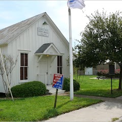
Old Pelly City Hall and Harris County Library Building

La Porte City Hall

City of Pasadena Construction Permits
La Porte First City Hall & Jail
Transit and Meeting Points
Useful pickup, handoff, or rendezvous points close to Highlands.
Houston
Houston, TX
Galveston (Texas Eagle Bus), Texas
Beaumont
Flight Path Map
This map shows the direct air route between Houston and Beach City. Straight-line distance: 29.25 mi (47.08 km).

#1 Houston
The fourth most populous city in the United States and the center of the Houston metropolitan area.
| Population | 2,316,120 |
| Coordinates | 29.7632800, -95.3632700 |
| Altitude | 12 |
| Country | United States |

#2 Beach City
City in Chambers County, Texas, United States
| Population | 2,792 |
| Coordinates | 29.6621700, -94.8899200 |
| Altitude | 7 |
| Country | United States |
End: Beach City (-94.88992, 29.66217)
Estimated Travel Time
Distance: 58 km by road
| Speed | Time |
|---|---|
| 30 mph (48.3 km/h) | 01h 12m |
| 40 mph (64.37 km/h) | 00h 54m |
| 50 mph (80.47 km/h) | 00h 43m |
| 60 mph (96.56 km/h) | 00h 36m |
| 70 mph (112.65 km/h) | 00h 30m |
| 80 mph (129 km/h) | 00h 27m |
Fuel, Round Trip and CO2
Estimated fuel cost and emissions for this route.
| Fuel | $/gal | One way | Round trip |
|---|---|---|---|
| Regular gas | $3.78 | $4.84 | $9.67 |
| Mid-grade | $4.25 | $5.44 | $10.89 |
| Premium | $4.59 | $5.88 | $11.75 |
| Diesel | $3.99 | $5.11 | $10.22 |
Assumes 8.3 L/100 km (about 28.3 MPG). CO2 is an estimate and varies by vehicle, fuel blend, traffic, and terrain.
Prices in Texas · Jul 18, 2026
Distance to Other Cities
Planning a road trip? See the full trip guide on Trip.ovh — stops, fuel costs, weather, and departure timing.