How far is Hansville, WA from Vancouver, WA?
Fastest route
The suggested route from Hansville, Washington to Vancouver, Washington is approximately 193 miles and takes about 3 hours and 8 minutes via I-5 S. This route has tolls. Here are the directions:
- Start by heading east on NE Twin Spits Rd toward Killarney Ln NE.
- Continue onto Hansville Rd NE.
- Turn right onto WA-104 W/NE State Hwy 104.
- Continue onto WA-307 S/Bond Rd NE.
- Turn right to merge onto WA-3 S toward Bremerton.
- Take WA-16 E and I-5 S to WA-501/E 15th St/Mill Plain Blvd in Vancouver.
- Take exit 1C from I-5 S.
- Use the right 2 lanes to take the exit toward I-5 S.
- Keep left at the fork, follow signs for Portland/I-5 and merge onto I-5 S.
- Keep left at the fork to stay on I-5 S, following signs for Vancouver/Portland.
- Use the right 2 lanes to take exit 1C for WA-501/Mill Plain Boulevard toward City Centre/Port of Vancouver.
- Keep right at the fork, follow signs for City Ctr and merge onto WA-501/E 15th St/Mill Plain Blvd.
- Continue on WA-501/E 15th St/Mill Plain Blvd.
- Merge onto WA-501/E 15th St/Mill Plain Blvd.
- Turn left onto Broadway St.
- Turn right onto E Evergreen Blvd.
Directions
- Start by heading east on NE Twin Spits Rd toward Killarney Ln NE.
- Continue onto Hansville Rd NE.
- Turn right onto WA-104 W/NE State Hwy 104.
- Continue onto WA-307 S/Bond Rd NE.
- Turn right to merge onto WA-3 S toward Bremerton.
- Take WA-16 E and I-5 S to WA-501/E 15th St/Mill Plain Blvd in Vancouver.
- Take exit 1C from I-5 S.
- Use the right 2 lanes to take the exit toward I-5 S.
- Keep left at the fork, follow signs for Portland/I-5 and merge onto I-5 S.
- Keep left at the fork to stay on I-5 S, following signs for Vancouver/Portland.
- Use the right 2 lanes to take exit 1C for WA-501/Mill Plain Boulevard toward City Centre/Port of Vancouver.
- Keep right at the fork, follow signs for City Ctr and merge onto WA-501/E 15th St/Mill Plain Blvd.
- Continue on WA-501/E 15th St/Mill Plain Blvd.
- Merge onto WA-501/E 15th St/Mill Plain Blvd.
- Turn left onto Broadway St.
- Turn right onto E Evergreen Blvd.
Tips & Suggestions
- 🚗 Take some snacks and drinks for the journey, especially if you have a long drive ahead.
- ⛽ Make sure to refuel your vehicle before starting the trip to avoid running out of gas.
- 🚧 Check for any road closures or construction updates before you leave to plan your route accordingly.
- 📱 Use a GPS navigation system or a reliable mapping app to stay on track and avoid getting lost.
- 💡 It's a good idea to have a roadside assistance service contact handy in case of any unexpected car troubles.
- 🕑 Consider the time of day you'll be traveling to anticipate traffic conditions and plan accordingly.
- 🧴 Bring some hand sanitizer and wipes for personal hygiene during rest stops.
- 📷 Take advantage of scenic viewpoints along the way to capture memorable photos of the journey.
- 🚫 Avoid using your phone while driving. If you need to make a call or send a message, pull over to a safe location first.
- 🚙 Drive safely, obey traffic laws, and be mindful of other drivers on the road.
Reverse, save, or send this route
This drive is better planned with a longer stop or an overnight stay. Copy the route link, send it to another device, or print a clean version before you head out.
This drive is better planned with a longer stop or an overnight stay.
Flight Distance
Driving Distance
Gas Cost Calculator
Leave and Arrive Planner
Pick a departure time to see your estimated arrival and same-day return window.
Drive time stays fixed at 03h 17m.
An early departure helps you fit a real stop into the day without turning the return into a late-night drive.
You are leaving earlier than the recommended window, which gives you extra margin for breaks and traffic.
Halfway Point
A useful midpoint for breaks, coffee, or meeting in the middle.
City in Thurston County, Washington, United States
Route Weather Snapshot
Check the forecast at both ends before you head out.
Mostly Sunny
Sunny
Driving Route Map
The map below follows the saved road route between Hansville and Vancouver.
Turn-by-Turn Driving Directions
Step-by-step road directions between Hansville and Vancouver.
-
1
Start on Northeast Twin Spits Road
1797 ft · 1 min · Northeast Twin Spits Road
-
2
Continue on Hansville Road Northeast
7.6 mi · 13 min · Hansville Road Northeast
-
3
Turn right onto Northeast State Highway 104
1.5 mi · 3 min · Northeast State Highway 104
-
4
Continue on Bond Road Northeast
5.2 mi · 9 min · Bond Road Northeast
-
5
Turn right onto State Highway 305 Northeast
1.1 km · 1 min · State Highway 305 Northeast
-
6
Take the ramp slight right toward WA 3 South: Bremerton
2762 ft · 1 min
-
7
Merge slight left onto State Highway 3 Northwest
16.1 mi · 21 min · State Highway 3 Northwest
-
8
Continue on State Highway 3 West
2.1 mi · 3 min · State Highway 3 West
-
9
Continue on West State Route 16
915 ft · 20 sec · West State Route 16
-
10
Continue on State Highway 16
26.5 mi · 34 min · State Highway 16
-
11
Keep slight right to continue on I 5 South: Portland
687 ft · 12 sec
-
12
Keep slight left to continue on I 5 South: Portland South 38th Street
1304 ft · 22 sec
-
13
Merge slight right
124.2 mi · 2 hr 20 min
-
14
Keep slight left
6.2 mi · 8 min
-
15
Take the exit slight right toward 4th Plain Boulevard
955 ft · 23 sec
-
16
Keep slight left to continue on 4th Plain Boulevard East
74 m · 13 sec
-
17
Turn left onto East Fourth Plain Boulevard
810 ft · 23 sec · East Fourth Plain Boulevard
-
18
Arrive at your destination
0 m · 1 sec · East Fourth Plain Boulevard
Car Route Details
A richer read on the saved driving route between Hansville and Vancouver.
Highway-focused drive
Most of the mileage stays on named highways, so the important moments are ramps, exits, merges, and the final local approach.
I 5 South
Merge slight right
124 mi · 02h 20m
Route Summary
A quick read on whether this route feels easy, ambitious, or worth planning around.
A longer out-and-back drive
This is still possible in one day, but it becomes a long driving day. Leaving early and planning your stop window matters more here.
Mostly Sunny leaving Hansville and Sunny near Vancouver.
Trip Questions
Direct answers travelers usually want before committing to the drive.
How long does it take to drive from Hansville to Vancouver?
The road trip is about 192.1 miles (309.1 km) and usually takes 03h 17m in normal driving conditions.
Is this a same-day trip or an overnight route?
This is still possible in one day, but it becomes a long driving day. Leaving early and planning your stop window matters more here.
What is the halfway point on this route?
Tumwater is a useful midpoint, sitting about 95.9 miles from Hansville and 96.2 miles from Vancouver.
How much longer is the road route than the straight-line distance?
The direct path is about 157.6 miles (253.7 km), while the road route adds roughly 34.5 extra miles because roads do not follow the straight air line.
When is the best time to leave for this route?
A good departure window is usually 6:00 AM to 8:00 AM PDT. If you want a more comfortable same-day return, try to leave by 10:26 AM PDT.
How much will gas cost for this route?
Using about 28.3 MPG, regular gas is estimated at $36.85 one way or $73.70 round trip. Estimated CO2 is about 60.3 kg one way.
What should you check before leaving?
Before you leave, expect Mostly Sunny around Hansville and Sunny near Vancouver.
Stop Ideas Near Tumwater
Useful break, food, and waypoint ideas within about 15 miles of the route midpoint.
City of Lacey - City Hall Parking
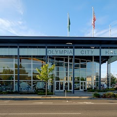
Olympia City Hall
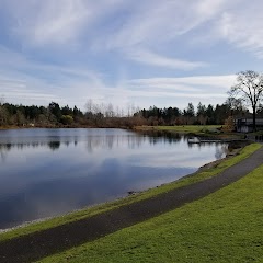
Lacey Community Center
Transit and Meeting Points
Useful pickup, handoff, or rendezvous points close to Tumwater.
Centennial Station
Centralia station
Tacoma Dome Station
Tukwila station
Flight Path Map
This map shows the direct air route between Hansville and Vancouver. Straight-line distance: 157.61 mi (253.65 km).
#1 Hansville
Situated at the northernmost tip of the Kitsap Peninsula where Puget Sound meets Admiralty Inlet, this coastal community sits at an approximate elevation of 26 feet.
| Population | 0 |
| Coordinates | 47.9187000, -122.5543100 |
| Altitude | 8 |
| Country | United States |

#2 Vancouver
The third most populous city in Washington.
| Population | 186,192 |
| Coordinates | 45.6387300, -122.6614900 |
| Altitude | 52 |
| Country | United States |
End: East Fourth Plain Boulevard (-122.661479, 45.638677)
Estimated Travel Time
Distance: 309 km by road
| Speed | Time |
|---|---|
| 30 mph (48.3 km/h) | 06h 23m |
| 40 mph (64.37 km/h) | 04h 48m |
| 50 mph (80.47 km/h) | 03h 50m |
| 60 mph (96.56 km/h) | 03h 12m |
| 70 mph (112.65 km/h) | 02h 44m |
| 80 mph (129 km/h) | 02h 23m |
Fuel, Round Trip and CO2
Estimated fuel cost and emissions for this route.
| Fuel | $/gal | One way | Round trip |
|---|---|---|---|
| Regular gas | $5.44 | $36.85 | $73.70 |
| Mid-grade | $5.72 | $38.77 | $77.55 |
| Premium | $5.98 | $40.52 | $81.05 |
| Diesel | $7.29 | $49.44 | $98.88 |
Assumes 8.3 L/100 km (about 28.3 MPG). CO2 is an estimate and varies by vehicle, fuel blend, traffic, and terrain.
Prices in Washington · Oct 15, 2026