How far is Fort Worth, TX from Kermit, TX?
The driving distance from Fort Worth, TX to Kermit, TX is about 366.9 miles (590.5 km), with a travel time of about 06h 32m by car.
- The straight-line flight distance is about 342.4 miles (551 km).
- For a round trip, plan for roughly 13h 05m of driving time before adding stops, traffic, or weather delays.
- A comfortable departure window is usually 6:00 AM to 7:30 AM CDT.
Reverse, save, or send this route
This drive is better planned with a longer stop or an overnight stay. Copy the route link, send it to another device, or print a clean version before you head out.
This drive is better planned with a longer stop or an overnight stay.
Flight Distance
Driving Distance
Gas Cost Calculator
Leave and Arrive Planner
Pick a departure time to see your estimated arrival and same-day return window.
Drive time stays fixed at 06h 32m.
Starting early still helps, but most travelers will want a longer stop or an overnight stay on a route this long.
You are leaving earlier than the recommended window, which gives you extra margin for breaks and traffic.
Halfway Point
A useful midpoint for breaks, coffee, or meeting in the middle.
Route Weather Snapshot
Check the forecast at both ends before you head out.
Partly Cloudy
Sunny
Driving Route Map
The map below follows the saved road route between Fort Worth and Kermit.
Turn-by-Turn Driving Directions
Step-by-step road directions between Fort Worth and Kermit.
-
1
Start on South Freeway
17 m · 3 sec · South Freeway
-
2
Turn right onto Elmwood Avenue
145 m · 23 sec · Elmwood Avenue
-
3
At the end of the road, turn right onto Epps Street
631 ft · 28 sec · Epps Street
-
4
Continue on East Maddox Avenue
126 m · 20 sec · East Maddox Avenue
-
5
At the end of the road, turn right onto South Freeway
98 m · 14 sec · South Freeway
-
6
Turn left onto East Allen Avenue
64 m · 13 sec · East Allen Avenue
-
7
Turn left onto South Freeway
2359 ft · 46 sec · South Freeway
-
8
Turn left onto East Rosedale Street
1.9 mi · 4 min · East Rosedale Street
-
9
Take the ramp slight right toward I 30 West
1.4 km · 2 min
-
10
Merge slight left onto West Freeway
12.9 mi · 14 min · West Freeway
-
11
Merge slight right
299.7 mi · 5 hr 4 min
-
12
Take the exit slight right toward Loop 338: Odessa
1015 ft · 20 sec
-
13
Turn left onto East Interstate 20
72 m · 5 sec · East Interstate 20
-
14
Turn right onto Southeast Loop 338
1.2 km · 53 sec · Southeast Loop 338
-
15
Continue on Ray C. Stoker, Jr. Memorial Highway
1.6 mi · 2 min · Ray C. Stoker, Jr. Memorial Highway
-
16
Turn left onto State Highway 191 East
2413 ft · 43 sec · State Highway 191 East
-
17
Continue on East 42nd Street
5.6 mi · 7 min · East 42nd Street
-
18
At the end of the road, turn right onto Kermit Highway
1996 ft · 35 sec · Kermit Highway
-
19
Continue on State Highway 302
40.4 mi · 52 min · State Highway 302
-
20
Continue on East Jim Sharp Boulevard
2638 ft · 48 sec · East Jim Sharp Boulevard
-
21
Turn right onto South Poplar Street
1.3 km · 1 min · South Poplar Street
-
22
Turn right onto East Austin Street
51 m · 5 sec · East Austin Street
-
23
Turn right
34 m · 8 sec
-
24
Arrive at your destination
0 m · 1 sec
Car Route Details
A richer read on the saved driving route between Fort Worth and Kermit.
Long-distance drive
This route is long enough that fuel, rest stops, weather, and timing matter more than any single maneuver.
West Freeway
Merge slight right
300 mi · 05h 04m
Route Summary
A quick read on whether this route feels easy, ambitious, or worth planning around.
Better with a longer stop
This route is long enough that most travelers will be better off planning an overnight stay or a more deliberate stop window.
Partly Cloudy leaving Fort Worth and Sunny near Kermit.
Trip Questions
Direct answers travelers usually want before committing to the drive.
How long does it take to drive from Fort Worth to Kermit?
The road trip is about 366.9 miles (590.5 km) and usually takes 06h 32m in normal driving conditions.
Is this a same-day trip or an overnight route?
This route is long enough that most travelers will be better off planning an overnight stay or a more deliberate stop window.
What is the halfway point on this route?
Trent is a useful midpoint, sitting about 183.2 miles from Fort Worth and 183.7 miles from Kermit.
How much longer is the road route than the straight-line distance?
The direct path is about 342.4 miles (551 km), while the road route adds roughly 24.5 extra miles because roads do not follow the straight air line.
When is the best time to leave for this route?
A good departure window is usually 6:00 AM to 7:30 AM CDT. Starting early still helps, but most travelers will want a longer stop or an overnight stay on a route this long.
How much will gas cost for this route?
Using about 28.3 MPG, regular gas is estimated at $48.94 one way or $97.88 round trip. Estimated CO2 is about 115.1 kg one way.
What should you check before leaving?
Before you leave, expect Partly Cloudy around Fort Worth and Sunny near Kermit.
Stop Ideas Near Trent
Useful break, food, and waypoint ideas within about 15 miles of the route midpoint.
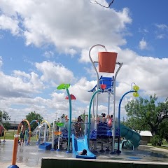
Mustang Harbor Splash Pad

City of Sweetwater
Transit and Meeting Points
Useful pickup, handoff, or rendezvous points close to Trent.
Flight Path Map
This map shows the direct air route between Fort Worth and Kermit. Straight-line distance: 342.36 mi (550.98 km).

#1 Fort Worth
The twelfth most populous city in the United States and the center of the Dallas-Fort Worth metropolitan area.
| Population | 927,720 |
| Coordinates | 32.7254100, -97.3208500 |
| Altitude | 199 |
| Country | United States |
#2 Kermit
City in Texas, United States
| Population | 6,367 |
| Coordinates | 31.8576300, -103.0926700 |
| Altitude | 872 |
| Country | United States |
End: Kermit (-103.09267, 31.85763)
Estimated Travel Time
Distance: 591 km by road
| Speed | Time |
|---|---|
| 30 mph (48.3 km/h) | 12h 13m |
| 40 mph (64.37 km/h) | 09h 10m |
| 50 mph (80.47 km/h) | 07h 20m |
| 60 mph (96.56 km/h) | 06h 06m |
| 70 mph (112.65 km/h) | 05h 14m |
| 80 mph (129 km/h) | 04h 34m |
Fuel, Round Trip and CO2
Estimated fuel cost and emissions for this route.
| Fuel | $/gal | One way | Round trip |
|---|---|---|---|
| Regular gas | $3.78 | $48.94 | $97.88 |
| Mid-grade | $4.25 | $55.06 | $110.13 |
| Premium | $4.59 | $59.45 | $118.91 |
| Diesel | $3.99 | $51.71 | $103.42 |
Assumes 8.3 L/100 km (about 28.3 MPG). CO2 is an estimate and varies by vehicle, fuel blend, traffic, and terrain.
Prices in Texas · Jun 10, 2026
Distance to Other Cities
Planning a road trip? See the full trip guide on Trip.ovh — stops, fuel costs, weather, and departure timing.