How far is Emeryville, CA from San Francisco, CA?
The driving distance from Emeryville, CA to San Francisco, CA is about 11.2 miles (18.1 km), with a travel time of about 00h 20m by car.
- The straight-line flight distance is about 8.3 miles (13.4 km).
- For a round trip, plan for roughly 00h 40m of driving time before adding stops, traffic, or weather delays.
- A comfortable departure window is usually 7:00 AM to 7:00 PM PDT.
Reverse, save, or send this route
This is an easy same-day return drive. Copy the route link, send it to another device, or print a clean version before you head out.
This is an easy same-day return drive.
Flight Distance
Driving Distance
Gas Cost Calculator
Leave and Arrive Planner
Pick a departure time to see your estimated arrival and same-day return window.
Drive time stays fixed at 00h 20m.
This is a short drive, so your comfort window is wide. Traffic and current weather matter more than the clock.
This departure sits inside the recommended comfort window for the route.
Halfway Point
A useful midpoint for breaks, coffee, or meeting in the middle.
The third most populous city in California, Oakland is a major center for business, manufacturing, and culture.
Route Weather Snapshot
Check the forecast at both ends before you head out.
Partly Cloudy
Patchy Fog
Driving Route Map
The map below follows the saved road route between Emeryville and San Francisco.
Turn-by-Turn Driving Directions
Step-by-step road directions between Emeryville and San Francisco.
-
1
Start on Park Avenue
53 m · 15 sec · Park Avenue
-
2
Turn left onto Hollis Street
145 m · 17 sec · Hollis Street
-
3
Turn right onto 40th Street
652 ft · 26 sec · 40th Street
-
4
Turn left onto Horton Street
143 m · 15 sec · Horton Street
-
5
Turn right onto Mandela Parkway
1.1 km · 2 min · Mandela Parkway
-
6
Turn slight right onto Campbell Street
744 ft · 35 sec · Campbell Street
-
7
Turn right onto West Grand Avenue
1 km · 1 min · West Grand Avenue
-
8
Take the ramp straight toward I 80 West, I 580 East: San Francisco, Hayward, Stockton
114 m · 6 sec
-
9
Keep slight left to continue on I 80 West: San Francisco
1.6 km · 1 min
-
10
Merge slight right onto Dwight D. Eisenhower Highway
5.1 mi · 8 min · Dwight D. Eisenhower Highway
-
11
Continue on Route 80
1438 ft · 24 sec · Route 80
-
12
Continue on Route 80
1.2 km · 1 min · Route 80
-
13
Continue on Route 80
1893 ft · 32 sec · Route 80
-
14
Keep slight right to continue on US 101 North: Golden Gate Bridge
1919 ft · 39 sec
-
15
Merge slight right onto Central Freeway
1462 ft · 25 sec · Central Freeway
-
16
Continue on Octavia Boulevard
2490 ft · 42 sec · Octavia Boulevard
-
17
Turn right onto Market Street
629 ft · 32 sec · Market Street
-
18
Keep slight right to continue on Market Street
961 ft · 35 sec · Market Street
-
19
Arrive at your destination
0 m · 1 sec · Market Street
Car Route Details
A richer read on the saved driving route between Emeryville and San Francisco.
Turn-heavy local drive
The route has frequent decision points for its length, so lane choice and turn timing will matter more than cruising speed.
Dwight D. Eisenhower Highway
Merge slight right onto Dwight D. Eisenhower Highway
5.09 mi · 00h 08m
Route Summary
A quick read on whether this route feels easy, ambitious, or worth planning around.
A short regional drive
This route is short enough to handle as a quick errand, commute, or easy same-day return without much planning overhead.
Partly Cloudy leaving Emeryville and Patchy Fog near San Francisco.
Trip Questions
Direct answers travelers usually want before committing to the drive.
How long does it take to drive from Emeryville to San Francisco?
The road trip is about 11.2 miles (18.1 km) and usually takes 00h 20m in normal driving conditions.
Is this a same-day trip or an overnight route?
This route is short enough to handle as a quick errand, commute, or easy same-day return without much planning overhead.
What is the halfway point on this route?
Oakland is a useful midpoint, sitting about 5.3 miles from Emeryville and 5.9 miles from San Francisco.
How much longer is the road route than the straight-line distance?
The direct path is about 8.3 miles (13.4 km), while the road route adds roughly 2.9 extra miles because roads do not follow the straight air line.
When is the best time to leave for this route?
A good departure window is usually 7:00 AM to 7:00 PM PDT. If you want a more comfortable same-day return, try to leave by 7:50 PM PDT.
How much will gas cost for this route?
Using about 28.3 MPG, regular gas is estimated at $2.31 one way or $4.62 round trip. Estimated CO2 is about 3.6 kg one way.
What should you check before leaving?
Before you leave, expect Partly Cloudy around Emeryville and Patchy Fog near San Francisco.
Stop Ideas Near Oakland
Useful break, food, and waypoint ideas within about 15 miles of the route midpoint.

San Francisco City Hall Wedding Photographer
Alameda Public Works Department
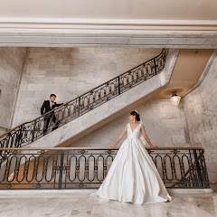
SF City Hall Photographer

My City Hall Wedding
Transit and Meeting Points
Useful pickup, handoff, or rendezvous points close to Oakland.
Oakland – Jack London Square station
Emeryville station
Berkeley station
Oakland Coliseum station
Flight Path Map
This map shows the direct air route between Emeryville and San Francisco. Straight-line distance: 8.3 mi (13.35 km).

#1 Emeryville
City in the United States state of California
| Population | 11,875 |
| Coordinates | 37.8313200, -122.2852500 |
| Altitude | 7 |
| Country | United States |

#2 San Francisco
The seventeenth most populous city in the United States and the center of the San Francisco Bay Area.
| Population | 866,606 |
| Coordinates | 37.7749300, -122.4194200 |
| Altitude | 16 |
| Country | United States |
End: Market Street (-122.419433, 37.774953)
Estimated Travel Time
Distance: 18 km by road
| Speed | Time |
|---|---|
| 30 mph (48.3 km/h) | 00h 22m |
| 40 mph (64.37 km/h) | 00h 16m |
| 50 mph (80.47 km/h) | 00h 13m |
| 60 mph (96.56 km/h) | 00h 11m |
| 70 mph (112.65 km/h) | 00h 09m |
| 80 mph (129 km/h) | 00h 08m |
Fuel, Round Trip and CO2
Estimated fuel cost and emissions for this route.
| Fuel | $/gal | One way | Round trip |
|---|---|---|---|
| Regular gas | $5.77 | $2.31 | $4.62 |
| Mid-grade | $6.07 | $2.43 | $4.85 |
| Premium | $6.24 | $2.50 | $4.99 |
| Diesel | $7.57 | $3.03 | $6.05 |
Assumes 8.3 L/100 km (about 28.3 MPG). CO2 is an estimate and varies by vehicle, fuel blend, traffic, and terrain.
Prices in California · Jul 17, 2026
Distance to Other Cities
Planning a road trip? See the full trip guide on Trip.ovh — stops, fuel costs, weather, and departure timing.