How far is Charleston, SC from Lincolnville, SC?
The driving distance from Charleston, SC to Lincolnville, SC is about 24 miles (38.6 km), with a travel time of about 00h 36m by car.
- The straight-line flight distance is about 20.6 miles (33.1 km).
- For a round trip, plan for roughly 01h 12m of driving time before adding stops, traffic, or weather delays.
- A comfortable departure window is usually 7:00 AM to 7:00 PM EDT.
Reverse, save, or send this route
This is an easy same-day return drive. Copy the route link, send it to another device, or print a clean version before you head out.
This is an easy same-day return drive.
Flight Distance
Driving Distance
Gas Cost Calculator
Leave and Arrive Planner
Pick a departure time to see your estimated arrival and same-day return window.
Drive time stays fixed at 00h 36m.
This is a short drive, so your comfort window is wide. Traffic and current weather matter more than the clock.
You are leaving earlier than the recommended window, which gives you extra margin for breaks and traffic.
Halfway Point
A useful midpoint for breaks, coffee, or meeting in the middle.
City in Berkeley County, South Carolina, United States of America
Route Weather Snapshot
Check the forecast at both ends before you head out.
Sunny then Slight Chance Showers And Thunderstorms
Driving Route Map
The map below follows the saved road route between Charleston and Lincolnville.
Turn-by-Turn Driving Directions
Step-by-step road directions between Charleston and Lincolnville.
-
1
Start on Broad Street
12 m · 5 sec · Broad Street
-
2
Turn right onto Meeting Street
1.2 km · 2 min · Meeting Street
-
3
Turn left onto Calhoun Street
689 ft · 15 sec · Calhoun Street
-
4
Turn right onto King Street
3052 ft · 1 min · King Street
-
5
Turn left onto Spring Street
853 ft · 30 sec · Spring Street
-
6
Turn right onto Coming Street
1144 ft · 31 sec · Coming Street
-
7
Turn right onto Septima Clark Expressway
3078 ft · 1 min · Septima Clark Expressway
-
8
Keep slight left
15.4 mi · 19 min
-
9
Take the exit slight right toward US 78 West
1440 ft · 35 sec
-
10
Turn straight onto University Boulevard
3.9 mi · 6 min · University Boulevard
-
11
Turn left onto Von Ohnsen Road
1.3 km · 2 min · Von Ohnsen Road
-
12
At the end of the road, turn right onto Lincolnville Road
3277 ft · 2 min · Lincolnville Road
-
13
Continue on Lincoln Avenue
1769 ft · 54 sec · Lincoln Avenue
-
14
Turn left onto Pickens Street
805 ft · 30 sec · Pickens Street
-
15
Turn right onto West Carolina Avenue
83 m · 12 sec · West Carolina Avenue
-
16
Arrive at your destination
0 m · 1 sec · West Carolina Avenue
Car Route Details
A richer read on the saved driving route between Charleston and Lincolnville.
Turn-heavy local drive
The route has frequent decision points for its length, so lane choice and turn timing will matter more than cruising speed.
Septima Clark Expressway
Keep slight left
15.4 mi · 00h 19m
Route Summary
A quick read on whether this route feels easy, ambitious, or worth planning around.
A short regional drive
This route is short enough to handle as a quick errand, commute, or easy same-day return without much planning overhead.
Sunny leaving Charleston and Sunny then Slight Chance Showers And Thunderstorms near Lincolnville.
Trip Questions
Direct answers travelers usually want before committing to the drive.
How long does it take to drive from Charleston to Lincolnville?
The road trip is about 24 miles (38.6 km) and usually takes 00h 36m in normal driving conditions.
Is this a same-day trip or an overnight route?
This route is short enough to handle as a quick errand, commute, or easy same-day return without much planning overhead.
What is the halfway point on this route?
Hanahan is a useful midpoint, sitting about 12 miles from Charleston and 12 miles from Lincolnville.
How much longer is the road route than the straight-line distance?
The direct path is about 20.6 miles (33.1 km), while the road route adds roughly 3.4 extra miles because roads do not follow the straight air line.
When is the best time to leave for this route?
A good departure window is usually 7:00 AM to 7:00 PM EDT. If you want a more comfortable same-day return, try to leave by 7:18 PM EDT.
How much will gas cost for this route?
Using about 28.3 MPG, regular gas is estimated at $3.37 one way or $6.73 round trip. Estimated CO2 is about 7.6 kg one way.
What should you check before leaving?
Before you leave, expect Sunny around Charleston and Sunny then Slight Chance Showers And Thunderstorms near Lincolnville.
Stop Ideas Near Hanahan
Useful break, food, and waypoint ideas within about 15 miles of the route midpoint.

Historic Charleston City Market

The City of Goose Creek
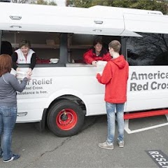
American Red Cross
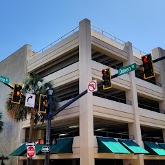
Charleston County Parking Garage
Transit and Meeting Points
Useful pickup, handoff, or rendezvous points close to Hanahan.
Charleston, South Carolina
Yemassee
Kingstree
Denmark
Flight Path Map
This map shows the direct air route between Charleston and Lincolnville. Straight-line distance: 20.56 mi (33.09 km).

#1 Charleston
The most populous city in South Carolina.
| Population | 139,714 |
| Coordinates | 32.7765700, -79.9309200 |
| Altitude | 6 |
| Country | United States |

#2 Lincolnville
City in South Carolina, United States of America
| Population | 2,624 |
| Coordinates | 33.0068400, -80.1553700 |
| Altitude | 24 |
| Country | United States |
End: Lincolnville (-80.15537, 33.00684)
Estimated Travel Time
Distance: 39 km by road
| Speed | Time |
|---|---|
| 30 mph (48.3 km/h) | 00h 47m |
| 40 mph (64.37 km/h) | 00h 36m |
| 50 mph (80.47 km/h) | 00h 28m |
| 60 mph (96.56 km/h) | 00h 24m |
| 70 mph (112.65 km/h) | 00h 20m |
| 80 mph (129 km/h) | 00h 17m |
Fuel, Round Trip and CO2
Estimated fuel cost and emissions for this route.
| Fuel | $/gal | One way | Round trip |
|---|---|---|---|
| Regular gas | $3.96 | $3.37 | $6.73 |
| Mid-grade | $4.43 | $3.76 | $7.53 |
| Premium | $4.78 | $4.06 | $8.12 |
| Diesel | $5.62 | $4.78 | $9.56 |
Assumes 8.3 L/100 km (about 28.3 MPG). CO2 is an estimate and varies by vehicle, fuel blend, traffic, and terrain.
Prices in South Carolina · Jul 18, 2026
Distance to Other Cities
Planning a road trip? See the full trip guide on Trip.ovh — stops, fuel costs, weather, and departure timing.