How far is Baton Rouge, LA from Grand Isle, LA?
The driving distance from Baton Rouge, LA to Grand Isle, LA is about 143.8 miles (231.4 km), with a travel time of about 03h 13m by car.
- The straight-line flight distance is about 110.1 miles (177.2 km).
- For a round trip, plan for roughly 06h 26m of driving time before adding stops, traffic, or weather delays.
- A comfortable departure window is usually 6:00 AM to 8:00 AM CDT.
Reverse, save, or send this route
This drive is better planned with a longer stop or an overnight stay. Copy the route link, send it to another device, or print a clean version before you head out.
This drive is better planned with a longer stop or an overnight stay.
Flight Distance
Driving Distance
Gas Cost Calculator
Leave and Arrive Planner
Pick a departure time to see your estimated arrival and same-day return window.
Drive time stays fixed at 03h 13m.
An early departure helps you fit a real stop into the day without turning the return into a late-night drive.
This departure sits inside the recommended comfort window for the route.
Halfway Point
A useful midpoint for breaks, coffee, or meeting in the middle.
City in Greenup County, Kentucky, United States of America
Route Weather Snapshot
Check the forecast at both ends before you head out.
Sunny
Driving Route Map
The map below follows the saved road route between Baton Rouge and Grand Isle.
Turn-by-Turn Driving Directions
Step-by-step road directions between Baton Rouge and Grand Isle.
-
1
Start on Government Street
2604 ft · 1 min · Government Street
-
2
Turn right onto South 10th Street
985 ft · 17 sec · South 10th Street
-
3
Take the ramp slight left toward I 10 East
1277 ft · 31 sec
-
4
Merge slight left onto Martin Luther King Jr Memorial Freeway
963 ft · 12 sec · Martin Luther King Jr Memorial Freeway
-
5
Merge slight right
31.3 mi · 35 min
-
6
Take the exit slight right toward US 61 South: Gramercy
2170 ft · 41 sec
-
7
Merge slight left onto Airline Highway
9.1 mi · 11 min · Airline Highway
-
8
Turn right
6.8 mi · 9 min
-
9
Turn right
2.3 mi · 3 min
-
10
Turn left
2.2 mi · 3 min
-
11
Turn straight
4 mi · 6 min
-
12
Turn sharp left
19.4 mi · 27 min
-
13
Turn left
2089 ft · 46 sec
-
14
Merge slight left
3.4 mi · 4 min
-
15
Take the exit slight right toward LA 308: Raceland
1636 ft · 30 sec
-
16
Keep slight left to continue on LA-308 East: Lockport
52 m · 4 sec
-
17
Turn left
17.3 mi · 24 min
-
18
Continue on Larose Lift Bridge
3183 ft · 1 min · Larose Lift Bridge
-
19
Turn straight
15.6 mi · 19 min
-
20
Continue on Highway 1
7.9 mi · 12 min · Highway 1
-
21
Turn right onto Gateway to the Gulf Expressway
8.3 mi · 12 min · Gateway to the Gulf Expressway
-
22
Turn left onto Highway 1
13.4 mi · 23 min · Highway 1
-
23
Arrive at your destination
0 m · 1 sec
Car Route Details
A richer read on the saved driving route between Baton Rouge and Grand Isle.
Interchange-aware route
The drive includes several ramps, exits, or merges, so checking the next few maneuvers before busy interchanges is useful.
Martin Luther King Jr Memorial Freeway
Merge slight right
31.3 mi · 00h 35m
Route Summary
A quick read on whether this route feels easy, ambitious, or worth planning around.
A longer out-and-back drive
This is still possible in one day, but it becomes a long driving day. Leaving early and planning your stop window matters more here.
Mostly Sunny leaving Baton Rouge and Sunny near Grand Isle.
Trip Questions
Direct answers travelers usually want before committing to the drive.
How long does it take to drive from Baton Rouge to Grand Isle?
The road trip is about 143.8 miles (231.4 km) and usually takes 03h 13m in normal driving conditions.
Is this a same-day trip or an overnight route?
This is still possible in one day, but it becomes a long driving day. Leaving early and planning your stop window matters more here.
What is the halfway point on this route?
Raceland is a useful midpoint, sitting about 72 miles from Baton Rouge and 71.8 miles from Grand Isle.
How much longer is the road route than the straight-line distance?
The direct path is about 110.1 miles (177.2 km), while the road route adds roughly 33.7 extra miles because roads do not follow the straight air line.
When is the best time to leave for this route?
A good departure window is usually 6:00 AM to 8:00 AM CDT. If you want a more comfortable same-day return, try to leave by 10:34 AM CDT.
How much will gas cost for this route?
Using about 28.3 MPG, regular gas is estimated at $19.20 one way or $38.40 round trip. Estimated CO2 is about 45.1 kg one way.
What should you check before leaving?
Before you leave, expect Mostly Sunny around Baton Rouge and Sunny near Grand Isle.
Stop Ideas Near Raceland
Useful break, food, and waypoint ideas within about 15 miles of the route midpoint.
Transit and Meeting Points
Useful pickup, handoff, or rendezvous points close to Raceland.
Schriever
New Orleans Union Passenger Terminal
Hammond
Baton Rouge, Louisiana
Flight Path Map
This map shows the direct air route between Baton Rouge and Grand Isle. Straight-line distance: 110.11 mi (177.21 km).
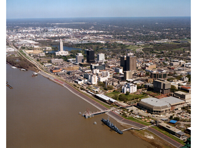
#1 Baton Rouge
The capital of Louisiana.
| Population | 219,052 |
| Coordinates | 30.4433200, -91.1874700 |
| Altitude | 14 |
| Country | United States |

#2 Grand Isle
Town of the United States
| Population | 1,447 |
| Coordinates | 29.2366200, -89.9872900 |
| Altitude | 2 |
| Country | United States |
End: Grand Isle (-89.98729, 29.23662)
Estimated Travel Time
Distance: 231 km by road
| Speed | Time |
|---|---|
| 30 mph (48.3 km/h) | 04h 47m |
| 40 mph (64.37 km/h) | 03h 35m |
| 50 mph (80.47 km/h) | 02h 52m |
| 60 mph (96.56 km/h) | 02h 23m |
| 70 mph (112.65 km/h) | 02h 03m |
| 80 mph (129 km/h) | 01h 47m |
Fuel, Round Trip and CO2
Estimated fuel cost and emissions for this route.
| Fuel | $/gal | One way | Round trip |
|---|---|---|---|
| Regular gas | $3.79 | $19.20 | $38.40 |
| Mid-grade | $4.26 | $21.59 | $43.19 |
| Premium | $4.63 | $23.45 | $46.90 |
| Diesel | $5.42 | $27.45 | $54.91 |
Assumes 8.3 L/100 km (about 28.3 MPG). CO2 is an estimate and varies by vehicle, fuel blend, traffic, and terrain.
Prices in Louisiana · Jun 27, 2026
Distance to Other Cities
Planning a road trip? See the full trip guide on Trip.ovh — stops, fuel costs, weather, and departure timing.