How far is Anderson County Airport, SC from Clover, SC?
The driving distance from Anderson County Airport, SC to Clover, SC is about 110.7 miles (178.1 km), with a travel time of about 02h 18m by car.
- The straight-line flight distance is about 94.3 miles (151.7 km).
- For a round trip, plan for roughly 04h 37m of driving time before adding stops, traffic, or weather delays.
- A comfortable departure window is usually 8:00 AM to 10:00 AM EDT.
Reverse, save, or send this route
This route works well as a day trip with time at the destination. Copy the route link, send it to another device, or print a clean version before you head out.
This route works well as a day trip with time at the destination.
Flight Distance
Driving Distance
Gas Cost Calculator
Leave and Arrive Planner
Pick a departure time to see your estimated arrival and same-day return window.
Drive time stays fixed at 02h 18m.
A morning start gives you useful time at the destination and keeps the return out of the late evening.
This departure sits inside the recommended comfort window for the route.
Halfway Point
A useful midpoint for breaks, coffee, or meeting in the middle.
Census-designated place in Spartanburg County, South Carolina
Route Weather Snapshot
Check the forecast at both ends before you head out.
Sunny
Mostly Sunny then Chance Showers And Thunderstorms
Driving Route Map
The map below follows the saved road route between Anderson County Airport and Clover.
Turn-by-Turn Driving Directions
Step-by-step road directions between Anderson County Airport and Clover.
-
1
Start on the route
89 m · 22 sec
-
2
Turn right onto Airport Road
1.2 km · 2 min · Airport Road
-
3
Turn right onto Highway 24
1 km · 1 min · Highway 24
-
4
Continue on West Whitner Street
1228 ft · 31 sec · West Whitner Street
-
5
Turn left onto Michelin Boulevard
1.2 km · 1 min · Michelin Boulevard
-
6
Turn right onto Standridge Road
763 ft · 29 sec · Standridge Road
-
7
Turn left onto Pearman Dairy Road
3.8 mi · 5 min · Pearman Dairy Road
-
8
Turn left onto Liberty Highway
1.2 mi · 2 min · Liberty Highway
-
9
Take the exit slight right
1927 ft · 47 sec
-
10
Merge slight left
47.7 mi · 58 min
-
11
Keep slight left
33.4 mi · 38 min
-
12
Take the exit slight right toward SC 5, SC 198: Blacksburg, Rock Hill
2272 ft · 55 sec
-
13
Turn right onto North Mountain Street
1.1 mi · 2 min · North Mountain Street
-
14
Continue on York Road
1.6 mi · 2 min · York Road
-
15
Continue on York Highway
1.2 km · 49 sec · York Highway
-
16
Continue on York Road
3.3 mi · 4 min · York Road
-
17
Continue on Kings Creek Drive
1.3 mi · 2 min · Kings Creek Drive
-
18
Turn left onto Clover Highway
1908 ft · 32 sec · Clover Highway
-
19
Continue on Highway 55 West
11.8 mi · 16 min · Highway 55 West
-
20
Continue on Kings Mountain Street
1.4 km · 1 min · Kings Mountain Street
-
21
Turn left onto Church Street
91 m · 10 sec · Church Street
-
22
Turn right onto Guinn Street
159 m · 26 sec · Guinn Street
-
23
Turn right onto North Main Street West
106 m · 6 sec · North Main Street West
-
24
Arrive at your destination
0 m · 1 sec · North Main Street West
Car Route Details
A richer read on the saved driving route between Anderson County Airport and Clover.
Highway-focused drive
Most of the mileage stays on named highways, so the important moments are ramps, exits, merges, and the final local approach.
Liberty Highway
Merge slight left
47.7 mi · 00h 58m
Route Summary
A quick read on whether this route feels easy, ambitious, or worth planning around.
A comfortable day-trip route
This route works well as a day trip. You can leave in the morning, spend meaningful time at the destination, and still return the same day.
Sunny leaving Anderson County Airport and Mostly Sunny then Chance Showers And Thunderstorms near Clover.
Trip Questions
Direct answers travelers usually want before committing to the drive.
How long does it take to drive from Anderson County Airport to Clover?
The road trip is about 110.7 miles (178.1 km) and usually takes 02h 18m in normal driving conditions.
Is this a same-day trip or an overnight route?
This route works well as a day trip. You can leave in the morning, spend meaningful time at the destination, and still return the same day.
What is the halfway point on this route?
Southern Shops is a useful midpoint, sitting about 55.3 miles from Anderson County Airport and 55.4 miles from Clover.
How much longer is the road route than the straight-line distance?
The direct path is about 94.3 miles (151.7 km), while the road route adds roughly 16.4 extra miles because roads do not follow the straight air line.
When is the best time to leave for this route?
A good departure window is usually 8:00 AM to 10:00 AM EDT. If you want a more comfortable same-day return, try to leave by 1:52 PM EDT.
How much will gas cost for this route?
Using about 28.3 MPG, regular gas is estimated at $15.45 one way or $30.90 round trip. Estimated CO2 is about 34.7 kg one way.
What should you check before leaving?
Before you leave, expect Sunny around Anderson County Airport and Mostly Sunny then Chance Showers And Thunderstorms near Clover.
Stop Ideas Near Southern Shops
Useful break, food, and waypoint ideas within about 15 miles of the route midpoint.
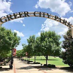
Greer City Park

City of Greer
Event Halls at Greer City Hall
Cowpens Police Department
Transit and Meeting Points
Useful pickup, handoff, or rendezvous points close to Southern Shops.
Spartanburg
Greenville
Gastonia
Clemson
Flight Path Map
This map shows the direct air route between Anderson County Airport and Clover. Straight-line distance: 94.26 mi (151.7 km).

#1 Anderson County Airport
A county-owned airport located in Anderson County, South Carolina.
| Population | 194,692 |
| Coordinates | 34.4948300, -82.7087500 |
| Altitude | 230 |
| Country | United States |

#2 Clover
Town in the U.
| Population | 6,800 |
| Coordinates | 35.1112500, -81.2264600 |
| Altitude | 258 |
| Country | United States |
End: Clover (-81.22646, 35.11125)
Estimated Travel Time
Distance: 178 km by road
| Speed | Time |
|---|---|
| 30 mph (48.3 km/h) | 03h 41m |
| 40 mph (64.37 km/h) | 02h 46m |
| 50 mph (80.47 km/h) | 02h 12m |
| 60 mph (96.56 km/h) | 01h 50m |
| 70 mph (112.65 km/h) | 01h 34m |
| 80 mph (129 km/h) | 01h 22m |
Fuel, Round Trip and CO2
Estimated fuel cost and emissions for this route.
| Fuel | $/gal | One way | Round trip |
|---|---|---|---|
| Regular gas | $3.96 | $15.45 | $30.90 |
| Mid-grade | $4.43 | $17.27 | $34.55 |
| Premium | $4.78 | $18.63 | $37.27 |
| Diesel | $5.62 | $21.93 | $43.87 |
Assumes 8.3 L/100 km (about 28.3 MPG). CO2 is an estimate and varies by vehicle, fuel blend, traffic, and terrain.
Prices in South Carolina · Jun 27, 2026
Distance to Other Cities
Planning a road trip? See the full trip guide on Trip.ovh — stops, fuel costs, weather, and departure timing.