How far is Amarillo, TX from Montopolis, TX?
The driving distance from Amarillo, TX to Montopolis, TX is about 498.7 miles (802.5 km), with a travel time of about 07h 50m by car.
- The straight-line flight distance is about 419.7 miles (675.5 km).
- For a round trip, plan for roughly 15h 40m of driving time before adding stops, traffic, or weather delays.
- A comfortable departure window is usually 6:00 AM to 7:30 AM CDT.
Reverse, save, or send this route
This drive is better planned with a longer stop or an overnight stay. Copy the route link, send it to another device, or print a clean version before you head out.
This drive is better planned with a longer stop or an overnight stay.
Flight Distance
Driving Distance
Gas Cost Calculator
Leave and Arrive Planner
Pick a departure time to see your estimated arrival and same-day return window.
Drive time stays fixed at 07h 50m.
Starting early still helps, but most travelers will want a longer stop or an overnight stay on a route this long.
You are leaving earlier than the recommended window, which gives you extra margin for breaks and traffic.
Halfway Point
A useful midpoint for breaks, coffee, or meeting in the middle.
City in Texas, United States
Route Weather Snapshot
Check the forecast at both ends before you head out.
Mostly Sunny
Mostly Sunny
Driving Route Map
The map below follows the saved road route between Amarillo and Montopolis.
Turn-by-Turn Driving Directions
Step-by-step road directions between Amarillo and Montopolis.
-
1
Start on East Amarillo Boulevard
87 m · 9 sec · East Amarillo Boulevard
-
2
Turn right onto North Pierce Street
2278 ft · 58 sec · North Pierce Street
-
3
Continue on North Pierce Street
1.5 km · 3 min · North Pierce Street
-
4
Continue on Canyon Expressway
14 mi · 16 min · Canyon Expressway
-
5
Keep slight left to continue on Marshall Formby Memorial Highway
103.7 mi · 1 hr 44 min · Marshall Formby Memorial Highway
-
6
Take the exit slight right toward Loop 289
1011 ft · 25 sec
-
7
Turn straight onto North Interstate 27
2536 ft · 1 min · North Interstate 27
-
8
Turn left onto North Loop 289
1110 ft · 24 sec · North Loop 289
-
9
Take the ramp slight left
885 ft · 22 sec
-
10
Merge slight left
7.5 mi · 9 min
-
11
Take the exit slight right toward Spur 331: Southeast Drive
128 m · 10 sec
-
12
Keep slight right to continue on Spur 331: Southeast Drive
71 m · 6 sec
-
13
Turn straight onto Southeast Loop 289
563 ft · 16 sec · Southeast Loop 289
-
14
Turn right onto Southeast Drive
1.9 mi · 3 min · Southeast Drive
-
15
Merge slight right onto Slaton Road
996 ft · 13 sec · Slaton Road
-
16
Continue on East Highway 84
6.9 mi · 7 min · East Highway 84
-
17
Continue on Trooper Jerry Don Davis Memorial Highway
4.5 mi · 5 min · Trooper Jerry Don Davis Memorial Highway
-
18
Continue on East Highway 84
20 mi · 20 min · East Highway 84
-
19
Continue on North US Highway 84
1 mi · 1 min · North US Highway 84
-
20
Turn left onto East 15th Street
734 ft · 17 sec · East 15th Street
-
21
Turn right onto Ralls Road
1863 ft · 38 sec · Ralls Road
-
22
Turn straight onto North Avenue F
1.1 mi · 2 min · North Avenue F
-
23
At the end of the road, turn left onto US Highway 84
73.9 mi · 1 hr 14 min · US Highway 84
-
24
Keep slight left to continue on I 20 East, US 84 East: Abilene
6.5 mi · 7 min
-
25
Take the exit slight right toward SH 70 South, SH 70 Business: Sweetwater, San Angelo
737 ft · 18 sec
-
26
Turn slight left onto Southwest Georgia Avenue
624 ft · 17 sec · Southwest Georgia Avenue
-
27
Turn right onto Lamar Street
1.2 km · 1 min · Lamar Street
-
28
Continue on State Highway 70
10.4 mi · 11 min · State Highway 70
-
29
Turn left onto State Highway 153
69 mi · 1 hr 14 min · State Highway 153
-
30
Continue on West Walnut Street
1.6 km · 2 min · West Walnut Street
-
31
Continue on East Walnut Street
1.5 km · 1 min · East Walnut Street
-
32
At the end of the road, turn left
9.4 mi · 11 min
-
33
Continue straight
21.5 mi · 25 min
-
34
Turn right onto Garmon Drive
1.3 mi · 1 min · Garmon Drive
-
35
Continue on US Highway 84 East
29.2 mi · 33 min · US Highway 84 East
-
36
Turn right
22.2 mi · 25 min
-
37
Continue straight
14.8 mi · 15 min
-
38
Merge slight left onto North US Highway 281
79 m · 4 sec · North US Highway 281
-
39
Continue on North Key Avenue
2.3 mi · 5 min · North Key Avenue
-
40
Continue on South US Highway 183
35.3 mi · 38 min · South US Highway 183
-
41
Continue straight
2151 ft · 30 sec
-
42
Keep slight left to continue on 183A Toll Road
14.3 mi · 14 min · 183A Toll Road
-
43
Continue straight
14.8 mi · 17 min
-
44
Continue on Bergstrom Expressway
4.8 mi · 5 min · Bergstrom Expressway
-
45
Take the exit slight right toward Montopolis Drive, Patton Avenue
1442 ft · 35 sec
-
46
Turn straight onto Ed Bluestein Boulevard
1951 ft · 30 sec · Ed Bluestein Boulevard
-
47
Take the ramp straight toward 183 Toll South: Lockhart
148 m · 12 sec
-
48
Arrive at your destination
0 m · 1 sec
Car Route Details
A richer read on the saved driving route between Amarillo and Montopolis.
Long-distance drive
This route is long enough that fuel, rest stops, weather, and timing matter more than any single maneuver.
Marshall Formby Memorial Highway
Keep slight left to continue on Marshall Formby Memorial Highway
104 mi · 01h 44m
Route Summary
A quick read on whether this route feels easy, ambitious, or worth planning around.
Better with a longer stop
This route is long enough that most travelers will be better off planning an overnight stay or a more deliberate stop window.
Mostly Sunny leaving Amarillo and Mostly Sunny near Montopolis.
Trip Questions
Direct answers travelers usually want before committing to the drive.
How long does it take to drive from Amarillo to Montopolis?
The road trip is about 498.7 miles (802.5 km) and usually takes 07h 50m in normal driving conditions.
Is this a same-day trip or an overnight route?
This route is long enough that most travelers will be better off planning an overnight stay or a more deliberate stop window.
What is the halfway point on this route?
Sweetwater is a useful midpoint, sitting about 249 miles from Amarillo and 249.6 miles from Montopolis.
How much longer is the road route than the straight-line distance?
The direct path is about 419.7 miles (675.5 km), while the road route adds roughly 79 extra miles because roads do not follow the straight air line.
When is the best time to leave for this route?
A good departure window is usually 6:00 AM to 7:30 AM CDT. Starting early still helps, but most travelers will want a longer stop or an overnight stay on a route this long.
How much will gas cost for this route?
Using about 28.3 MPG, regular gas is estimated at $66.51 one way or $133.02 round trip. Estimated CO2 is about 156.4 kg one way.
What should you check before leaving?
Before you leave, expect Mostly Sunny around Amarillo and Mostly Sunny near Montopolis.
Stop Ideas Near Sweetwater
Useful break, food, and waypoint ideas within about 15 miles of the route midpoint.
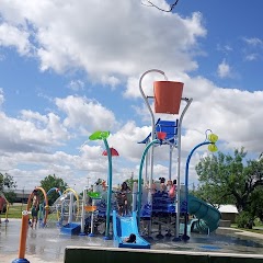
Mustang Harbor Splash Pad

City of Sweetwater
Transit and Meeting Points
Useful pickup, handoff, or rendezvous points close to Sweetwater.
Flight Path Map
This map shows the direct air route between Amarillo and Montopolis. Straight-line distance: 419.72 mi (675.47 km).

#1 Amarillo
The second most populous city in Texas Panhandle.
| Population | 199,654 |
| Coordinates | 35.2220000, -101.8313000 |
| Altitude | 1118 |
| Country | United States |
#2 Montopolis
This Travis County community, situated at an elevation of 469 feet, is known for its Colorado River industrial areas.
| Population | 912,791 |
| Coordinates | 30.2432700, -97.6905600 |
| Altitude | 143 |
| Country | United States |
End: 183 Toll (-97.690637, 30.243248)
Estimated Travel Time
Distance: 802 km by road
| Speed | Time |
|---|---|
| 30 mph (48.3 km/h) | 16h 36m |
| 40 mph (64.37 km/h) | 12h 28m |
| 50 mph (80.47 km/h) | 09h 58m |
| 60 mph (96.56 km/h) | 08h 18m |
| 70 mph (112.65 km/h) | 07h 07m |
| 80 mph (129 km/h) | 06h 13m |
Fuel, Round Trip and CO2
Estimated fuel cost and emissions for this route.
| Fuel | $/gal | One way | Round trip |
|---|---|---|---|
| Regular gas | $3.78 | $66.51 | $133.02 |
| Mid-grade | $4.25 | $74.84 | $149.67 |
| Premium | $4.59 | $80.80 | $161.60 |
| Diesel | $3.99 | $70.28 | $140.55 |
Assumes 8.3 L/100 km (about 28.3 MPG). CO2 is an estimate and varies by vehicle, fuel blend, traffic, and terrain.
Prices in Texas · Jun 24, 2026
Distance to Other Cities
Planning a road trip? See the full trip guide on Trip.ovh — stops, fuel costs, weather, and departure timing.