MapSof
.net
Places
Countries
States
Capital Cities
All Places
Maps
Physical Maps
Political Maps
Historical Maps
All Maps
Tools
Distance Calculator
Address Locator
Geocoder
Street View
Coordinate Finder
Distances
Countries
States
Cities
Maps
Distance Calculator
Geocoder
Distances
Home
/
North America
/
Canada
/
Nova Scotia
/
Cape Breton Island
/
Maps
/
Cape Breton Island Map
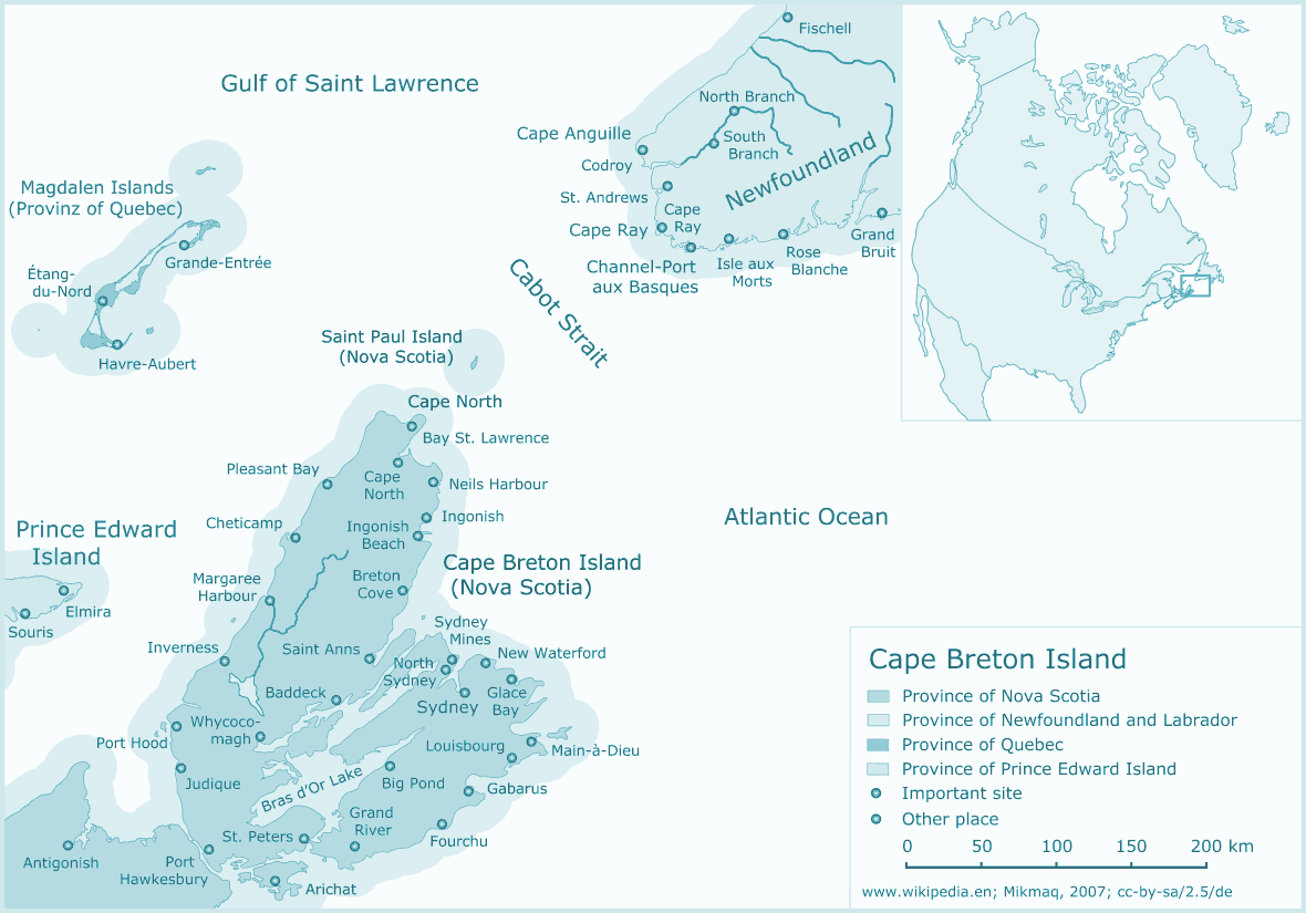
Click on the
Cape Breton Island Map
to view it full screen.
File Type:
png,
File size:
65765 bytes (64.22 KB),
Map Dimensions:
1180px x 825px (256 colors)
More
Cape Breton Island Static Maps
Cape Breton Island Map
1180 x 825 - 65,765k - png