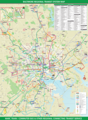
Baltimore Downtown Transport Map
Click on the Baltimore Downtown Transport Map to view it full screen. File Type: png, File size: 423595 bytes (413.67 KB), Map Dimensions: 1450px x 1843px (256 colors)
More Baltimore Static Maps
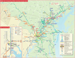
Baltimore Commuter Bus Map (link)
2000 x 1545 - 549,639k - png
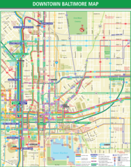
Baltimore Downtown Transport Map
1450 x 1843 - 423,595k - png
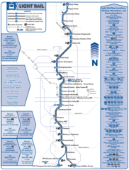
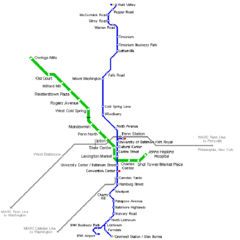
Baltimore Light Rail Map (tram)
1211 x 1600 - 177,026k - png
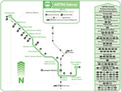
Baltimore Subway Map (metro)
1200 x 913 - 73,111k - png
Baltimore Transport Map
2140 x 2924 - 1,735,562k - png
Baltimore Metro Map
700 x 700 - 9,761k - png