West Barnstable, Massachusetts
West Barnstable: city in Barnstable County, Massachusetts, United States of America
About
West Barnstable is a city located in the county of Barnstable in the U.S. state of Massachusetts.

Quick Facts about West Barnstable
| Population | 1,508 |
| Country | United States of America |
| State | Massachusetts (United States) |
| County | Barnstable County |
| Latitude & Longitude | 41.7057,-70.3745 |
| Altitude | 43 feet / 13 meters |
| Time Zone | America/New_York |
| Local time | 10:02:22 (14th July 2026) |
| Postal code | 02668 |

Geography
West Barnstable is located at 41°42'20"N 70°22'28"W (41.7056600, -70.3744700).
West Barnstable map
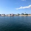
Best Things to Do in West Barnstable
1Sandy Neck Gate House
425 Sandy Neck Rd, West Barnstable, MA 02668, United States View details
Phone: +15083628300 | Website available

2Sandy Neck Lighthouse
West Barnstable, MA 02668, United States View details
Website available
People born in West Barnstable (2)
People born in West Barnstable, including Officer of the United States Navy John Percival, United States jurist Lemuel Shaw, .
More notable people
Nearby Schools and Colleges
Schools and campuses linked to West Barnstable, MA. Select a name to open its map and contact details.
| Code | Name | City | ZIP |
|---|---|---|---|
| 165194 | Cape Cod Community College | West Barnstable (MA) | 02668-1599 |
Nearby Transit Stations (8)
Rail and bus stations connected to West Barnstable, MA. Select a station to open its map and address details.
| Code | Name | Address | Type |
|---|---|---|---|
| RTE | Route 128 station | 50 University Ave | RAIL |
| PVD | Providence station | 100 Gaspee Street | RAIL |
| BOS | South Station | 2 South Station | RAIL |
| BBY | Back Bay station | 145 Dartmouth St. | RAIL |
| BON | North Station | 100 Legends Way | RAIL |
Closest post offices linked to West Barnstable.
| Post Office Name | City | ZIP |
|---|---|---|
| West Barnstabl Post Office | West Barnstable (MA) | 02668 |
Other cities in Barnstable County
Cities, towns, neighborhoods & other populated places in Barnstable County , MA. (more)
| City Name | Population | Title |
|---|---|---|
| Barnstable | 44,535 | A town in Barnstable County, Massachusetts. |
| Falmouth | 31,107 | Town in Massachusetts, United States |
| Yarmouth | 23,166 | City in Massachusetts |
| Sandwich | 20,151 | Human settlement in Barnstable County, Massachusetts, United States of America |
| Bourne | 19,743 | Town in Barnstable County, Massachusetts, United States |
| Mashpee | 14,266 | Town in Barnstable County, Massachusetts, United States |
| Hyannis | 14,120 | Village in town of Barnstable, Barnstable County, Massachusetts, United States |
| Dennis | 13,890 | Town in Barnstable County, Massachusetts, United States |
| Harwich | 12,144 | Town on Cape Cod, in Barnstable County in the state of Massachusetts |
| South Yarmouth | 11,092 | Census-designated place in Barnstable County, Massachusetts |
| Brewster | 9,772 | Town in Massachusetts |
| Marstons Mills | 8,017 | City in Barnstable County, Massachusetts, United States of America |
| East Falmouth | 6,038 | Census-designated place in Barnstable County, Massachusetts |
| West Yarmouth | 6,012 | Census-designated place in Barnstable County, Massachusetts |
| Chatham | 5,994 | Town in Massachusetts, USA |
| Orleans | 5,802 | Town of Barnstable County, Massachusetts, United States |
Distance to Other Cities
West Barnstable distances to largest Massachusetts cities