Unionville, Nevada
Unionville: ghost town and unincorporated community in Pershing County, Nevada, United States.
About
Unionville is a town located in the county of Pershing in the U.S. state of Nevada.
Quick Facts about Unionville
| Country | United States of America |
| State | Nevada (United States) |
| County | Pershing County |
| Latitude & Longitude | 40.4455,-118.1207 |
| Time Zone | America/Los_Angeles |
| Local time | 08:14:36 (6th November 2026) |
| Weather | 33℉ Mostly Clear 7-days weather |
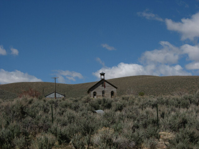
Unionville Nevada image
Geography
Unionville is located at 40°26'44"N 118°7'15"W (40.4454600, -118.1207000).
Unionville map
Click "full screen"  icon to open full mode. View satellite images
Weather
33°F
Mostly Clear
5 to 10 mph N
Tonight
Mostly clear, with a low around 33. North wind 5 to 10 mph.
7-Day Forecast
Buena Vista, Dixie
Nearby Transit Stations (1)
Rail and bus stations connected to Unionville, NV. Select a station to open its map and address details.
| Code | Name | Address | Type |
|---|---|---|---|
| WNN | Winnemucca station | 209 Railroad Street | RAIL |
Closest post offices linked to Unionville.
| Post Office Name | City | ZIP |
|---|---|---|
| Imlay Post Office | Imlay (NV) | 89418 |
Other places with the same name (2)
- Unionville, North Carolina county seat of Union County, South Carolina. with a population of 7,344 people.
- Unionville, Missouri City in Putnam County, Missouri, United States. with a population of 1,733 people.
Other cities in Pershing County
Cities, towns, neighborhoods & other populated places in Pershing County , NV.
| City Name | Population | Title |
|---|---|---|
| Lovelock | 1,819 | City in and county seat of Pershing County, Nevada, United States |