Tel Aviv District, Tel Aviv
Tel Aviv District: one of the six districts in Israel
About
State Snapshot
Tel Aviv District at a glance
Tel Aviv District currently has 10 quality-checked populated place pages and 0 county pages linked on MapSof.
Mapped cities & towns
10
These counts use a stricter populated-place filter so the main lists stay focused on real city and town pages.
County pages
0
Open related pagesLargest city
H̱olonPopulation 194,300
Top linked places
Quick Facts about Tel Aviv District
| Population | 1,350,000 |
| Country | Israel |
| State | Tel Aviv (Israel) |
| Area | 186 km2 |
| Latitude & Longitude | 32.0841,34.8000 |
| Capital | Tel Aviv |
| Time Zone | Asia/Jerusalem |
| Local time | 17:54:47 (16th July 2026) |
Geography
Tel Aviv District is located at 32°5'3"N 34°47'60"E (32.0841400, 34.7999500).
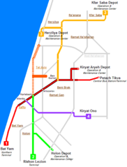
Tel Aviv District map
The largest city of Tel Aviv District is H̱olon with a population of 194,300. Other cities include, Bnei Brak population 193,774, Ramat Gan population 156,277, Bat Yam population 128,800 and Herzliya population 95,100. See all Tel Aviv District cities & populated places.
- Givatayim
- Bat Yam
- Herzliya
- Kfar Shmaryahu
- Azor
- Ramat HaSharon
- Kiryat Ono
- Tel Aviv
- Bnei Brak
- Ramat Gan
- Or Yehuda
- Holon
Demographics
| Year | Population | % Change | Method |
|---|---|---|---|
| 1948 | 305,700 | - | census |
| 1961 | 699,300 | 56.28% | census |
| 1972 | 907,200 | 22.92% | census |
| 1983 | 1,000,200 | 9.3% | census |
| 1995 | 1,142,000 | 12.42% | census |
| 2008 | 1,258,800 | 9.28% | census |
| 2009 | 1,277,100 | 1.43% | census |
| 2011 | 1,303,400 | 2.02% | census |
| 2012 | 1,313,300 | 0.75% | census |
| 2013 | 1,331,300 | 1.35% | census |
| 2014 | 1,350,000 | 1.39% | census |
Map & Images (more maps)