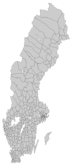
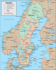
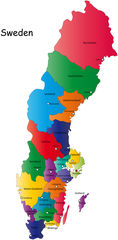
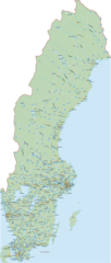
Provinces of Sweden
Sweden is divided into 21 counties or provinces that serve as the country's primary administrative divisions. Getting familiar with Sweden's provinces provides insight into the country's regional organization.
Historical Provinces
Historically, Sweden was comprised of 25 landskap or traditional provinces based on geography and culture:
- Scania, Halland, Blekinge - Southern provinces forming a historical region.
- Bohuslän, Dalsland, Västergötland - Western coastal and interior provinces.
- Östergötland, Södermanland, Närke, Värmland - East central provinces.
- Dalarna, Hälsingland, Gästrikland, Härjedalen - North central forested and mountainous provinces.
- Jämtland, Ångermanland, Medelpad - Northern interior provinces extending into arctic region.
Modern Counties
Today, Sweden's local administration is organized into counties including:
- Stockholm, Uppsala, Södermanland, Östergötland, Jönköping - Eastern counties containing Sweden's largest cities.
- Blekinge, Skåne, Halland - Southern counties forming a cultural region.
- Värmland, Örebro, Västmanland, Dalarna - South central counties.
- Gävleborg, Västernorrland, Jämtland - Northern counties.
In summary, Sweden's provinces reflect both historical regional identities and modern administrative needs in governing this Scandinavian nation.

Click on the Provinces of Sweden to view it full screen. File Type: png, File size: 123803 bytes (120.9 KB), Map Dimensions: 1274px x 2780px (256 colors)
More Kingdom of Sweden Static Maps
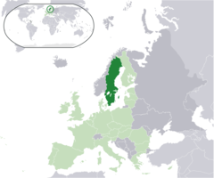
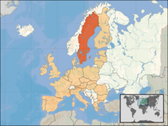
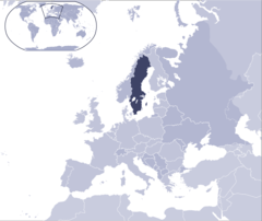
Location Sweden Eu Europe
2056 x 1710 - 132,113k - png
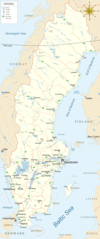
Map of Sweden Cities
999 x 2387 - 288,420k - png
Outline Map of Sweden
2400 x 3395 - 585,268k - jpg
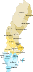
Provinces of Sweden
1274 x 2780 - 123,803k - png
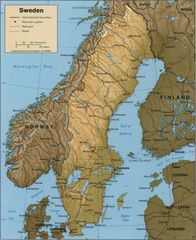
Shaded Relief Map
1741 x 2132 - 391,778k - jpg
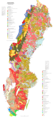
Soil Map of Sweden
1800 x 3970 - 995,382k - png
Sweden Blank Map With Municipal Borders
1040 x 2345 - 156,510k - png
Sweden Cia Old
524 x 1192 - 371,194k - png
Sweden Eu Location
1600 x 1200 - 244,891k - png
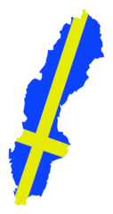
Sweden Flag In Sweden Map
1936 x 3658 - 79,763k - png

Sweden Flag Map
1024 x 2417 - 55,047k - png
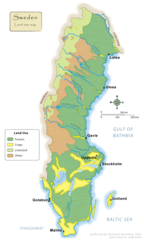
Sweden Land Use Map
900 x 1500 - 150,978k - png
Sweden Map
800 x 994 - 212,942k - gif
Sweden Map 1
720 x 1464 - 134,232k - jpg
Sweden Map 2
549 x 1173 - 60,922k - png
Sweden Physical Map
2051 x 3036 - 999,771k - gif
Sweden Stockholm Districts Map
800 x 850 - 18,591k - png
Swedish Language Speakers Map
1100 x 1300 - 120,351k - png
Sweden Map Physical
973 x 1200 - 243,958k - jpg

Sweden Physical Map 1
1600 x 2368 - 349,369k - jpg
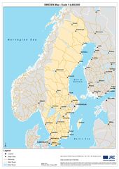
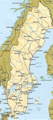
Sweden Road Map
1500 x 3544 - 369,387k - png
Historical Map Sweden And Norway
1025 x 1402 - 193,744k - jpg
Where Is Sweden Located
1000 x 841 - 67,571k - png