MapSof
.net
Places
Countries
States
Capital Cities
All Places
Maps
Physical Maps
Political Maps
Historical Maps
All Maps
Tools
Distance Calculator
Address Locator
Geocoder
Street View
Coordinate Finder
Distances
Countries
States
Cities
Maps
Distance Calculator
Geocoder
Distances
Home
/
North America
/
United States
/
Texas
/
Wise County
/
Newark
/
Maps
/
Newark Light Rail Map (subway)
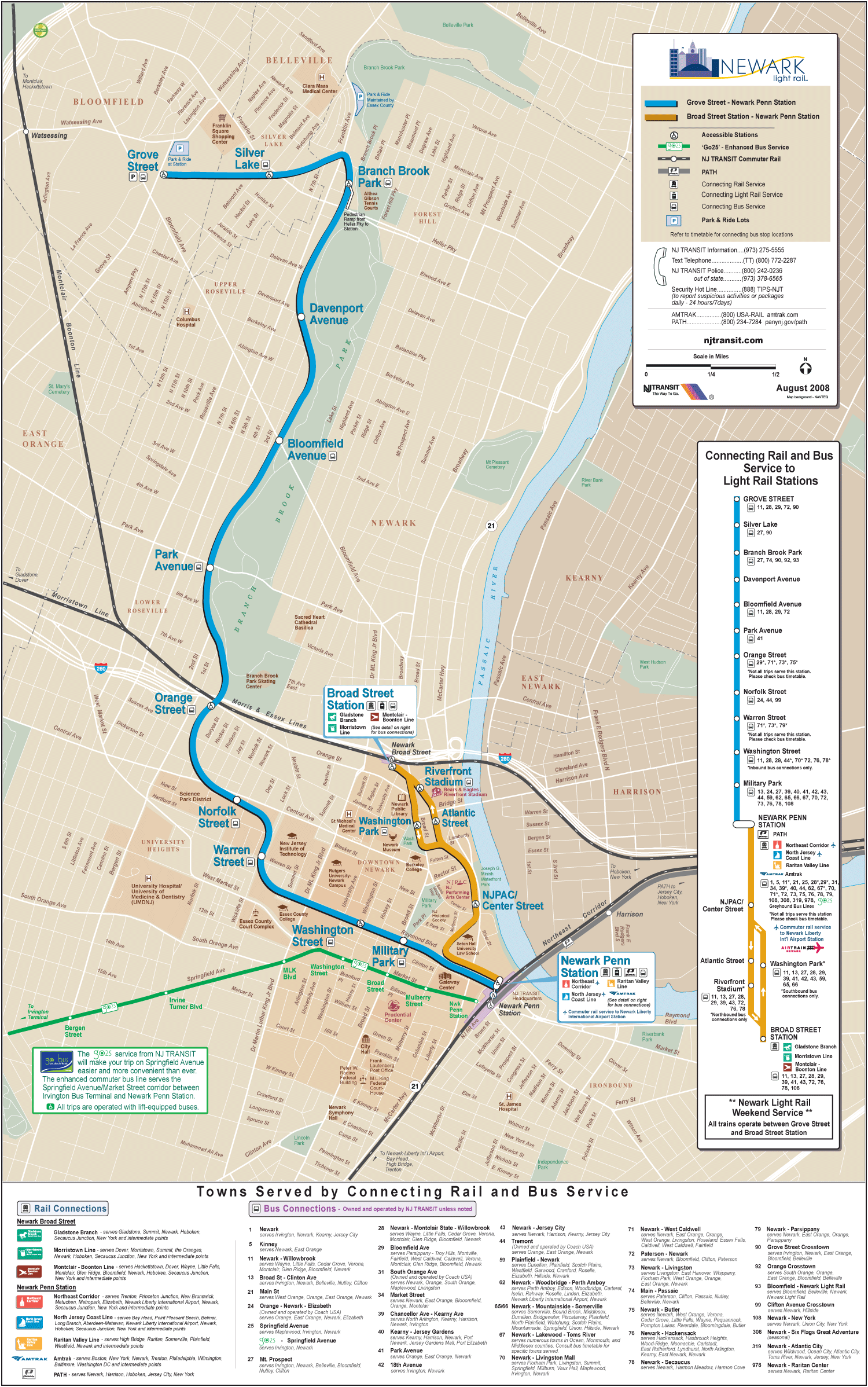
Click on the
Newark Light Rail Map (subway)
to view it full screen.
File Type:
png,
File size:
645056 bytes (629.94 KB),
Map Dimensions:
1500px x 2396px (256 colors)
More
Newark Static Maps
Newark Light Rail Map (subway)
1500 x 2396 - 645,056k - png