MapSof
.net
Places
Countries
States
Capital Cities
All Places
Maps
Physical Maps
Political Maps
Historical Maps
All Maps
Tools
Distance Calculator
Address Locator
Geocoder
Street View
Coordinate Finder
Distances
Countries
States
Cities
Maps
Distance Calculator
Geocoder
Distances
Home
/
Maps
/
Physical Maps
Physical Maps
Browse our collection of physical maps from around the world.
Physical
Political
Historical
Relief
Climate
Thematic
Elevation
Satellite
Road
Topo
Street
Contour
Election
Showing
44
maps — Page 2 of 2
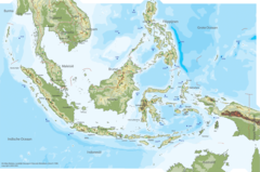
Indonesia Physical Map
Republic of Indonesia
1600x1060 · 496,691k · png
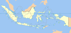
Indonesia Provinces Blank Map
Republic of Indonesia
2000x938 · 101,785k · png
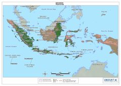
Indonesia Physical Map 1
Republic of Indonesia
1890x1336 · 269,463k · jpg
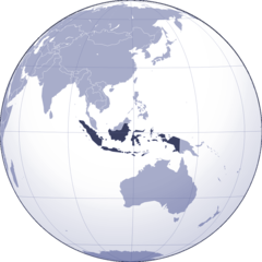
Where Is Indonesia Located
Republic of Indonesia
1000x1002 · 91,420k · png
«
1
2
»