MapSof
.net
Places
Countries
States
Capital Cities
All Places
Maps
Physical Maps
Political Maps
Historical Maps
All Maps
Tools
Distance Calculator
Address Locator
Geocoder
Street View
Coordinate Finder
Distances
Countries
States
Cities
Maps
Distance Calculator
Geocoder
Distances
Home
/
Maps
/
Physical Maps
Physical Maps
Browse our collection of physical maps from around the world.
Physical
Political
Historical
Relief
Climate
Thematic
Elevation
Satellite
Road
Topo
Street
Contour
Election
Showing
48
maps — Page 2 of 2
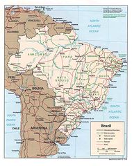
Brazil Political Map 1994
Federative Republic of Brazil
1397x1761 · 233,551k · jpg
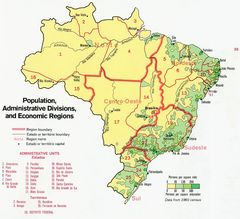
Brazil Population Map 1977
Federative Republic of Brazil
871x795 · 186,502k · jpg
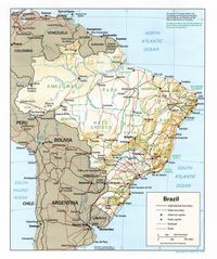
Brazil Shading Relief Map
Federative Republic of Brazil
1092x1304 · 270,164k · jpg
Brazil Shading Relief Map 1994
Federative Republic of Brazil
1092x1304 · 270,164k · jpg
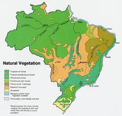
Brazil Vegetation Map 1977
Federative Republic of Brazil
799x758 · 169,948k · jpg
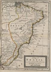
Brazil Historical Map
Federative Republic of Brazil
772x1090 · 169,858k · jpg
Where Is Brazil Located
Federative Republic of Brazil
1000x1000 · 88,522k · png
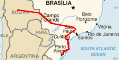
Map Gas Brazil Bolivia 1
Plurinational State of Bolivia
372x189 · 12,464k · png
«
1
2
»