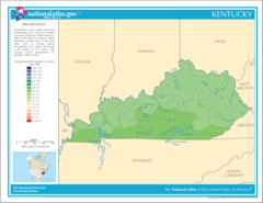
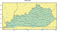
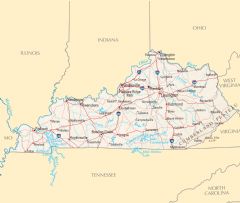
Kentucky Rivers And Lakes
Kentucky has several important river systems flowing through its landscape.
Ohio River
The Ohio River forms the northern border between Kentucky and Indiana/Ohio. Facts about the Ohio River in Kentucky:
- At over 1,000 miles long, it flows from Pittsburgh to the Mississippi River.
- The Ohio River passes through Louisville, Kentucky's largest city.
- It was a strategic river and trade route during settlement of the region.
- Today it supports commercial shipping and provides drinking water.
Kentucky River
The Kentucky River flows west to east through central Kentucky. Details about the Kentucky River:
- It spans over 250 miles across the state.
- The river flows through the Kentucky River Palisades and the state capital of Frankfort.
- Dams along the river generate hydroelectric power.
- It provides opportunities for fishing, boating and tourism.
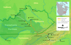
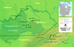
Cumberland River
The Cumberland River flows through southern Kentucky before joining the Ohio River. Facts about the Cumberland River:
- It starts in eastern Kentucky and flows over 600 miles.
- The river passes through the city of Bowling Green, Kentucky.
- It was named after the Duke of Cumberland by explorer Thomas Walker.
Major Lakes in Kentucky
Some notable lakes in Kentucky include:
- Lake Cumberland - One of the largest man-made lakes in the eastern U.S.
- Lake Barkley - Impounded by a dam on the Cumberland River.
- Kentucky Lake - Formed by the Tennessee Valley Authority along the Tennessee River.
- Cave Run Lake - Located within the Daniel Boone National Forest.
Kentucky's rivers and lakes have shaped its history and landscape while providing essential water, energy, transportation, and recreation resources.
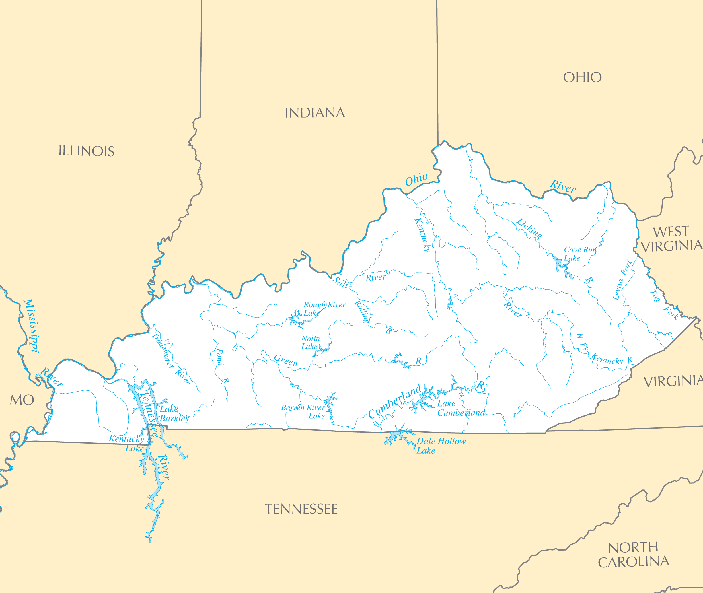
Click on the Kentucky Rivers And Lakes to view it full screen. File Type: PNG, File size: 148923 bytes (145.43 KB), Map Dimensions: 2451px x 2067px ( colors)
More Kentucky Static Maps
Map of Kentucky Na 1
1200 x 927 - 175,718k - png
Frankfort Bird Eye
1800 x 1619 - 524,072k - jpg

Ky01 109
636 x 379 - 28,520k - png
Ky02 109
635 x 379 - 30,870k - png

Ky04 109
635 x 380 - 27,359k - png

Ky05 109
635 x 380 - 30,146k - png
Ky06 109
635 x 379 - 28,299k - png
Kentucky 90
1359 x 644 - 190,343k - jpg
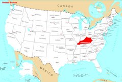
Kentucky Locator Map With Us
454 x 206 - 9,766k - png
Kentucky Locator Map
450 x 202 - 6,924k - png
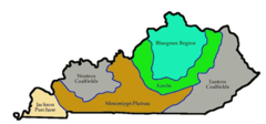
Kentucky Regions
800 x 372 - 19,301k - png
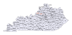
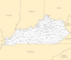
Kentucky Counties Map
1153 x 558 - 70,449k - gif
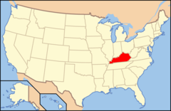
Map of Usa Ky
920 x 598 - 29,460k - png
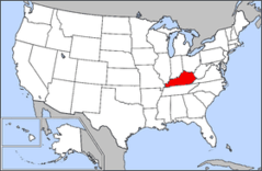
Map of Usa Highlighting Kentucky
280 x 183 - 10,558k - png
Portland1850s
960 x 720 - 100,103k - jpg
Precipitation of Kentucky
2122 x 1640 - 163,074k - png
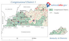
United States House of Representatives, Kentucky District 1 Map
636 x 379 - 28,520k - png

United States House of Representatives, Kentucky District 2 Map
635 x 379 - 30,870k - png
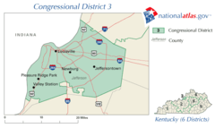
United States House of Representatives, Kentucky District 3 Map
635 x 379 - 17,770k - png
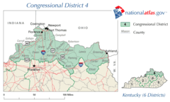
United States House of Representatives, Kentucky District 4 Map
635 x 380 - 27,359k - png
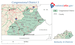
United States House of Representatives, Kentucky District 5 Map
635 x 380 - 30,146k - png

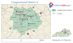
United States House of Representatives, Kentucky District 6 Map
635 x 379 - 28,299k - png
Wilderness Road De
1200 x 762 - 581,644k - png
Wilderness Road En
950 x 603 - 367,990k - png

Kentucky Flag Map
1534 x 694 - 43,365k - png
Counties Map of Kentucky
1451 x 789 - 125,639k - png
Where Is Kentucky Located
1476 x 1002 - 135,309k - png
Kentucky Cities And Towns
2454 x 2061 - 175,358k - PNG
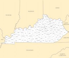
Kentucky County Map
2442 x 2058 - 164,079k - PNG
Kentucky Reference Map
2454 x 2076 - 590,428k - PNG