Ireland, IE
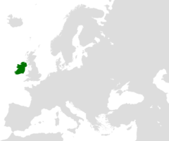
Ireland: Located on the westernmost edge of Europe, this island nation is known for its lush green landscapes, rich history, and vibrant culture.
About

Country Snapshot
Ireland at a glance
Ireland currently has 219 quality-checked populated place pages and 0 state or regional pages linked on MapSof.
Mapped cities & towns
219
These counts use a stricter populated-place filter so the main lists stay focused on real city and town pages.
States & regions
0
Open related pagesLargest city
DublinPopulation 1,173,179
Top linked places
Quick Facts about Ireland
| Population | 5,458,600 |
| Country | Ireland |
| Different from | Northern Ireland, Ireland |
| Twitter username | IrishEmbJapan |
| Plate code | EIR, IRL |
| Area | 70273 km2 |
| Official name | Poblacht na hÉireann, l’Irlande, Republic of Ireland, Éire, Ireland |
| Continent | Europe |
| Easternmost point | Point(-5.997722222 52.965361111) |
| Northernmost point | Point(-7.371833333 55.384194444) |
| Latitude & Longitude | 53.0000,-8.0000 |
| Legislative body | Oireachtas |
| Named for | Ireland |
| Official language | Irish, English |
| Capital | Dublin |
| Establishment | December 29, 1937 (88 years ago) |
| Time Zone | Europe/Dublin, UTC+01:00, UTC±00:00 |
| Local time | 14:13:01 (15th July 2026) |

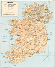
Geography
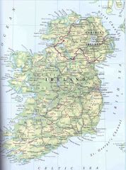
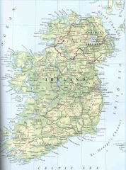
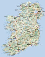
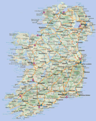
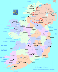
Ireland is located at 53°0'0"N 8°0'0"W (53.0000000, -8.0000000). It has 2 neighbors: United Kingdom and Northern Ireland.
Ireland map
The largest city of Ireland is Dublin with a population of 1,173,179. Other cities include, Cork population 208,669, Drogheda population 33,441, Westport population 6,200 and Killorglin population 2,082. See all Ireland cities & populated places.
Compare Ireland with
- County Offaly
- County Kilkenny
- County Galway
- County Cavan
- County Sligo
- County Westmeath
- County Cork
- County Longford
- County Laois
- County Leitrim
- County Waterford
- Ulster
- County Mayo
- County Kerry
- County Kildare
- County Monaghan
- County Donegal
- County Clare
- County Wicklow
- County Meath
- County Tipperary
- Munster
- County Dublin
- County Louth
- Connacht
- County Carlow
- Leinster
- County Wexford
- County Roscommon
- County Limerick
Demographics
| Year | Population | % Change | Method |
|---|---|---|---|
| 1960 | 2,828,600 | - | 2128999 |
| 1961 | 2,824,400 | -0.15% | estimation process |
| 1962 | 2,836,050 | 0.41% | 2128999 |
| 1963 | 2,852,650 | 0.58% | 2128999 |
| 1964 | 2,866,550 | 0.48% | 2128999 |
| 1965 | 2,877,300 | 0.37% | Census of Ireland 2011 |
| 1966 | 2,888,800 | 0.4% | Census of Ireland 2011 |
| 1967 | 2,902,450 | 0.47% | 2128999 |
| 1968 | 2,915,550 | 0.45% | 2128999 |
| 1969 | 2,932,650 | 0.58% | 2128999 |
| 1970 | 2,957,250 | 0.83% | estimation process |
| 1971 | 2,992,050 | 1.16% | 2128999 |
| 1972 | 3,036,850 | 1.48% | 2128999 |
| 1973 | 3,085,950 | 1.59% | 2128999 |
| 1974 | 3,137,500 | 1.64% | estimation process |
| 1975 | 3,189,550 | 1.63% | 2128999 |
| 1976 | 3,238,050 | 1.5% | 2128999 |
| 1977 | 3,282,200 | 1.35% | Census of Ireland 2011 |
| 1978 | 3,329,100 | 1.41% | 2128999 |
| 1979 | 3,373,750 | 1.32% | 2128999 |
| 1980 | 3,412,800 | 1.14% | 2128999 |
| 1981 | 3,453,000 | 1.16% | 2128999 |
| 1982 | 3,485,800 | 0.94% | Census of Ireland 2011 |
| 1983 | 3,510,600 | 0.71% | 2128999 |
| 1984 | 3,532,423 | 0.62% | 2128999 |
| 1985 | 3,538,082 | 0.16% | estimation process |
| 1986 | 3,539,690 | 0.05% | estimation process |
| 1987 | 3,540,057 | 0.01% | Census of Ireland 2011 |
| 1988 | 3,524,949 | -0.43% | 2128999 |
| 1989 | 3,511,009 | -0.4% | estimation process |
| 1990 | 3,513,974 | 0.08% | 2128999 |
| 1991 | 3,534,235 | 0.57% | 2128999 |
| 1992 | 3,558,430 | 0.68% | 2128999 |
| 1993 | 3,576,261 | 0.5% | 2128999 |
| 1994 | 3,590,386 | 0.39% | 2128999 |
| 1995 | 3,608,841 | 0.51% | Census of Ireland 2011 |
| 1996 | 3,637,510 | 0.79% | 2128999 |
| 1997 | 3,674,171 | 1% | 2128999 |
| 1998 | 3,712,696 | 1.04% | 2128999 |
| 1999 | 3,754,786 | 1.12% | 2128999 |
| 2000 | 3,805,174 | 1.32% | 2128999 |
| 2001 | 3,866,243 | 1.58% | 2128999 |
| 2002 | 3,931,947 | 1.67% | estimation process |
| 2003 | 3,996,521 | 1.62% | estimation process |
| 2004 | 4,070,262 | 1.81% | 2128999 |
| 2005 | 4,159,914 | 2.16% | Census of Ireland 2011 |
| 2006 | 4,273,591 | 2.66% | Census of Ireland 2011 |
| 2007 | 4,398,942 | 2.85% | Census of Ireland 2011 |
| 2008 | 4,489,544 | 2.02% | 2128999 |
| 2009 | 4,535,375 | 1.01% | 2128999 |
| 2010 | 4,560,155 | 0.54% | 2128999 |
| 2011 | 4,576,794 | 0.36% | 2128999 |
| 2012 | 4,586,897 | 0.22% | estimation process |
| 2013 | 4,597,558 | 0.23% | 2128999 |
| 2014 | 4,657,740 | 1.29% | (Worldbank) |
| 2015 | 4,701,957 | 0.94% | (Worldbank) |
| 2016 | 4,761,865 | 1.26% | estimation process |
| 2017 | 4,813,608 | 1.07% | Census of Ireland 2011 |
| 2018 | 4,867,316 | 1.1% | (Worldbank) |
| 2019 | 4,941,444 | 1.5% | (Worldbank) |
| 2026 | 5,458,600 | 9.47% |
Map & Images (more maps)
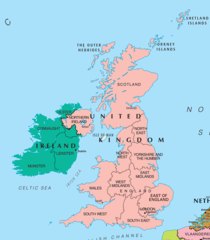
Uk Map Northern Ireland 1
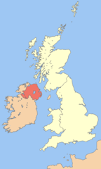
Nireland 1
Ireland Uk 1
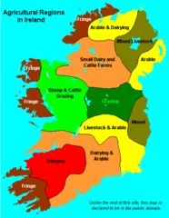
Ireland Maps Island Agriculture 1
Ireland 2 3
Ireland 4
Ireland 5
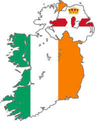
Ireland Flag Map
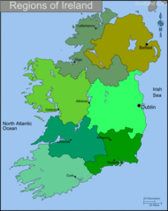
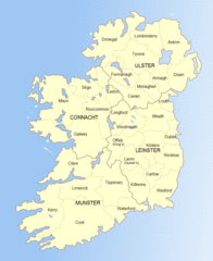
Ireland Regions Map
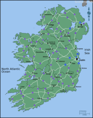
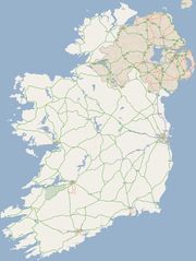
Ireland Road Map
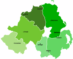
Northern Ireland Map
Ireland Map
Ireland Map 2
Ireland Map Big
Ireland Map Big 1
Ireland Political Map
Ireland Relief Map
Ireland Railway Map
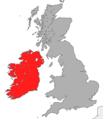
Where Is Ireland Located