Yarmouth Port, Massachusetts
Yarmouth Port: census designated place
About
Yarmouth Port is a CDP located in the county of Barnstable in the U.S. state of Massachusetts.

Quick Facts about Yarmouth Port
| Population | 5,320 |
| Country | United States of America |
| State | Massachusetts (United States) |
| County | Barnstable County |
| Postal code | 02675 |
| Area | 16.74 km2 |
| Latitude & Longitude | 41.7021,-70.2495 |
| Altitude | 52 feet / 16 meters |
| Time Zone | America/New_York |
| Local time | 15:23:02 (9th June 2026) |

Geography
Yarmouth Port is located at 41°42'7"N 70°14'58"W (41.7020500, -70.2494700).
Yarmouth Port map
Best Things to Do in Yarmouth Port
1Edward Gorey House
8 Strawberry Ln, Yarmouth Port, MA 02675, United States View details
Phone: +15083623909 | Website available

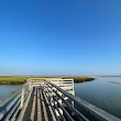
2GJK Viewpoint
400 Center St, Yarmouth Port, MA 02675, United States View details
3Winslow Crocker House
250 MA-6A, Yarmouth Port, MA 02675, United States View details
Phone: +16179946661 | Website available

People born in Yarmouth Port (2)
People born in Yarmouth Port, including politician Thomas Chandler Thacher, baseball player Keith Reed, .
More notable people
Nearby Schools and Colleges
Schools and campuses linked to Yarmouth Port, MA. Select a name to open its map and contact details.
| Code | Name | City | ZIP |
|---|---|---|---|
| 165194 | Cape Cod Community College | West Barnstable (MA) | 02668-1599 |
Nearby Transit Stations (8)
Rail and bus stations connected to Yarmouth Port, MA. Select a station to open its map and address details.
| Code | Name | Address | Type |
|---|---|---|---|
| RTE | Route 128 station | 50 University Ave | RAIL |
| BOS | South Station | 2 South Station | RAIL |
| PVD | Providence station | 100 Gaspee Street | RAIL |
| BBY | Back Bay station | 145 Dartmouth St. | RAIL |
| BON | North Station | 100 Legends Way | RAIL |
Closest post offices linked to Yarmouth Port.
| Post Office Name | City | ZIP |
|---|---|---|
| Yarmouth Por Post Office | Yarmouth Port (MA) | 02675 |
Other cities in Barnstable County
Cities, towns, neighborhoods & other populated places in Barnstable County , MA. (more)
| City Name | Population | Title |
|---|---|---|
| Barnstable | 44,535 | A town in Barnstable County, Massachusetts. |
| Falmouth | 31,107 | Town in Massachusetts, United States |
| Yarmouth | 23,166 | City in Massachusetts |
| Sandwich | 20,151 | Human settlement in Barnstable County, Massachusetts, United States of America |
| Bourne | 19,743 | Town in Barnstable County, Massachusetts, United States |
| Mashpee | 14,266 | Town in Barnstable County, Massachusetts, United States |
| Hyannis | 14,120 | Village in town of Barnstable, Barnstable County, Massachusetts, United States |
| Dennis | 13,890 | Town in Barnstable County, Massachusetts, United States |
| Harwich | 12,144 | Town on Cape Cod, in Barnstable County in the state of Massachusetts |
| South Yarmouth | 11,092 | Census-designated place in Barnstable County, Massachusetts |
| Brewster | 9,772 | Town in Massachusetts |
| Marstons Mills | 8,017 | City in Barnstable County, Massachusetts, United States of America |
| East Falmouth | 6,038 | Census-designated place in Barnstable County, Massachusetts |
| West Yarmouth | 6,012 | Census-designated place in Barnstable County, Massachusetts |
| Chatham | 5,994 | Town in Massachusetts, USA |
| Orleans | 5,802 | Town of Barnstable County, Massachusetts, United States |
Distance to Other Cities
Yarmouth Port distances to largest Massachusetts cities