Togo (Togolese Republic), TG
Togo: Located in West Africa, on the Gulf of Guinea, this sub-Saharan nation is characterized by its palm-lined beaches and a vibrant kente cloth industry.
About

Country Snapshot
Togolese Republic at a glance
Togolese Republic currently has 15 quality-checked populated place pages and 5 state or regional pages linked on MapSof.
Mapped cities & towns
15
These counts use a stricter populated-place filter so the main lists stay focused on real city and town pages.
States & regions
5
Open related pagesLargest city
LoméPopulation 749,700
Top linked places
Quick Facts about Togolese Republic
| Population | 8,095,498 |
| Country | Togo |
| Plate code | TG |
| Area | 56785 km2 |
| Official name | Togo, Togo, la République togolaise |
| Continent | Africa |
| Northernmost point | Point(-0.13 11.13) |
| Latitude & Longitude | 8.6667,1.0833 |
| Legislative body | National Assembly |
| Official language | French |
| Capital | Lomé |
| Establishment | April 27, 1960 (66 years ago) |
| Time Zone | UTC±00:00 |
| Local time | 21:34:20 (25th July 2026) |

Geography
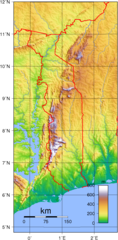
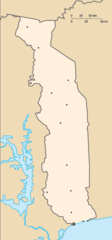
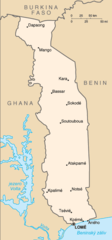
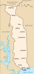
Togolese Republic is located at 8°40'0"N 1°4'60"E (8.6666700, 1.0833300). It has 3 neighbors: Ghana, Burkina Faso and Benin.
Togo map
The largest city of Togolese Republic is Lomé with a population of 749,700. Other cities include, Sokodé population 117,811, Tsévié population 55,775, Aného population 47,579 and Sansanné-Mango population 37,748. See all Togolese Republic cities & populated places.
Official website of Togolese Republic
Official WebsiteCompare Togolese Republic with
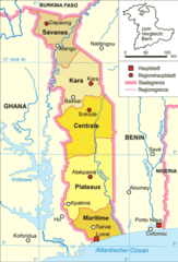
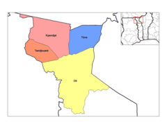
- Centrale Region
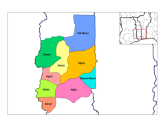
- Kara Region
- Plateaux Region
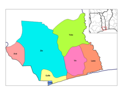
- Maritime
- Savanes Region
Demographics
| Year | Population | % Change | Method |
|---|---|---|---|
| 1960 | 1,580,513 | - | census |
| 1961 | 1,597,528 | 1.07% | census |
| 1962 | 1,612,758 | 0.94% | census |
| 1963 | 1,631,763 | 1.16% | census |
| 1964 | 1,662,072 | 1.82% | census |
| 1965 | 1,708,632 | 2.72% | census |
| 1966 | 1,774,029 | 3.69% | census |
| 1967 | 1,855,445 | 4.39% | census |
| 1968 | 1,945,781 | 4.64% | census |
| 1969 | 2,034,909 | 4.38% | census |
| 1970 | 2,115,521 | 3.81% | census |
| 1971 | 2,185,661 | 3.21% | census |
| 1972 | 2,247,575 | 2.75% | census |
| 1973 | 2,303,345 | 2.42% | census |
| 1974 | 2,356,623 | 2.26% | census |
| 1975 | 2,410,446 | 2.23% | census |
| 1976 | 2,464,459 | 2.19% | census |
| 1977 | 2,518,572 | 2.15% | census |
| 1978 | 2,576,477 | 2.25% | census |
| 1979 | 2,642,853 | 2.51% | census |
| 1980 | 2,720,838 | 2.87% | census |
| 1981 | 2,812,051 | 3.24% | census |
| 1982 | 2,915,098 | 3.53% | census |
| 1983 | 3,026,308 | 3.67% | census |
| 1984 | 3,140,297 | 3.63% | census |
| 1985 | 3,252,995 | 3.46% | census |
| 1986 | 3,363,537 | 3.29% | census |
| 1987 | 3,472,650 | 3.14% | census |
| 1988 | 3,579,803 | 2.99% | census |
| 1989 | 3,684,782 | 2.85% | census |
| 1990 | 3,787,602 | 2.71% | census |
| 1991 | 3,887,716 | 2.58% | census |
| 1992 | 3,985,364 | 2.45% | census |
| 1993 | 4,082,422 | 2.38% | census |
| 1994 | 4,181,481 | 2.37% | census |
| 1995 | 4,284,497 | 2.4% | census |
| 1996 | 4,392,177 | 2.45% | census |
| 1997 | 4,504,291 | 2.49% | census |
| 1998 | 4,620,710 | 2.52% | census |
| 1999 | 4,740,974 | 2.54% | census |
| 2000 | 4,864,753 | 2.54% | census |
| 2001 | 4,992,225 | 2.55% | census |
| 2002 | 5,123,674 | 2.57% | census |
| 2003 | 5,258,956 | 2.57% | census |
| 2004 | 5,397,851 | 2.57% | census |
| 2005 | 5,540,214 | 2.57% | census |
| 2006 | 5,685,845 | 2.56% | census |
| 2007 | 5,834,806 | 2.55% | census |
| 2008 | 5,987,491 | 2.55% | census |
| 2009 | 6,144,457 | 2.55% | census |
| 2010 | 6,337,000 | 3.04% | census |
| 2011 | 6,472,304 | 2.09% | census |
| 2012 | 6,642,928 | 2.57% | census |
| 2013 | 6,816,982 | 2.55% | census |
| 2014 | 7,137,997 | 4.5% | (Worldbank) |
| 2015 | 7,323,158 | 2.53% | (Worldbank) |
| 2016 | 7,509,952 | 2.49% | (Worldbank) |
| 2017 | 7,797,694 | 3.69% | census |
| 2018 | 7,889,094 | 1.16% | (Worldbank) |
| 2019 | 8,082,366 | 2.39% | (Worldbank) |
| 2026 | 8,095,498 | 0.16% |
Map & Images (more maps)
000 Togo Harta
408px Togo Karte Politisch

At0111 Map 2

At0707 Map 5

At0722 Map 6
Centrale Prefectures
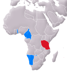
Deutschen Kolonie Afrika Deutsch Ostafrika 2
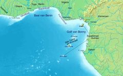
Golf Van Guinee 6
Golf Von Guinea 6
Gulf of Guinea (english) 6
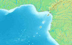
Gulf of Guinea (blank) 6
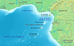
Gulf of Guinea Fr 6
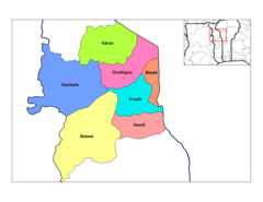
Kara Prefectures
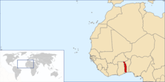
Locationtogo
Mapa Toga
Maritime Prefectures
Plateaux Prefectures
Savanes Prefectures
To Map
Togo Falkoberdorf