Transport Map of Karnataka
Click on the Transport Map of Karnataka to view it full screen. File Type: jpg, File size: 304940 bytes (297.79 KB), Map Dimensions: 816px x 1300px (16777216 colors)
More State of Kerala Static Maps
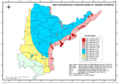
Hazard Map of Andhra Pradesh
1400 x 989 - 121,044k - png
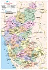
Political Map of Karnataka
900 x 1324 - 260,535k - jpg
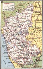
Transport Map of Karnataka
816 x 1300 - 304,940k - jpg