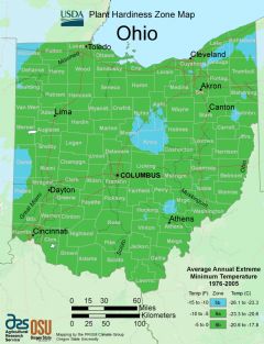
Ohio, US
Ohio: Located in the Midwest region of the United States, this state is home to major cities like Columbus, Cleveland, and Cincinnati.
Ohio is a Midwestern state that played a central role in early U.S. history and development. Bordered by Lake Erie, Ohio, Kentucky, West Virginia, Pennsylvania, Indiana, and Michigan.
Some key facts about Ohio:
- Capital: Columbus
- Population: Around 11.8 million (7th most populous state)
- Area: 44,825 square miles (34th largest state)
- Nickname: The Buckeye State
Ohio features varied topography including rolling hills, mountains, caves, rivers, and Lake Erie shoreline. The interior has rich farmland. Ohio has four seasons with hot humid summers and cold winters.
Ohio's largest cities are Columbus, Cleveland, Cincinnati, and Toledo. Columbus is the state capital and home to Ohio State University. Cleveland lies on the shores of Lake Erie. Cincinnati played a key role in early American history and development.
Ohio was home to the first major battles of the Civil War. Eight U.S. presidents hailed from Ohio. The state was central to the Industrial Revolution and assembly lines. Today, major industries include manufacturing, healthcare, and agriculture.
Culturally, Ohio is renowned for its museums, symphony orchestras, and professional sports teams. Popular attractions include the Rock & Roll Hall of Fame, Cedar Point, and Amish Country. The state has an ethnically diverse population.
In summary, with its blend of major metros, natural beauty, history, culture, and “heartland” allure, Ohio is a quintessential Midwestern state and significant contributor to American identity.

State Snapshot
Ohio at a glance
Ohio currently has 675 quality-checked populated place pages and 88 county pages linked on MapSof.
Mapped cities & towns
675
These counts use a stricter populated-place filter so the main lists stay focused on real city and town pages.
County pages
88
Open related pagesLargest city
ColumbusPopulation 884,356
Top linked places
Quick Facts about Ohio
| Population | 11,693,217 |
| Country | United States of America |
| Area | 116096 km2 |
| Water as percent of area | 8.85% |
| Land as percent of area | 91.15% |
| Continent | North America |
| Northernmost point | Point(-80.519841666 42.327108333) |
| Latitude & Longitude | 40.2503,-83.0002 |
| Legislative body | Ohio General Assembly |
| Named for | Ohio River |
| Altitude | 951 feet / 290 meters |
| Capital | Columbus |
| Establishment | March 01, 1803 (223 years ago) |
| Time Zone | Eastern Time Zone, America/New_York |
| Local time | 05:56:51 (23rd September 2026) |
| Weather | 66℉ Showers And Thunderstorms Likely 7-days weather |

Geography
Ohio is located at 40°15'1"N 83°0'1"W (40.2503400, -83.0001800). It has 6 neighbors: West Virginia, Indiana, Michigan, Ontario, Kentucky and Pennsylvania.
Ohio map
 icon to open full mode. View satellite images
The largest city of Ohio is Columbus with a population of 884,356. Other cities include, Cleveland population 378,589, Cincinnati population 304,548, Toledo population 271,455 and Akron population 195,994. See all Ohio cities & populated places.
Largest Cities in Ohio (more)
Cities, Towns, Villages, Neighborhoods & Other Populated Places in Ohio.
| City Name | County | Population |
|---|---|---|
| Columbus | Franklin | 884,356 |
| Cleveland | Cuyahoga | 378,589 |
| Cincinnati | Hamilton | 304,548 |
| Toledo | Lucas | 271,455 |
| Akron | Summit | 195,994 |
| Dayton | Montgomery | 139,907 |
| Parma | Cuyahoga | 77,558 |
| Lorain | Lorain | 63,872 |
| Youngstown | Mahoning | 63,828 |
| West Chester | Tuscarawas | 62,791 |
| Hamilton | Butler | 62,148 |
| Colerain | Belmont | 59,145 |
| Springfield | Clark | 58,456 |
| Kettering | Montgomery | 54,313 |
| Dublin | Franklin | 49,372 |
| Lakewood | Cuyahoga | 49,350 |
Show more Ohio cities and populated places
Weather
A chance of rain showers before 8am, then showers and thunderstorms likely. Cloudy, with a high near 66. East wind around 13 mph. Chance of precipitat...
7-Day ForecastOfficial website of Ohio
Official Website- Buenos Aires
- Saitama Prefecture (1990 )
- Putnam County
- Madison County
- Gallia County
- Erie County
- Morrow County
- Licking County
- Logan County
- Richland County
- Pickaway County
- Clinton County
- Hardin County
- Columbiana County
- Marion County
- Stark County
- Trumbull County
- Highland County
- Muskingum County
- Mahoning County
- Allen County
- Champaign County
- Guernsey County
- Paulding County
- Darke County
- Summit County
- Wayne County
- Franklin County
- Carroll County
- Ross County
- Fairfield County
- Lucas County
- Tuscarawas County
- Hocking County
- Adams County
- Williams County
- Cuyahoga County
- Meigs County
- Mercer County
- Perry County
- Pike County
- Harrison County
- Greene County
- Miami County
- Huron County
- Brown County
- Fayette County
- Auglaize County
- Butler County
- Union County
- Seneca County
- Jackson County
- Geauga County
- Hamilton County
- Holmes County
- Ashland County
- Belmont County
- Portage County
- Athens County
- Ottawa County
- Ashtabula County
- Sandusky County
- Noble County
- Wyandot County
- Warren County
- Knox County
- Delaware County
- Lake County
- Washington County
- Wood County
- Van Wert County
- Hancock County
- Clermont County
- Montgomery County
- Scioto County
- Lorain County
- Clark County
- Shelby County
- Henry County
- Crawford County
- Defiance County
- Coshocton County
- Morgan County
- Lawrence County
- Jefferson County
- Vinton County
- Fulton County
- Preble County
- Monroe County
- Medina County
Demographics
| Year | Population | % Change | Method |
|---|---|---|---|
| 1910 | 4,767,121 | - | census |
| 1920 | 5,759,394 | 20.81% | census |
| 1930 | 6,646,697 | 15.41% | census |
| 1940 | 6,907,612 | 3.93% | census |
| 1950 | 7,946,627 | 15.04% | census |
| 1960 | 9,706,397 | 22.14% | census |
| 1970 | 10,652,017 | 9.74% | census |
| 1980 | 10,797,630 | 1.37% | census |
| 1990 | 10,847,115 | 0.46% | census |
| 2000 | 11,353,140 | 4.67% | census |
| 2010 | 11,536,504 | 1.62% | census |
| 2011 | 11,544,663 | 0.07% | estimation process |
| 2012 | 11,548,923 | 0.04% | estimation process |
| 2013 | 11,576,684 | 0.24% | estimation process |
| 2014 | 11,602,700 | 0.22% | estimation process |
| 2015 | 11,617,527 | 0.13% | estimation process |
| 2016 | 11,634,370 | 0.14% | estimation process |
| 2017 | 11,659,650 | 0.22% | estimation process |
| 2018 | 11,676,341 | 0.14% | estimation process |
| 2019 | 11,689,100 | 0.11% | estimation process |
| 2020 | 11,693,217 | 0.04% | estimation process |
People born in Ohio (200)
People born in Ohio, including sociologist Edwin M. Lemert, novelist Thomas Berger, conceptual artist Jenny Holzer, .
More notable people
- Brooklyn Lee (American movie actress) she was born in 01/06/1989
- David A. Huffman (American computer scientist) he was born in 09/08/1925
- LaMarcus Adna Thompson (American businessman) he was born in 08/03/1848
- Henry B. Banning (Union Army general (1836-1881)) he was born in 10/11/1836
- Gene Force (racing driver) he was born in 15/06/1916
- Constance Rourke (American historian) she was born in 14/11/1885
- Tenskwatawa (political leader of the Shawnee tribe) he was born in 01/01/1775
- Tecumseh (Native American leader of the Shawnee (1768-1813)) he was born in 01/01/1768
- Jessica Beinecke (broadcaster) she was born in 01/01/1986
- Andrea Thompson (American actress) she was born in 22/05/1959
- Ella Guru (American painter and musician living in London) she was born in 24/05/1966
- John Maddox Roberts (American author) he was born in 25/06/1947
- William Ernest Castle (American geneticist) he was born in 25/10/1867
- Chauncey H. Griffith (American typesetter) he was born in 01/01/1879
- Chester Hardy Aldrich (American politician (1862-1924)) he was born in 10/11/1862
- Evelyn Beatrice Longman (American artist) she was born in 21/11/1874
- Kathryn Bolkovac (American human rights advocate and former police investigator) she was born in 01/01/2000
- Chad Donovan (American movie film actor and director) he was born in 11/01/1972
Ohio Counties (more)
Franklin County

county in Massachusetts, United States.
Cuyahoga County

county in Ohio, United States.
Hamilton County

county in New York, United States.
| County Name | Population |
|---|---|
| Franklin County | 1,324,624 |
| Cuyahoga County | 1,227,883 |
| Hamilton County | 817,985 |
| Summit County | 538,866 |
| Montgomery County | 531,610 |
| Lucas County | 428,294 |
| Butler County | 385,648 |
| Stark County | 369,772 |
| Lorain County | 312,172 |
| Warren County | 238,412 |
| Lake County | 229,569 |
| Mahoning County | 226,075 |
| Delaware County | 213,554 |
| Clermont County | 207,449 |
| Trumbull County | 196,800 |
| Medina County | 180,912 |
Show more Ohio counties
Map & Images (more maps)
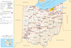
Map of Ohio 1
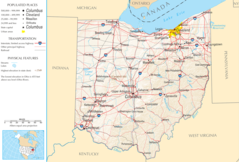
Map of Ohio Na 1
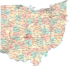
Ohio Map
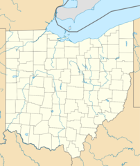
Usa Ohio Location Map
Ohio Flag Map
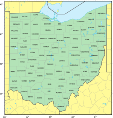
Counties Map of Ohio
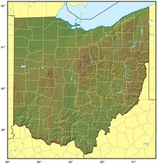
Ohio Relief Map
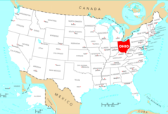
Where Is Ohio Located
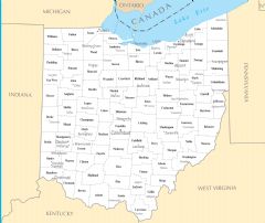
Ohio Cities And Towns
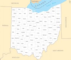
Ohio County Map
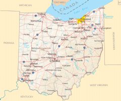
Ohio Reference Map
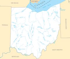
Ohio Rivers And Lakes