Kentucky, US
Kentucky: Located in the Upland South of the United States, this state is bordered by the Ohio River to the north.
About
Kentucky covers 40,409 square miles spanning diverse geography including mountains, plateaus, fertile plains and swamps. It shares borders with 7 states: Illinois, Indiana, Ohio, West Virginia, Virginia, Tennessee and Missouri.
The climate is humid subtropical with abundant rainfall. Winters are cool while summers are hot and humid.
Economy and Industry
Kentucky has a diversified economy led by manufacturing, agriculture, healthcare, transportation and tourism. Key industries include automotive manufacturing, aerospace, aluminum production, food processing and distilling.
Major companies like UPS, GE Appliances and Ford have operations in Kentucky. The state leads in tobacco and bourbon production. Tourism draws visitors to the Kentucky Derby and bourbon distilleries on the Bourbon Trail.
Culture and Demographics
Kentucky has about 4.5 million residents. The population is predominately white at 87%, with Black or African Americans making up 8%. The culture reflects traditional southern hospitality mixed with Appalachian influences.
Education and Sports
The University of Kentucky and University of Louisville are the two major universities with storied college sports programs. Churchill Downs racetrack and the Louisville Slugger Museum are icons of Kentucky’s sports legacy.
Government and Politics
The capital is Frankfort while Louisville is the largest city. The current governor is Andy Beshear, a Democrat. Kentucky has voted Republican in recent presidential elections.
Conclusion
In summary, Kentucky is known for horse racing, bourbon, coal mining and scenic natural beauty. It has a diversified economy and culture deeply rooted in the American South. Kentucky offers a unique blend of pioneering history, hospitality and tradition.

State Snapshot
Kentucky at a glance
Kentucky currently has 450 quality-checked populated place pages and 120 county pages linked on MapSof.
Mapped cities & towns
450
These counts use a stricter populated-place filter so the main lists stay focused on real city and town pages.
County pages
120
Open related pagesLargest city
LouisvillePopulation 760,026
Top linked places
Quick Facts about Kentucky
| Population | 4,477,251 |
| Country | United States of America |
| Twitter username | kygov |
| Area | 104659 km2 |
| Water as percent of area | 2.28% |
| Land as percent of area | 97.72% |
| Northernmost point | Point(-84.7478 39.1434) |
| Latitude & Longitude | 38.2004,-84.8776 |
| Legislative body | Kentucky General Assembly |
| Named for | Kentucky River |
| Official language | English |
| Altitude | 755 feet / 230 meters |
| Capital | Frankfort |
| Establishment | June 01, 1792 (234 years ago) |
| Time Zone | America/New_York, Eastern Time Zone |
| Local time | 08:25:47 (24th July 2026) |
| Weather | 83℉ Partly Sunny 7-days weather |

Geography
Kentucky is located at 38°12'2"N 84°52'39"W (38.2004200, -84.8776200). It has 7 neighbors: Missouri, Tennessee, West Virginia, Illinois, Indiana, Ohio and Virginia.
Kentucky map
The largest city of Kentucky is Louisville with a population of 760,026. Other cities include, Lexington-Fayette population 314,488, Lexington population 225,366, Bowling Green population 70,631 and Owensboro population 60,344. See all Kentucky cities & populated places.
Largest Cities in Kentucky (more)
Cities, Towns, Villages, Neighborhoods & Other Populated Places in Kentucky.
| City Name | County | Population |
|---|---|---|
| Louisville | Jefferson | 760,026 |
| Lexington-Fayette | Fayette | 314,488 |
| Lexington | Fayette | 225,366 |
| Bowling Green | Warren | 70,631 |
| Owensboro | Daviess | 60,344 |
| Covington | Kenton | 40,314 |
| Richmond | Madison | 36,800 |
| Florence | Boone | 33,423 |
| Hopkinsville | Christian | 30,899 |
| Nicholasville | Jessamine | 30,888 |
| Elizabethtown | Hardin | 30,331 |
| Independence | Kenton | 28,903 |
| Henderson | Henderson | 27,974 |
| Frankfort | Franklin | 27,715 |
| Jeffersontown | Jefferson | 27,562 |
| Paducah | McCracken | 24,883 |
Show more Kentucky cities and populated places
Weather
Partly sunny, with a high near 83. Northeast wind around 5 mph.
7-Day Forecast- Kenton County
- Pendleton County
- Boyle County
- Menifee County
- Lewis County
- Henry County
- Letcher County
- Metcalfe County
- Harlan County
- Powell County
- Bracken County
- Taylor County
- Laurel County
- Jefferson County
- Morgan County
- Johnson County
- Breckinridge County
- Hopkins County
- Jessamine County
- Adair County
- Magoffin County
- Carroll County
- Hancock County
- Washington County
- Rockcastle County
- Casey County
- Montgomery County
- Calloway County
- Knott County
- Meade County
- Estill County
- Boyd County
- Floyd County
- McCreary County
- Crittenden County
- Allen County
- Clay County
- Union County
- Perry County
- Edmonson County
- Nicholas County
- Lyon County
- Woodford County
- Madison County
- Russell County
- Campbell County
- Lee County
- Graves County
- Ohio County
- Bell County
- Fulton County
- Nelson County
- Logan County
- LaRue County
- Owen County
- Greenup County
- Muhlenberg County
- Oldham County
- Spencer County
- Franklin County
- Grayson County
- Barren County
- Trimble County
- Marshall County
- Bath County
- Elliott County
- Jackson County
- Monroe County
- Bourbon County
- Lincoln County
- Grant County
- Livingston County
- Garrard County
- Wolfe County
- Marion County
- Rowan County
- Hickman County
- Cumberland County
- Pulaski County
- Owsley County
- Todd County
- Daviess County
- Carter County
- Simpson County
- Hart County
- Carlisle County
- Christian County
- Fayette County
- Gallatin County
- Scott County
- Whitley County
- Shelby County
- Bullitt County
- McLean County
- Pike County
- Webster County
- Mercer County
- Robertson County
- Knox County
- Mason County
- Caldwell County
- Wayne County
- Henderson County
- Anderson County
- Clinton County
- Boone County
- Lawrence County
- Butler County
- Harrison County
- Martin County
- Clark County
- Green County
- Breathitt County
- Fleming County
- McCracken County
- Hardin County
- Trigg County
- Leslie County
- Ballard County
- Warren County
Demographics
| Year | Population | % Change | Method |
|---|---|---|---|
| 1910 | 2,289,905 | - | census |
| 1920 | 2,416,630 | 5.24% | census |
| 1930 | 2,614,589 | 7.57% | census |
| 1940 | 2,845,627 | 8.12% | census |
| 1950 | 2,944,806 | 3.37% | census |
| 1960 | 3,038,156 | 3.07% | census |
| 1970 | 3,218,706 | 5.61% | census |
| 1980 | 3,660,777 | 12.08% | census |
| 1990 | 3,685,296 | 0.67% | census |
| 2000 | 4,041,769 | 8.82% | census |
| 2010 | 4,339,367 | 6.86% | census |
| 2011 | 4,369,821 | 0.7% | estimation process |
| 2012 | 4,386,346 | 0.38% | estimation process |
| 2013 | 4,404,659 | 0.42% | estimation process |
| 2014 | 4,414,349 | 0.22% | estimation process |
| 2015 | 4,425,976 | 0.26% | estimation process |
| 2016 | 4,438,182 | 0.28% | estimation process |
| 2017 | 4,452,268 | 0.32% | estimation process |
| 2018 | 4,461,153 | 0.2% | estimation process |
| 2019 | 4,467,673 | 0.15% | estimation process |
| 2020 | 4,477,251 | 0.21% | estimation process |
People born in Kentucky (200)
People born in Kentucky, including actress Abby Brammell, race horse Sunday Silence, actress Una Merkel, .
More notable people
- Levi Day Boone (American mayor (1808-1882)) he was born in 06/12/1808
- Fletcher Stockdale (American politician (1823-1890)) he was born in 01/01/1823
- Bill Coleman (American musician) he was born in 04/08/1904
- Vernon Benjamin Mountcastle (American neuroscientist) he was born in 15/07/1918
- Frederick William Franz (American Jehovah's Witness leader) he was born in 12/09/1893
- David S. Walker (American politician (1815-1891)) he was born in 02/05/1815
- Paul Tanner (American trombonist) he was born in 15/10/1917
- Benjamin M. Friedman (American economist) he was born in 01/01/1944
- Milton George Henschel (American Jehovah's Witness leader (1920-2003)) he was born in 09/08/1920
- Arthur Lake (actor (1905-1987)) he was born in 17/04/1905
- Citation (Thoroughbred race horse; winner of US Triple Crown of Thoroughbred Racing in 1948) was born in 11/04/1945
- Marvin Hart (American boxer) he was born in 16/09/1876
- Ben Lucien Burman (American writer) he was born in 12/12/1895
- J. Lawrence Smith (American chemist, mineralogist, and student of meteorites (1818-1883)) he was born in 17/12/1818
- Dorothy Spencer (American film editor) she was born in 03/02/1909
- Elizabeth Blair Lee (an American woman who lived through the American Civil War, and wrote hundreds of letters) she was born in 20/06/1818
- Jack Lawrence (American singer and banjoist) he was born in 18/12/1976
- Bernard Coy (American bank robber) he was born in 13/02/1900
Kentucky Counties (more)
Jefferson County

county in Alabama, United States
Fayette County

county in West Virginia, United States
Kenton County

county in Kentucky, United States
| County Name | Population |
|---|---|
| Jefferson County | 767,452 |
| Fayette County | 324,735 |
| Kenton County | 167,949 |
| Boone County | 135,396 |
| Warren County | 134,510 |
| Hardin County | 111,309 |
| Daviess County | 101,978 |
| Madison County | 94,265 |
| Campbell County | 94,020 |
| Bullitt County | 82,182 |
| Christian County | 71,478 |
| Oldham County | 66,999 |
| McCracken County | 65,644 |
| Pulaski County | 65,530 |
| Laurel County | 61,238 |
| Scott County | 58,470 |
Show more Kentucky counties
Map & Images (more maps)
Map of Kentucky Na 1
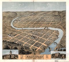
Frankfort Bird Eye

Ky01 109
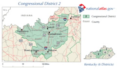
Ky02 109

Ky04 109

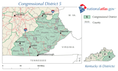
Ky05 109
Ky06 109
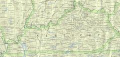
Kentucky 90
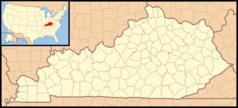
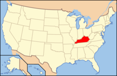
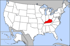
Kentucky Locator Map With Us
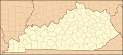
Kentucky Locator Map
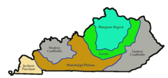
Kentucky Regions
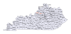
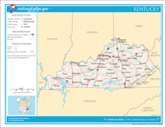
Kentucky Counties Map
Map of Usa Ky
Map of Usa Highlighting Kentucky
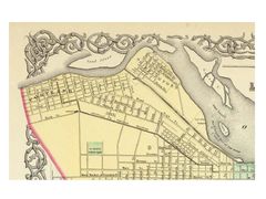
Portland1850s
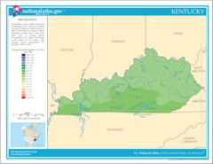
Precipitation of Kentucky
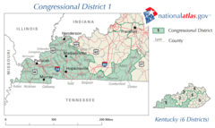
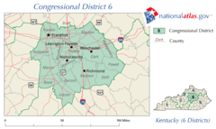
United States House of Representatives, Kentucky District 1 Map

United States House of Representatives, Kentucky District 2 Map
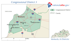
United States House of Representatives, Kentucky District 3 Map
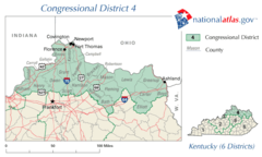
United States House of Representatives, Kentucky District 4 Map