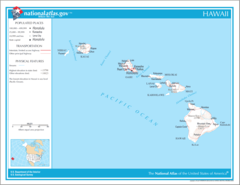
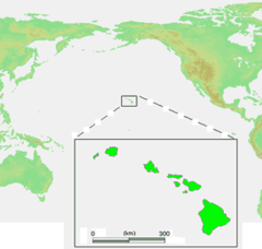
Hawaii, US
Hawaii: This U.
About
Hawaii became the 50th and most recent state admitted to the Union on August 21, 1959. It is the only state located in Oceania and the only one comprised entirely of islands.
Geography
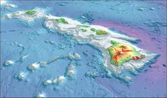
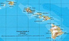
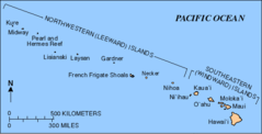
The Hawaiian archipelago consists of 137 volcanic islands, atolls, and reefs spanning 1,500 miles. The six largest islands are Hawaii, Maui, Oahu, Kauai, Molokai and Lanai. Hawaii's total area is 10,931 square miles. The islands are known for their diverse natural scenery of volcanoes, tropical forests, beaches and coral reefs.
Hawaii has a tropical climate all year round with average highs of 85-90°F.
History and Culture
Hawaii has a unique Polynesian culture influenced by native Hawaiians, Asian immigrants and American settlers. Native Hawaiians arrived first, traveling from other Polynesian islands like Tahiti.
The islands were united under King Kamehameha I. Later important events include the arrival of Christian missionaries, the overthrow of the Hawaiian monarchy, Hawaii becoming a U.S. territory, and finally statehood.
Economy and Industry
Key industries include tourism, agriculture and defense. Tourism drives the economy. Popular destinations include Waikiki Beach, Volcanoes National Park, the Pearl Harbor memorial and historic sites like the USS Arizona. Agriculture produces macadamia nuts, pineapples, coffee, sugarcane and more. The U.S. Pacific Fleet is headquartered at Pearl Harbor.
Government and Politics
Honolulu, located on Oahu, is the state capital and largest city. The current governor is David Ige, a Democrat. Hawaii has reliably voted Democratic in presidential elections since 1988.
In summary, Hawaii is the island state known for tropical landscapes, Polynesian culture and the bombing of Pearl Harbor. Tourism, agriculture and military presence shape the economy today. Hawaii offers a unique blend of island beauty, traditions and American influence.

State Snapshot
Hawaii at a glance
Hawaii currently has 107 quality-checked populated place pages and 5 county pages linked on MapSof.
Mapped cities & towns
107
These counts use a stricter populated-place filter so the main lists stay focused on real city and town pages.
County pages
5
Open related pagesLargest city
HonoluluPopulation 371,657
Top linked places
Quick Facts about Hawaii
| Population | 1,407,006 |
| Country | United States of America |
| Different from | Hawaii |
| Area | 28311 km2 |
| Water as percent of area | 41.25% |
| Land as percent of area | 58.75% |
| Continent | Oceania |
| Latitude & Longitude | 20.7879,-156.3861 |
| Legislative body | Hawaii State Legislature |
| Named for | Hawaii, Hawaiiloa, Hawaiki, Kingdom of Hawaiʻi |
| Official language | Hawaiian, English |
| Altitude | 3,035 feet / 925 meters |
| Capital | Honolulu |
| Establishment | August 21, 1959 (66 years ago) |
| Time Zone | Pacific/Honolulu, Hawaii–Aleutian Time Zone |
| Local time | 03:19:50 (24th July 2026) |
| Weather | 68℉ Mostly Clear 7-days weather |

Geography
Hawaii is located at 20°47'16"N 156°23'10"W (20.7878500, -156.3861200).
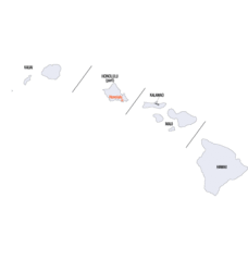
Hawaii map
The largest city of Hawaii is Honolulu with a population of 371,657. Other cities include, Hālawa Heights population 13,408, Waianae population 13,177, Lahaina population 11,704 and Hawaiian Paradise Park population 11,404. See all Hawaii cities & populated places.
Largest Cities in Hawaii (more)
Cities, Towns, Villages, Neighborhoods & Other Populated Places in Hawaii.
| City Name | County | Population |
|---|---|---|
| Honolulu | Honolulu | 371,657 |
| East Honolulu | Honolulu | 49,914 |
| Pearl City | Honolulu | 47,698 |
| Hilo | Hawaii | 43,263 |
| Kailua | Honolulu | 38,635 |
| Waipahu | Honolulu | 38,216 |
| Kaneohe | Honolulu | 34,597 |
| Mililani Town | Honolulu | 27,629 |
| Kahului | Maui | 26,337 |
| ‘Ewa Gentry | Honolulu | 22,690 |
| Kīhei | Maui | 20,881 |
| Makakilo City | Honolulu | 18,248 |
| Wahiawā | Honolulu | 17,821 |
| Wailuku | Maui | 15,313 |
| Kapolei | Honolulu | 15,186 |
| ‘Ewa Beach | Honolulu | 14,955 |
Show more Hawaii cities and populated places
Weather
Mostly clear, with a low around 68. East northeast wind 7 to 13 mph.
7-Day ForecastOfficial website of Hawaii
Official Website- Ehime Prefecture (2003 )
- Fukuoka Prefecture (1981 )
- Hiroshima Prefecture (1997 )
- Okinawa Prefecture (1985 )
- Maui County
- Kauai County
- Honolulu County
- Hawaii County
- Kalawao County
Demographics
| Year | Population | % Change | Method |
|---|---|---|---|
| 1900 | 154,001 | - | census |
| 1910 | 191,909 | 19.75% | census |
| 1920 | 255,912 | 25.01% | census |
| 1930 | 368,336 | 30.52% | census |
| 1940 | 423,330 | 12.99% | census |
| 1950 | 499,794 | 15.3% | census |
| 1960 | 632,772 | 21.02% | census |
| 1970 | 768,561 | 17.67% | census |
| 1980 | 964,691 | 20.33% | census |
| 1990 | 1,108,229 | 12.95% | census |
| 2000 | 1,211,537 | 8.53% | census |
| 2010 | 1,360,301 | 10.94% | census |
| 2011 | 1,379,329 | 1.38% | estimation process |
| 2012 | 1,394,804 | 1.11% | estimation process |
| 2013 | 1,408,243 | 0.95% | estimation process |
| 2014 | 1,414,538 | 0.45% | estimation process |
| 2015 | 1,422,052 | 0.53% | estimation process |
| 2016 | 1,427,559 | 0.39% | estimation process |
| 2017 | 1,424,393 | -0.22% | estimation process |
| 2018 | 1,420,593 | -0.27% | estimation process |
| 2019 | 1,415,872 | -0.33% | estimation process |
| 2020 | 1,407,006 | -0.63% | estimation process |
People born in Hawaii (158)
People born in Hawaii, including voice actor Micah Solusod, Chilean pianist from Easter Island Mahani Teave, Movie actress Jade Marcela, .
More notable people
- Bobby Lowe (martial artist) he was born in 23/08/1929
- John Guerin (American drummer) he was born in 31/10/1939
- Randall Duk Kim (Korean American actor) he was born in 24/09/1943
- Michael Hoffman (American film director) he was born in 30/11/1956
- Kaui Hart Hemmings (American writer) she was born in 01/01/1975
- Sara Lov (American singer) she was born in 08/10/1971
- Don Muraco (American professional wrestler) he was born in 10/09/1949
- Michael Okuda (graphic designer known for working on Star Trek) he was born in 01/01/2000
- Benjamin W.S. Lum (American actor (1953-2002)) he was born in 09/05/1953
- Katie Kox (American movie actress and adult model) she was born in 17/12/1985
- Albert Pyun (film director) he was born in 19/05/1953
- George Varoff (American pole vaulter) he was born in 25/03/1914
- Al Dacascos he was born in 06/09/1942
- Richard Lee (American martial arts master) he was born in 18/06/1933
- Brian Haberlin (Co-creator of the "Witchblade" comic books) he was born in 01/01/1963
- Danielle Delaunay (American singer active in Japan) she was born in 06/09/1983
- Joy Monahan (American surfer) she was born in 01/01/1953
- Kazimir Strzepek (cartoonist) he was born in 01/01/1978
Hawaii Counties
Honolulu County

county in Hawaii, United States
Hawaii County

county in Hawaii, United States
Maui County

county in Hawaii, United States
| County Name | Population |
|---|---|
| Honolulu County | 963,826 |
| Hawaii County | 203,340 |
| Maui County | 167,902 |
| Kauai County | 71,851 |
| Kalawao County | 87 |
Show more Hawaii counties
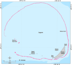
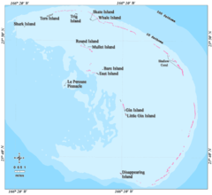
Map & Images (more maps)
Map of Hawaii Na 1
2003 3d Hawaiian Islands Usgs I2809
Ffs Map Lrg
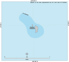
Gardner Map Lrg
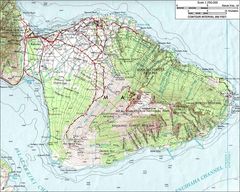
Haleakalamap
Hawaii Island Ecosystem Native Map Fr
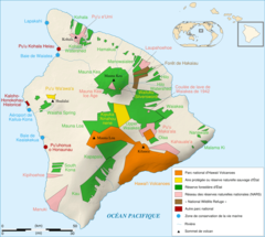
Hawaii Island Protected Areas Map Fr

Hawaii Islands
Hawaii Islands2
Hawaii Map
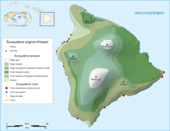
Hawaii Ecosystem Today
Hawaii Gmt De
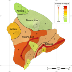
Hawaii Hazard Map Fr
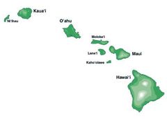
Hawaii Islands 3
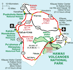
Hawaii National Parks Map

Hawaii Population Map 1
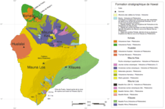
Hawaii Stratigraphic Map Fr
Hawaii Counties Map
Hawaiianislandchain Usgs
Karte Des Hawaiarchipels