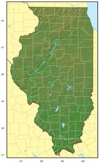
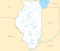
Illinois Rivers And Lakes
Several important rivers flow through the state of Illinois.
Mississippi River
The Mississippi River forms the western border of Illinois. Facts about the Mississippi River in Illinois:
- It flows over 2,300 miles from Minnesota to the Gulf of Mexico.
- The river passes through cities like East St. Louis, Chester, and Cairo, Illinois.
- Locks and dams along the Mississippi allow major commercial barge traffic.
- It provides drinking water, transportation, and recreation including riverboat casinos.
Illinois River
The Illinois River flows across central Illinois into the Mississippi. Details about the Illinois River:
- It runs 273 miles from Chicago through agricultural areas to the Mississippi River.
- The river passes through cities like Peoria, Pekin, and LaSalle.
- It was a major transportation route for fur traders and early settlers in frontier Illinois.
Rock River
The Rock River rises from Wisconsin and flows south through northern Illinois. Facts about the Rock River:
- It passes through Rockford, Illinois which is named after the river.
- The Rock River joins the Mississippi River near the Quad Cities.
- It provides habitat for over 70 species of fish as well as eagles, herons and migratory birds.
Major Lakes in Illinois
Some noteworthy lakes in Illinois include:
- Lake Michigan - Forms Illinois' eastern border and shoreline.
- Carlyle Lake - The largest man-made lake in Illinois.
- Shelbyville Lake - Created by damming the Kaskaskia River in central Illinois.
- Lake Springfield - Provides water supply for the city of Springfield.
Illinois' rivers and lakes have supported vital transportation, commerce, agriculture, and ecosystems throughout its history.
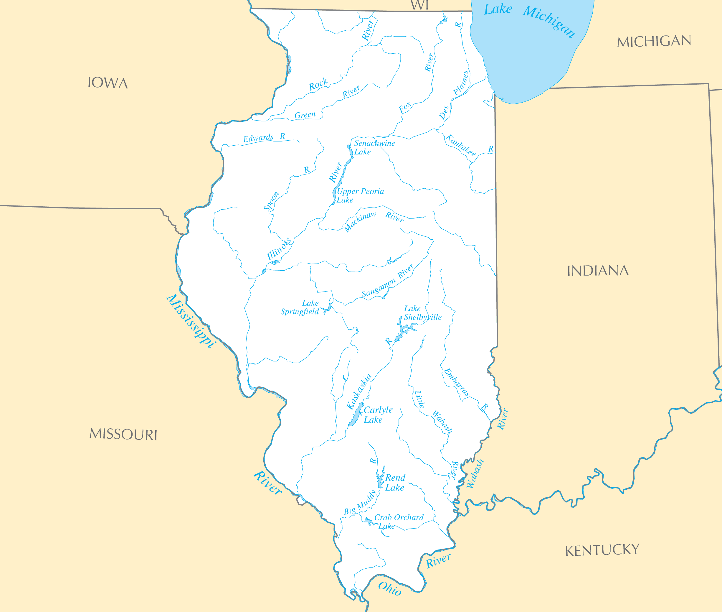
Click on the Illinois Rivers And Lakes to view it full screen. File Type: PNG, File size: 133012 bytes (129.89 KB), Map Dimensions: 2451px x 2076px ( colors)
More Illinois Static Maps
Map of Illinois Na 1
1200 x 927 - 142,473k - png
Illinois Regions Map
1551 x 2700 - 180,136k - png

Illinois Flag Map
826 x 1523 - 70,770k - png
Counties Map of Illinois
792 x 1320 - 90,085k - png
Illinois Relief Map
1197 x 1955 - 255,316k - jpg
Illinois Transport Map
2187 x 1697 - 542,184k - png
Where Is Illinois Located
1476 x 1002 - 135,445k - png
Illinois Cities And Towns
2448 x 2067 - 163,934k - PNG
Illinois County Map
2451 x 2067 - 120,175k - PNG
Illinois Reference Map
2454 x 2073 - 650,255k - PNG
Illinois Rivers And Lakes
2451 x 2076 - 133,012k - PNG
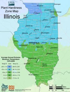
Illinois Plant Hardiness Zone Map
2212 x 2884 - 292,342k - PNG