Houston Metro Map (light Rail)
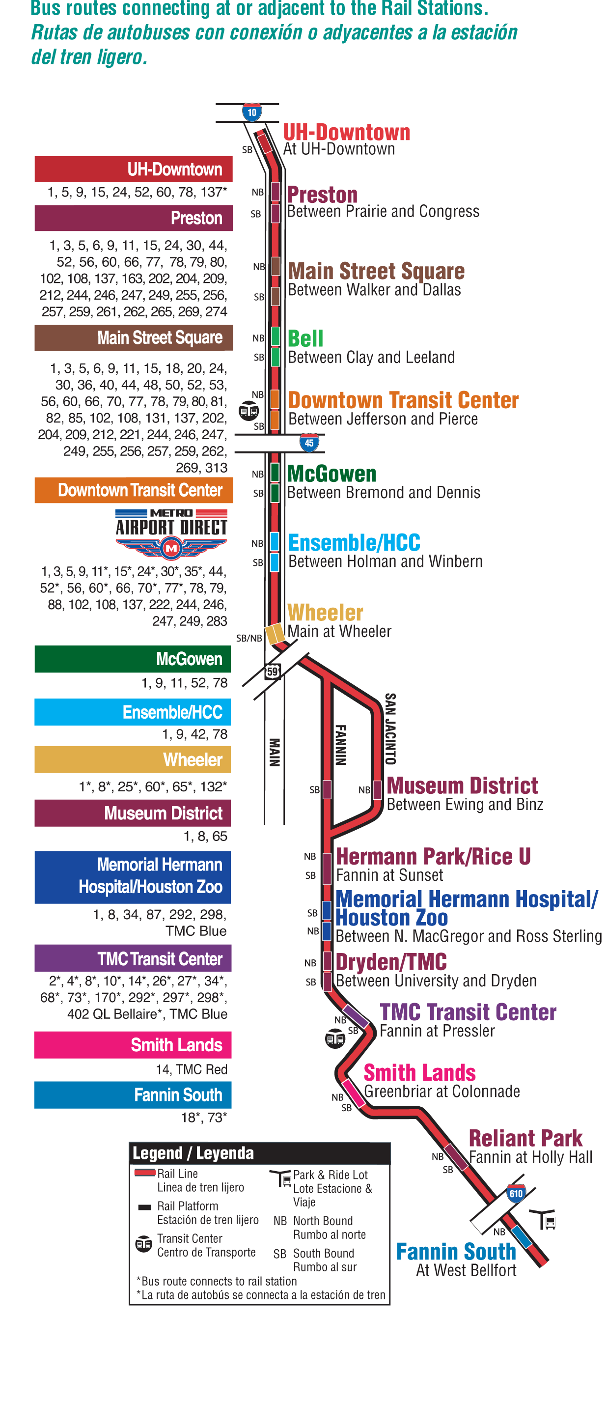
Click on the Houston Metro Map (light Rail) to view it full screen. File Type: png, File size: 168629 bytes (164.68 KB), Map Dimensions: 1236px x 2852px (256 colors)
More Houston Static Maps

Houston Downtown Transport Map
1200 x 1350 - 245,774k - png
Houston Metro Map (light Rail)
1236 x 2852 - 168,629k - png

Houston Transport Map
2400 x 2027 - 1,009,030k - jpg
Houston Metro Map
650 x 445 - 6,230k - png