How far is Woodburn, OR from Keizer, OR?
The driving distance from Woodburn, OR to Keizer, OR is about 15.7 miles (25.3 km), with a travel time of about 00h 22m by car.
- The straight-line flight distance is about 13.5 miles (21.7 km).
- For a round trip, plan for roughly 00h 45m of driving time before adding stops, traffic, or weather delays.
- A comfortable departure window is usually 7:00 AM to 7:00 PM PDT.
Reverse, save, or send this route
This is an easy same-day return drive. Copy the route link, send it to another device, or print a clean version before you head out.
This is an easy same-day return drive.
Flight Distance
Driving Distance
Gas Cost Calculator
Leave and Arrive Planner
Pick a departure time to see your estimated arrival and same-day return window.
Drive time stays fixed at 00h 22m.
This is a short drive, so your comfort window is wide. Traffic and current weather matter more than the clock.
This departure sits inside the recommended comfort window for the route.
Halfway Point
A useful midpoint for breaks, coffee, or meeting in the middle.
Route Weather Snapshot
Check the forecast at both ends before you head out.
Mostly Clear
Mostly Clear
Driving Route Map
The map below follows the saved road route between Woodburn and Keizer.
Turn-by-Turn Driving Directions
Step-by-step road directions between Woodburn and Keizer.
-
1
Start on the route
43 m · 16 sec
-
2
Turn left onto West Lincoln Street
1753 ft · 48 sec · West Lincoln Street
-
3
Turn right onto North Settlemier Avenue
798 ft · 34 sec · North Settlemier Avenue
-
4
Turn left onto Newberg Highway
1 mi · 3 min · Newberg Highway
-
5
Take the ramp slight right toward I 5 South: Salem
11.5 mi · 14 min
-
6
Take the exit slight right toward Chemawa Road Northeast: Keizer
2128 ft · 43 sec
-
7
Turn right onto Chemawa Road Northeast
669 ft · 13 sec · Chemawa Road Northeast
-
8
Keep slight right to continue on Chemawa Road Northeast
864 ft · 31 sec · Chemawa Road Northeast
-
9
Continue on Chemawa Road Northeast
1.3 km · 1 min · Chemawa Road Northeast
-
10
Enter the roundabout and take exit 2 toward Chemawa Road Northeast
30 m · 2 sec · Chemawa Road Northeast
-
11
Exit the roundabout onto Chemawa Road Northeast
1.1 km · 2 min · Chemawa Road Northeast
-
12
Turn left onto River Road North
2553 ft · 1 min · River Road North
-
13
Turn left
38 m · 9 sec
-
14
Keep slight left
63 m · 15 sec
-
15
Arrive at your destination
0 m · 1 sec
Car Route Details
A richer read on the saved driving route between Woodburn and Keizer.
Turn-heavy local drive
The route has frequent decision points for its length, so lane choice and turn timing will matter more than cruising speed.
I 5 South
Take the ramp slight right toward I 5 South: Salem
11.5 mi · 00h 14m
Route Summary
A quick read on whether this route feels easy, ambitious, or worth planning around.
A short regional drive
This route is short enough to handle as a quick errand, commute, or easy same-day return without much planning overhead.
Mostly Clear leaving Woodburn and Mostly Clear near Keizer.
Trip Questions
Direct answers travelers usually want before committing to the drive.
How long does it take to drive from Woodburn to Keizer?
The road trip is about 15.7 miles (25.3 km) and usually takes 00h 22m in normal driving conditions.
Is this a same-day trip or an overnight route?
This route is short enough to handle as a quick errand, commute, or easy same-day return without much planning overhead.
What is the halfway point on this route?
Gervais is a useful midpoint, sitting about 7.9 miles from Woodburn and 7.8 miles from Keizer.
How much longer is the road route than the straight-line distance?
The direct path is about 13.5 miles (21.7 km), while the road route adds roughly 2.2 extra miles because roads do not follow the straight air line.
When is the best time to leave for this route?
A good departure window is usually 7:00 AM to 7:00 PM PDT. If you want a more comfortable same-day return, try to leave by 7:44 PM PDT.
How much will gas cost for this route?
Using about 28.3 MPG, regular gas is estimated at $2.72 one way or $5.45 round trip. Estimated CO2 is about 4.9 kg one way.
What should you check before leaving?
Before you leave, expect Mostly Clear around Woodburn and Mostly Clear near Keizer.
Stop Ideas Near Gervais
Useful break, food, and waypoint ideas within about 15 miles of the route midpoint.
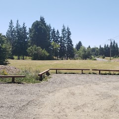
Salem city park
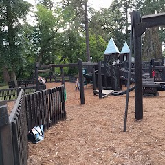
McMinnville Parks and Recreation Department
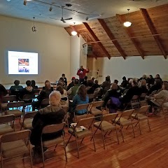
Palmer Creek Lodge Community Event Center
Transit and Meeting Points
Useful pickup, handoff, or rendezvous points close to Gervais.
Woodburn, OR
Salem station
Oregon City station
Portland, OR
Flight Path Map
This map shows the direct air route between Woodburn and Keizer. Straight-line distance: 13.5 mi (21.72 km).

#1 Woodburn
City in Oregon, USA
| Population | 26,175 |
| Coordinates | 45.1437300, -122.8553700 |
| Altitude | 57 |
| Country | United States |

#2 Keizer
City in Oregon, USA
| Population | 39,593 |
| Coordinates | 44.9901200, -123.0262100 |
| Altitude | 42 |
| Country | United States |
End: Dietz Avenue Northeast (-123.026207, 44.990264)
Estimated Travel Time
Distance: 25 km by road
| Speed | Time |
|---|---|
| 30 mph (48.3 km/h) | 00h 31m |
| 40 mph (64.37 km/h) | 00h 23m |
| 50 mph (80.47 km/h) | 00h 18m |
| 60 mph (96.56 km/h) | 00h 15m |
| 70 mph (112.65 km/h) | 00h 13m |
| 80 mph (129 km/h) | 00h 11m |
Fuel, Round Trip and CO2
Estimated fuel cost and emissions for this route.
| Fuel | $/gal | One way | Round trip |
|---|---|---|---|
| Regular gas | $4.95 | $2.72 | $5.45 |
| Mid-grade | $5.34 | $2.94 | $5.87 |
| Premium | $5.57 | $3.06 | $6.12 |
| Diesel | $6.37 | $3.50 | $7.00 |
Assumes 8.3 L/100 km (about 28.3 MPG). CO2 is an estimate and varies by vehicle, fuel blend, traffic, and terrain.
Prices in Oregon · Jul 27, 2026
Distance to Other Cities
Planning a road trip? See the full trip guide on Trip.ovh — stops, fuel costs, weather, and departure timing.