How far is Vernon, TX from Garland, TX?
The driving distance from Vernon, TX to Garland, TX is about 286 miles (460.3 km), with a travel time of about 04h 28m by car.
- The straight-line flight distance is about 267.4 miles (430.4 km).
- For a round trip, plan for roughly 08h 56m of driving time before adding stops, traffic, or weather delays.
- A comfortable departure window is usually 6:00 AM to 8:00 AM CDT.
Reverse, save, or send this route
This drive is better planned with a longer stop or an overnight stay. Copy the route link, send it to another device, or print a clean version before you head out.
This drive is better planned with a longer stop or an overnight stay.
Flight Distance
Driving Distance
Gas Cost Calculator
Leave and Arrive Planner
Pick a departure time to see your estimated arrival and same-day return window.
Drive time stays fixed at 04h 28m.
An early departure helps you fit a real stop into the day without turning the return into a late-night drive.
You are leaving earlier than the recommended window, which gives you extra margin for breaks and traffic.
Halfway Point
A useful midpoint for breaks, coffee, or meeting in the middle.
Town in Cooke County, Texas, United States
Route Weather Snapshot
Check the forecast at both ends before you head out.
Mostly Sunny then Slight Chance Showers And Thunderstorms
Driving Route Map
The map below follows the saved road route between Vernon and Garland.
Turn-by-Turn Driving Directions
Step-by-step road directions between Vernon and Garland.
-
1
Start on the route
44 m · 16 sec
-
2
Turn left
620 ft · 47 sec
-
3
At the end of the road, turn right onto US Highway 287 East
3053 ft · 1 min · US Highway 287 East
-
4
Take the ramp straight
1720 ft · 43 sec
-
5
Continue on US Highway 287 East
40.5 mi · 43 min · US Highway 287 East
-
6
Continue on Northwest Freeway
4.6 mi · 5 min · Northwest Freeway
-
7
Keep slight right to continue on Northwest Freeway
2984 ft · 42 sec · Northwest Freeway
-
8
Merge slight left onto Central Freeway
2.5 mi · 3 min · Central Freeway
-
9
Continue on Lloyd Ruby Overpass
1.4 km · 1 min · Lloyd Ruby Overpass
-
10
Continue on Central East Freeway
1.4 km · 1 min · Central East Freeway
-
11
Keep slight right to continue on Central East Freeway
1.8 mi · 2 min · Central East Freeway
-
12
Keep slight right to continue on Central East Freeway
14.4 mi · 15 min · Central East Freeway
-
13
Take the exit slight right toward US 82 East: Henrietta, Gainesville
159.1 mi · 2 hr 57 min
-
14
Turn right onto 7th Street Southwest
82 m · 10 sec · 7th Street Southwest
-
15
Turn left onto Grand Avenue
2043 ft · 39 sec · Grand Avenue
-
16
Continue on Clarksville Street
1.2 km · 1 min · Clarksville Street
-
17
Turn left onto 12th Street Southeast
751 ft · 17 sec · 12th Street Southeast
-
18
Turn right onto Lamar Avenue
2 mi · 3 min · Lamar Avenue
-
19
Continue on Lamar Road
3.2 mi · 4 min · Lamar Road
-
20
Continue on US Highway 82 East
2.9 mi · 3 min · US Highway 82 East
-
21
Continue on West Front Street
2 mi · 2 min · West Front Street
-
22
Continue on US Highway 82 East
16.6 mi · 19 min · US Highway 82 East
-
23
Continue on West Main Street
1.6 mi · 2 min · West Main Street
-
24
Turn left onto Captain Henry Stout Bypass
3.2 mi · 4 min · Captain Henry Stout Bypass
-
25
Continue on US Highway 82 East
23.7 mi · 27 min · US Highway 82 East
-
26
Turn right onto County Road 3215
731 ft · 34 sec · County Road 3215
-
27
Turn right
1.5 mi · 4 min
-
28
Arrive at your destination
0 m · 1 sec
Car Route Details
A richer read on the saved driving route between Vernon and Garland.
Highway-focused drive
Most of the mileage stays on named highways, so the important moments are ramps, exits, merges, and the final local approach.
US 82 East
Take the exit slight right toward US 82 East: Henrietta, Gainesville
159 mi · 02h 57m
Route Summary
A quick read on whether this route feels easy, ambitious, or worth planning around.
A longer out-and-back drive
This is still possible in one day, but it becomes a long driving day. Leaving early and planning your stop window matters more here.
Sunny leaving Vernon and Mostly Sunny then Slight Chance Showers And Thunderstorms near Garland.
Trip Questions
Direct answers travelers usually want before committing to the drive.
How long does it take to drive from Vernon to Garland?
The road trip is about 286 miles (460.3 km) and usually takes 04h 28m in normal driving conditions.
Is this a same-day trip or an overnight route?
This is still possible in one day, but it becomes a long driving day. Leaving early and planning your stop window matters more here.
What is the halfway point on this route?
Oak Ridge is a useful midpoint, sitting about 142.1 miles from Vernon and 143.9 miles from Garland.
How much longer is the road route than the straight-line distance?
The direct path is about 267.4 miles (430.4 km), while the road route adds roughly 18.6 extra miles because roads do not follow the straight air line.
When is the best time to leave for this route?
A good departure window is usually 6:00 AM to 8:00 AM CDT. If you want a more comfortable same-day return, try to leave by 8:04 AM CDT.
How much will gas cost for this route?
Using about 28.3 MPG, regular gas is estimated at $38.13 one way or $76.26 round trip. Estimated CO2 is about 89.7 kg one way.
What should you check before leaving?
Before you leave, expect Sunny around Vernon and Mostly Sunny then Slight Chance Showers And Thunderstorms near Garland.
Stop Ideas Near Oak Ridge
Useful break, food, and waypoint ideas within about 15 miles of the route midpoint.
Old City Hall-Fire Station - Texas State Historical Marker
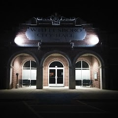
Whitesboro City Hall
Transit and Meeting Points
Useful pickup, handoff, or rendezvous points close to Oak Ridge.
Gainesville
Ardmore station
Union Station
Dallas, TX
Flight Path Map
This map shows the direct air route between Vernon and Garland. Straight-line distance: 267.46 mi (430.44 km).

#1 Vernon
City in Wilbarger County, Texas, United States
| Population | 10,138 |
| Coordinates | 34.1553600, -99.2662800 |
| Altitude | 361 |
| Country | United States |

#2 Garland
The fourth most populous city in Texas.
| Population | 238,139 |
| Coordinates | 33.5165000, -94.6693800 |
| Altitude | 117 |
| Country | United States |
End: FM 1701 (-94.669398, 33.516846)
Estimated Travel Time
Distance: 460 km by road
| Speed | Time |
|---|---|
| 30 mph (48.3 km/h) | 09h 31m |
| 40 mph (64.37 km/h) | 07h 09m |
| 50 mph (80.47 km/h) | 05h 43m |
| 60 mph (96.56 km/h) | 04h 46m |
| 70 mph (112.65 km/h) | 04h 05m |
| 80 mph (129 km/h) | 03h 34m |
Fuel, Round Trip and CO2
Estimated fuel cost and emissions for this route.
| Fuel | $/gal | One way | Round trip |
|---|---|---|---|
| Regular gas | $3.78 | $38.13 | $76.26 |
| Mid-grade | $4.25 | $42.90 | $85.81 |
| Premium | $4.59 | $46.32 | $92.65 |
| Diesel | $3.99 | $40.29 | $80.58 |
Assumes 8.3 L/100 km (about 28.3 MPG). CO2 is an estimate and varies by vehicle, fuel blend, traffic, and terrain.
Prices in Texas · Jul 14, 2026
Distance to Other Cities
Planning a road trip? See the full trip guide on Trip.ovh — stops, fuel costs, weather, and departure timing.