How far is Umatilla, FL from Orlando, FL?
Fastest route
The distance from Umatilla, Florida 32784 to Orlando, Florida is approximately 42.9 miles (69.0 kilometers). The estimated travel time is 57 minutes.
Directions
-
🚗 Get on FL-453 from FL-19 S/N Central Ave, County Rd 450a, N Thrill Hill Rd, and Britt Rd.
- Head north on N Trowell Ave toward Bulldog Ln.
- Turn left onto Bulldog Ln.
- Turn left onto FL-19 S/N Central Ave.
- Turn left onto County Rd 450a.
- Continue onto County Rd 44A S.
- Turn left onto Bill Collins Rd.
- Turn right onto N Thrill Hill Rd.
- Turn left onto Wolf Branch Rd.
- Turn right onto Round Lake Rd.
- Use the right lane to take the FL-453 S ramp to FL-429/Orlando/Daytona Beach (Toll road).
-
🛣️ Take FL-429 S, FL-414 E, and I-4 W to E Anderson St in Orlando. Take exit 83 from I-4 W (Toll road).
- Use the right 2 lanes to merge onto FL-429 S toward Orlando/Tampa (Toll road).
- Keep right at the fork to continue on FL-414 E, follow signs for Maitland (Toll road).
- Keep left to continue on Maitland Blvd.
- Merge onto I-4 W via the ramp to Orlando/Tampa.
- Use the right 2 lanes to take exit 83 for Anderson St.
-
🚗 Continue on E Anderson St. Drive to E South St.
- Use the left 2 lanes to turn left onto E Anderson St.
- Turn left onto S Rosalind Ave.
- Turn left onto E South St.
Tips & Suggestions
-
🚘 Plan your departure time: Traffic conditions can significantly affect travel time. Consider checking real-time traffic updates before starting your journey to choose the best time to travel.
-
🛣️ Use navigation apps: Utilize navigation apps or GPS devices to stay on track and receive real-time directions during your drive.
-
⛽ Refuel before the journey: Ensure your vehicle has enough fuel before embarking on the trip to avoid any unnecessary stops.
-
🍴 Pack snacks and drinks: Having some refreshments on hand can be helpful during longer drives, especially if you or your passengers get hungry or thirsty.
-
📱 Keep your phone charged: Charge your phone before the trip, or carry a portable charger, in case you need to make calls or use navigation apps throughout the journey.
-
🚧 Be aware of tolls: Some routes may have tolls, so be prepared with cash or an electronic toll payment method.
-
🚗 Follow road signs and rules: Pay attention to road signs, speed limits, and other traffic regulations to ensure a safe and smooth journey.
Reverse, save, or send this route
This route works well as a day trip with time at the destination. Copy the route link, send it to another device, or print a clean version before you head out.
This route works well as a day trip with time at the destination.
Flight Distance
Driving Distance
Gas Cost Calculator
Leave and Arrive Planner
Pick a departure time to see your estimated arrival and same-day return window.
Drive time stays fixed at 00h 55m.
A morning start gives you useful time at the destination and keeps the return out of the late evening.
You are leaving earlier than the recommended window, which gives you extra margin for breaks and traffic.
Halfway Point
A useful midpoint for breaks, coffee, or meeting in the middle.
Census-designated place in Orange County, Florida
Route Weather Snapshot
Check the forecast at both ends before you head out.
Mostly Sunny then Chance Showers And Thunderstorms
Mostly Sunny then Chance Showers And Thunderstorms
Driving Route Map
The map below follows the saved road route between Umatilla and Orlando.
Turn-by-Turn Driving Directions
Step-by-step road directions between Umatilla and Orlando.
-
1
Start on North Trowell Avenue
44 m · 12 sec · North Trowell Avenue
-
2
Continue on North Trowell Avenue
67 m · 18 sec · North Trowell Avenue
-
3
Turn right onto Lone Star Street
619 ft · 27 sec · Lone Star Street
-
4
Turn left onto Central Avenue
4.1 mi · 7 min · Central Avenue
-
5
Turn left
2.2 mi · 3 min
-
6
Turn right
1.1 mi · 2 min
-
7
Turn left onto East Orange Avenue
1.2 mi · 2 min · East Orange Avenue
-
8
Turn right onto State Route 44
2.1 mi · 4 min · State Route 44
-
9
Turn left
2.5 mi · 4 min
-
10
Turn left onto Sanford Road
2.2 mi · 3 min · Sanford Road
-
11
Take the ramp slight right toward FL 453 Toll South
2219 ft · 54 sec
-
12
Merge slight left
2 mi · 2 min
-
13
Keep slight right to continue on FL 429 Toll South: Orlando, Tampa
3111 ft · 1 min
-
14
Merge slight left onto Wekiva Parkway
5 mi · 5 min · Wekiva Parkway
-
15
Continue on Western Beltway
2.8 mi · 3 min · Western Beltway
-
16
Keep slight right to continue on John Land Apopka Expressway
3.1 mi · 4 min · John Land Apopka Expressway
-
17
Continue on Apopka Expressway
3 mi · 4 min · Apopka Expressway
-
18
Take the exit slight right toward US 441: Orange Blossom Trail
1479 ft · 42 sec
-
19
Turn right onto North Orange Blossom Trail
6.7 mi · 12 min · North Orange Blossom Trail
-
20
Turn left onto West Colonial Drive
1.3 km · 2 min · West Colonial Drive
-
21
Take the exit right toward I 4 West: Tampa
1266 ft · 31 sec
-
22
Merge slight left
1.1 km · 55 sec
-
23
Take the exit slight right toward Anderson Street
1355 ft · 28 sec
-
24
Turn left onto West Anderson Street
1261 ft · 45 sec · West Anderson Street
-
25
Turn left onto Boone Avenue
655 ft · 22 sec · Boone Avenue
-
26
Turn right onto West South Street
60 m · 5 sec · West South Street
-
27
Turn slight right
31 m · 4 sec
-
28
Arrive at your destination
0 m · 1 sec
Car Route Details
A richer read on the saved driving route between Umatilla and Orlando.
Turn-heavy local drive
The route has frequent decision points for its length, so lane choice and turn timing will matter more than cruising speed.
North Orange Blossom Trail
Turn right onto North Orange Blossom Trail
6.74 mi · 00h 12m
Route Summary
A quick read on whether this route feels easy, ambitious, or worth planning around.
A comfortable day-trip route
This route works well as a day trip. You can leave in the morning, spend meaningful time at the destination, and still return the same day.
Mostly Sunny then Chance Showers And Thunderstorms leaving Umatilla and Mostly Sunny then Chance Showers And Thunderstorms near Orlando.
Trip Questions
Direct answers travelers usually want before committing to the drive.
How long does it take to drive from Umatilla to Orlando?
The road trip is about 42.6 miles (68.5 km) and usually takes 00h 55m in normal driving conditions.
Is this a same-day trip or an overnight route?
This route works well as a day trip. You can leave in the morning, spend meaningful time at the destination, and still return the same day.
What is the halfway point on this route?
Zellwood is a useful midpoint, sitting about 21 miles from Umatilla and 21.6 miles from Orlando.
How much longer is the road route than the straight-line distance?
The direct path is about 32.1 miles (51.7 km), while the road route adds roughly 10.5 extra miles because roads do not follow the straight air line.
When is the best time to leave for this route?
A good departure window is usually 8:00 AM to 10:00 AM EDT. If you want a more comfortable same-day return, try to leave by 4:40 PM EDT.
How much will gas cost for this route?
Using about 28.3 MPG, regular gas is estimated at $6.22 one way or $12.44 round trip. Estimated CO2 is about 13.3 kg one way.
What should you check before leaving?
Before you leave, expect Mostly Sunny then Chance Showers And Thunderstorms around Umatilla and Mostly Sunny then Chance Showers And Thunderstorms near Orlando.
Stop Ideas Near Zellwood
Useful break, food, and waypoint ideas within about 15 miles of the route midpoint.

City of Tavares - City Hall
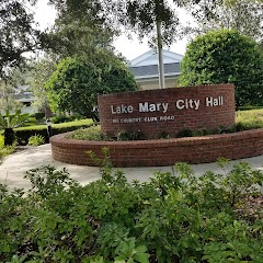
City of Lake Mary City Hall

City Hall
Transit and Meeting Points
Useful pickup, handoff, or rendezvous points close to Zellwood.
Winter Park
Orlando Health/Amtrak
Sanford
DeLand
Flight Path Map
This map shows the direct air route between Umatilla and Orlando. Straight-line distance: 32.11 mi (51.68 km).

#1 Umatilla
City in Lake County, Florida, United States of America
| Population | 3,895 |
| Coordinates | 28.9294300, -81.6656300 |
| Altitude | 30 |
| Country | United States |

#2 Orlando
The most populous city in Florida and the center of the Orlando metropolitan area.
| Population | 289,457 |
| Coordinates | 28.5383400, -81.3792400 |
| Altitude | 30 |
| Country | United States |
End: South Street (-81.379244, 28.538325)
Estimated Travel Time
Distance: 69 km by road
| Speed | Time |
|---|---|
| 30 mph (48.3 km/h) | 01h 25m |
| 40 mph (64.37 km/h) | 01h 03m |
| 50 mph (80.47 km/h) | 00h 51m |
| 60 mph (96.56 km/h) | 00h 42m |
| 70 mph (112.65 km/h) | 00h 36m |
| 80 mph (129 km/h) | 00h 31m |
Fuel, Round Trip and CO2
Estimated fuel cost and emissions for this route.
| Fuel | $/gal | One way | Round trip |
|---|---|---|---|
| Regular gas | $4.15 | $6.22 | $12.44 |
| Mid-grade | $4.60 | $6.89 | $13.79 |
| Premium | $4.90 | $7.34 | $14.69 |
| Diesel | $4.35 | $6.52 | $13.05 |
Assumes 8.3 L/100 km (about 28.3 MPG). CO2 is an estimate and varies by vehicle, fuel blend, traffic, and terrain.
Prices in Florida · Jun 10, 2026
Distance to Other Cities
Planning a road trip? See the full trip guide on Trip.ovh — stops, fuel costs, weather, and departure timing.