How far is Tumwater, WA from Kirkland, WA?
The driving distance from Tumwater, WA to Kirkland, WA is about 70.8 miles (114 km), with a travel time of about 01h 18m by car.
- The straight-line flight distance is about 57 miles (91.7 km).
- For a round trip, plan for roughly 02h 36m of driving time before adding stops, traffic, or weather delays.
- A comfortable departure window is usually 8:00 AM to 10:00 AM PDT.
Reverse, save, or send this route
This route works well as a day trip with time at the destination. Copy the route link, send it to another device, or print a clean version before you head out.
This route works well as a day trip with time at the destination.
Flight Distance
Driving Distance
Gas Cost Calculator
Leave and Arrive Planner
Pick a departure time to see your estimated arrival and same-day return window.
Drive time stays fixed at 01h 18m.
A morning start gives you useful time at the destination and keeps the return out of the late evening.
This departure sits inside the recommended comfort window for the route.
Halfway Point
A useful midpoint for breaks, coffee, or meeting in the middle.
City in Pierce County, Washington, United States
Route Weather Snapshot
Check the forecast at both ends before you head out.
Sunny
Driving Route Map
The map below follows the saved road route between Tumwater and Kirkland.
Turn-by-Turn Driving Directions
Step-by-step road directions between Tumwater and Kirkland.
-
1
Start on the route
24 m · 5 sec
-
2
Continue on 2nd Avenue Southwest
1.1 km · 2 min · 2nd Avenue Southwest
-
3
Turn right onto Custer Way Southwest
623 ft · 16 sec · Custer Way Southwest
-
4
Turn right onto Boston Street Southeast
679 ft · 18 sec · Boston Street Southeast
-
5
At the end of the road, turn right onto Deschutes Way
1957 ft · 40 sec · Deschutes Way
-
6
Take the ramp right
1710 ft · 42 sec
-
7
Merge slight left
28.8 mi · 36 min
-
8
Keep slight right
20.7 mi · 26 min
-
9
Take the exit slight right toward WA 518 West, I 405 North: Seattle-Tacoma International Airport, Bellevue
136 m · 11 sec
-
10
Keep slight right to continue on I 405 North: Renton, Bellevue
2062 ft · 50 sec
-
11
Merge slight left
17.4 mi · 22 min
-
12
Take the exit slight right toward Northeast 85th Street, Kirkland
2063 ft · 50 sec
-
13
Keep slight left
55 m · 7 sec
-
14
Turn straight onto Northeast 85th Street
1.1 km · 2 min · Northeast 85th Street
-
15
Turn right onto 6th Street
137 m · 18 sec · 6th Street
-
16
Turn left onto 7th Avenue
542 ft · 16 sec · 7th Avenue
-
17
Exit the roundabout onto 7th Avenue
1699 ft · 51 sec · 7th Avenue
-
18
Exit the roundabout onto 7th Avenue
588 ft · 19 sec · 7th Avenue
-
19
Turn right onto 1st Street
122 m · 11 sec · 1st Street
-
20
Arrive at your destination
0 m · 1 sec · 1st Street
Car Route Details
A richer read on the saved driving route between Tumwater and Kirkland.
Turn-heavy local drive
The route has frequent decision points for its length, so lane choice and turn timing will matter more than cruising speed.
Deschutes Way
Merge slight left
28.8 mi · 00h 36m
Route Summary
A quick read on whether this route feels easy, ambitious, or worth planning around.
A comfortable day-trip route
This route works well as a day trip. You can leave in the morning, spend meaningful time at the destination, and still return the same day.
Sunny leaving Tumwater and Sunny near Kirkland.
Trip Questions
Direct answers travelers usually want before committing to the drive.
How long does it take to drive from Tumwater to Kirkland?
The road trip is about 70.8 miles (114 km) and usually takes 01h 18m in normal driving conditions.
Is this a same-day trip or an overnight route?
This route works well as a day trip. You can leave in the morning, spend meaningful time at the destination, and still return the same day.
What is the halfway point on this route?
Fife is a useful midpoint, sitting about 35.4 miles from Tumwater and 35.5 miles from Kirkland.
How much longer is the road route than the straight-line distance?
The direct path is about 57 miles (91.7 km), while the road route adds roughly 13.8 extra miles because roads do not follow the straight air line.
When is the best time to leave for this route?
A good departure window is usually 8:00 AM to 10:00 AM PDT. If you want a more comfortable same-day return, try to leave by 3:54 PM PDT.
How much will gas cost for this route?
Using about 28.3 MPG, regular gas is estimated at $13.08 one way or $26.17 round trip. Estimated CO2 is about 22.2 kg one way.
What should you check before leaving?
Before you leave, expect Sunny around Tumwater and Sunny near Kirkland.
Stop Ideas Near Fife
Useful break, food, and waypoint ideas within about 15 miles of the route midpoint.
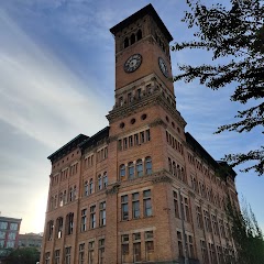
Old City Hall Tacoma
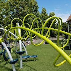
City Hall Park
Auburn Building Permits
City of Normandy Park City Hall
Transit and Meeting Points
Useful pickup, handoff, or rendezvous points close to Fife.
Tacoma Dome Station
Tukwila station
King Street Station
Seattle (Ferry - Pier 69), Washington
Flight Path Map
This map shows the direct air route between Tumwater and Kirkland. Straight-line distance: 56.97 mi (91.68 km).

#1 Tumwater
City in Thurston County, Washington, United States
| Population | 24,272 |
| Coordinates | 47.0073200, -122.9093100 |
| Altitude | 53 |
| Country | United States |

#2 Kirkland
A city in King County, Washington.
| Population | 95,431 |
| Coordinates | 47.6814900, -122.2087400 |
| Altitude | 47 |
| Country | United States |
End: 1st Street (-122.208447, 47.681494)
Estimated Travel Time
Distance: 114 km by road
| Speed | Time |
|---|---|
| 30 mph (48.3 km/h) | 02h 21m |
| 40 mph (64.37 km/h) | 01h 46m |
| 50 mph (80.47 km/h) | 01h 25m |
| 60 mph (96.56 km/h) | 01h 10m |
| 70 mph (112.65 km/h) | 01h 00m |
| 80 mph (129 km/h) | 00h 53m |
Fuel, Round Trip and CO2
Estimated fuel cost and emissions for this route.
| Fuel | $/gal | One way | Round trip |
|---|---|---|---|
| Regular gas | $5.23 | $13.08 | $26.17 |
| Mid-grade | $5.57 | $13.92 | $27.84 |
| Premium | $5.77 | $14.43 | $28.86 |
| Diesel | $5.47 | $13.67 | $27.33 |
Assumes 8.3 L/100 km (about 28.3 MPG). CO2 is an estimate and varies by vehicle, fuel blend, traffic, and terrain.
Prices in Washington · Jul 14, 2026
Distance to Other Cities
Planning a road trip? See the full trip guide on Trip.ovh — stops, fuel costs, weather, and departure timing.