How far is Tom Bean, TX from Arlington, TX?
Fastest route
The distance between Tom Bean, Texas and Arlington, Texas is approximately 82.1 miles (132 kilometers). The fastest route is via US-75 S and the estimated travel time is 1 hour and 19 minutes. Please note that this route has tolls.
Directions
- Start by heading south on Lyon St toward E King St.
- Turn right at the 1st cross street onto E King St.
- Slight left onto FM 902 W/Luby Dr and continue to follow FM 902 W.
- Turn left onto N Denny St, then turn right onto W Haning St.
- Turn left onto S Collins Fwy and take the ramp on the left onto US-75 S.
- Continue on US-75 S, then take Sam Rayburn Tollway S, President George Bush Tpke S, and State Hwy 161 S to Lincoln Dr in Arlington.
- Take exit 28A from I-30 W and merge onto Lincoln Dr.
- Follow N Center St to W Abram St, then continue straight onto N Center St.
- Turn right onto W Abram St.
Tips & Suggestions
- 🚗 Take the US-75 S route for the fastest journey.
- 💰 Be prepared for tolls along the way.
- 📅 Consider checking traffic conditions before you start your trip.
- ⛽ Make sure your vehicle has enough fuel for the journey.
- 📱 Use a navigation app or GPS device to stay on track.
- 🚧 Follow road signs and be aware of any construction or detours.
- 🕒 Allow some extra time for unforeseen delays.
- 🍴 Pack snacks and drinks for the road, or plan to stop at a convenient location for refreshments.
- 🛣️ Enjoy the scenic drive and have a safe trip!
Reverse, save, or send this route
This route works well as a day trip with time at the destination. Copy the route link, send it to another device, or print a clean version before you head out.
This route works well as a day trip with time at the destination.
Flight Distance
Driving Distance
Gas Cost Calculator
Leave and Arrive Planner
Pick a departure time to see your estimated arrival and same-day return window.
Drive time stays fixed at 01h 28m.
A morning start gives you useful time at the destination and keeps the return out of the late evening.
You are leaving earlier than the recommended window, which gives you extra margin for breaks and traffic.
Halfway Point
A useful midpoint for breaks, coffee, or meeting in the middle.
The fifth most populous city in Collin County, Texas.
Route Weather Snapshot
Check the forecast at both ends before you head out.
Showers And Thunderstorms Likely
Chance Showers And Thunderstorms
Driving Route Map
The map below follows the saved road route between Tom Bean and Arlington.
Turn-by-Turn Driving Directions
Step-by-step road directions between Tom Bean and Arlington.
-
1
Start on Lyon Street
64 m · 6 sec · Lyon Street
-
2
Turn right onto King Street
147 m · 10 sec · King Street
-
3
Continue on Luby Drive
6.5 mi · 9 min · Luby Drive
-
4
Keep slight left
1.2 mi · 2 min
-
5
Turn left onto North Denny Street
1358 ft · 25 sec · North Denny Street
-
6
Turn right onto West Haning Street
1778 ft · 41 sec · West Haning Street
-
7
Turn left onto South Collins Freeway
1.6 km · 2 min · South Collins Freeway
-
8
Take the ramp slight left
991 ft · 24 sec
-
9
Merge slight left onto South Collins Freeway
6.7 mi · 7 min · South Collins Freeway
-
10
Continue on North Central Expressway
35.2 mi · 38 min · North Central Expressway
-
11
Take the exit slight right toward I 635
1474 ft · 32 sec
-
12
Keep slight right to continue on I 635 West
1.4 km · 55 sec
-
13
Merge slight left onto Lyndon B. Johnson Freeway
2.4 mi · 3 min · Lyndon B. Johnson Freeway
-
14
Continue on Lyndon B Johnson Freeway
1.5 mi · 2 min · Lyndon B Johnson Freeway
-
15
Take the exit slight right toward I 635 TEXpress West
2217 ft · 32 sec
-
16
Merge slight left onto I 635 TEXpress
3.5 mi · 3 min · I 635 TEXpress
-
17
Merge slight right onto Lyndon B Johnson Freeway
1.5 mi · 2 min · Lyndon B Johnson Freeway
-
18
Take the exit slight right toward PGBT Toll South: President George Bush Turnpike, Las Colinas Boulevard
2244 ft · 40 sec
-
19
Keep slight left to continue on PGBT South: President George Bush Turnpike South
1.1 km · 1 min
-
20
Merge slight left onto President George Bush Turnpike
12 mi · 13 min · President George Bush Turnpike
-
21
Take the exit slight right toward I 30 West: Fort Worth
1119 ft · 27 sec
-
22
Merge slight left onto Tom Landry Freeway
3.3 mi · 4 min · Tom Landry Freeway
-
23
Take the exit slight right toward FM 157: Collins Street
1490 ft · 36 sec
-
24
Turn straight onto Wet N Wild Way
2742 ft · 59 sec · Wet N Wild Way
-
25
Turn left onto North Center Street
1.8 mi · 4 min · North Center Street
-
26
Turn right onto West Abram Street
90 m · 8 sec · West Abram Street
-
27
Arrive at your destination
0 m · 1 sec · West Abram Street
Car Route Details
A richer read on the saved driving route between Tom Bean and Arlington.
Highway-focused drive
Most of the mileage stays on named highways, so the important moments are ramps, exits, merges, and the final local approach.
North Central Expressway
Continue on North Central Expressway
35.2 mi · 00h 38m
Route Summary
A quick read on whether this route feels easy, ambitious, or worth planning around.
A comfortable day-trip route
This route works well as a day trip. You can leave in the morning, spend meaningful time at the destination, and still return the same day.
Showers And Thunderstorms Likely leaving Tom Bean and Chance Showers And Thunderstorms near Arlington.
Trip Questions
Direct answers travelers usually want before committing to the drive.
How long does it take to drive from Tom Bean to Arlington?
The road trip is about 83.1 miles (133.8 km) and usually takes 01h 28m in normal driving conditions.
Is this a same-day trip or an overnight route?
This route works well as a day trip. You can leave in the morning, spend meaningful time at the destination, and still return the same day.
What is the halfway point on this route?
Allen is a useful midpoint, sitting about 40.7 miles from Tom Bean and 42.4 miles from Arlington.
How much longer is the road route than the straight-line distance?
The direct path is about 65.1 miles (104.8 km), while the road route adds roughly 18 extra miles because roads do not follow the straight air line.
When is the best time to leave for this route?
A good departure window is usually 8:00 AM to 10:00 AM CDT. If you want a more comfortable same-day return, try to leave by 3:32 PM CDT.
How much will gas cost for this route?
Using about 28.3 MPG, regular gas is estimated at $11.07 one way or $22.14 round trip. Estimated CO2 is about 26 kg one way.
What should you check before leaving?
Before you leave, expect Showers And Thunderstorms Likely around Tom Bean and Chance Showers And Thunderstorms near Arlington.
Stop Ideas Near Allen
Useful break, food, and waypoint ideas within about 15 miles of the route midpoint.

Clifford E 'Bill' Hall Park

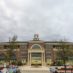
Richardson City Hall

Galleria Dallas
Town of Prosper City Hall
Transit and Meeting Points
Useful pickup, handoff, or rendezvous points close to Allen.
Mesquite, TX
Dallas, TX
Union Station
Fort Worth Central Station
Flight Path Map
This map shows the direct air route between Tom Bean and Arlington. Straight-line distance: 65.13 mi (104.82 km).

#1 Tom Bean
City in Grayson County, Texas, United States
| Population | 1,073 |
| Coordinates | 33.5201100, -96.4838700 |
| Altitude | 250 |
| Country | United States |

#2 Arlington
The third most populous city in Texas and the center of the Dallas-Fort Worth metropolitan area.
| Population | 398,864 |
| Coordinates | 32.7356900, -97.1080700 |
| Altitude | 184 |
| Country | United States |
End: West Abram Street (-97.108073, 32.735603)
Estimated Travel Time
Distance: 134 km by road
| Speed | Time |
|---|---|
| 30 mph (48.3 km/h) | 02h 46m |
| 40 mph (64.37 km/h) | 02h 04m |
| 50 mph (80.47 km/h) | 01h 39m |
| 60 mph (96.56 km/h) | 01h 23m |
| 70 mph (112.65 km/h) | 01h 11m |
| 80 mph (129 km/h) | 01h 02m |
Fuel, Round Trip and CO2
Estimated fuel cost and emissions for this route.
| Fuel | $/gal | One way | Round trip |
|---|---|---|---|
| Regular gas | $3.78 | $11.07 | $22.14 |
| Mid-grade | $4.25 | $12.46 | $24.92 |
| Premium | $4.59 | $13.45 | $26.90 |
| Diesel | $3.99 | $11.70 | $23.40 |
Assumes 8.3 L/100 km (about 28.3 MPG). CO2 is an estimate and varies by vehicle, fuel blend, traffic, and terrain.
Prices in Texas · Jun 19, 2026
Distance to Other Cities
Planning a road trip? See the full trip guide on Trip.ovh — stops, fuel costs, weather, and departure timing.