How far is Sorrento, LA from Baton Rouge, LA?
Fastest route
The distance from Sorrento, Louisiana to Baton Rouge, Louisiana is approximately 29.8 miles (48 kilometers). The fastest route, considering current traffic conditions, is via I-10 W. Here are some tips and suggestions for your journey:
Directions
- Head southwest on Main St toward Pecan Oaks Ave.
- Turn left onto LA-22 W/John Leblanc Blvd.
- Continue to follow LA-22 W.
- Use the right lane to merge onto I-10 W via the ramp to Baton Rouge.
- Follow I-10 W.
- Take exit 155B toward Downtown.
- Keep right at the fork, follow signs for Louisiana Old State Capitol Museum and merge onto Convention St.
- Continue on Convention St to your destination in Baton Rouge, Louisiana.
Tips & Suggestions
- 🚗 Tip: Check real-time traffic conditions before your journey to ensure the fastest route.
- 🛣️ Tip: Follow the signs for Louisiana Old State Capitol Museum when merging onto Convention St.
- ⛽ Tip: Consider refueling your vehicle before starting the trip.
- 🕒 Tip: Allow extra time for potential delays due to traffic.
- 🚧 Tip: Be aware of any construction or road closures along the route.
- 🚥 Tip: Observe and follow traffic regulations and signals.
- 📱 Tip: Use a navigation app or GPS device to help you stay on track during your journey.
Reverse, save, or send this route
This is an easy same-day return drive. Copy the route link, send it to another device, or print a clean version before you head out.
This is an easy same-day return drive.
Flight Distance
Driving Distance
Gas Cost Calculator
Leave and Arrive Planner
Pick a departure time to see your estimated arrival and same-day return window.
Drive time stays fixed at 00h 30m.
This is a short drive, so your comfort window is wide. Traffic and current weather matter more than the clock.
This departure sits inside the recommended comfort window for the route.
Halfway Point
A useful midpoint for breaks, coffee, or meeting in the middle.
Town in West Carroll Parish, Louisiana
Route Weather Snapshot
Check the forecast at both ends before you head out.
Showers And Thunderstorms Likely
Mostly Clear
Driving Route Map
The map below follows the saved road route between Sorrento and Baton Rouge.
Turn-by-Turn Driving Directions
Step-by-step road directions between Sorrento and Baton Rouge.
-
1
Start on Main Street
49 m · 9 sec · Main Street
-
2
Turn right onto Lee Street
1412 ft · 1 min · Lee Street
-
3
Turn sharp left
1.4 mi · 2 min
-
4
Take the exit slight right toward I 10 West: Baton Rouge
2092 ft · 51 sec
-
5
Merge slight left
26.7 mi · 30 min
-
6
Keep slight right to continue on Martin Luther King Jr Memorial Freeway
2034 ft · 29 sec · Martin Luther King Jr Memorial Freeway
-
7
Take the exit slight right toward LA 73: Government Street, River Center, Downtown
1035 ft · 37 sec
-
8
Turn left onto Government Street
3035 ft · 1 min · Government Street
-
9
Arrive at your destination
0 m · 1 sec · Government Street
Car Route Details
A richer read on the saved driving route between Sorrento and Baton Rouge.
Turn-heavy local drive
The route has frequent decision points for its length, so lane choice and turn timing will matter more than cruising speed.
I 10 West
Merge slight left
26.7 mi · 00h 30m
Route Summary
A quick read on whether this route feels easy, ambitious, or worth planning around.
A short regional drive
This route is short enough to handle as a quick errand, commute, or easy same-day return without much planning overhead.
Showers And Thunderstorms Likely leaving Sorrento and Mostly Clear near Baton Rouge.
Trip Questions
Direct answers travelers usually want before committing to the drive.
How long does it take to drive from Sorrento to Baton Rouge?
The road trip is about 29.6 miles (47.7 km) and usually takes 00h 30m in normal driving conditions.
Is this a same-day trip or an overnight route?
This route is short enough to handle as a quick errand, commute, or easy same-day return without much planning overhead.
What is the halfway point on this route?
Oak Grove is a useful midpoint, sitting about 15 miles from Sorrento and 14.7 miles from Baton Rouge.
How much longer is the road route than the straight-line distance?
The direct path is about 26.5 miles (42.7 km), while the road route adds roughly 3.1 extra miles because roads do not follow the straight air line.
When is the best time to leave for this route?
A good departure window is usually 7:00 AM to 7:00 PM CDT. If you want a more comfortable same-day return, try to leave by 7:28 PM CDT.
How much will gas cost for this route?
Using about 28.3 MPG, regular gas is estimated at $3.98 one way or $7.95 round trip. Estimated CO2 is about 9.3 kg one way.
What should you check before leaving?
Before you leave, expect Showers And Thunderstorms Likely around Sorrento and Mostly Clear near Baton Rouge.
Stop Ideas Near Oak Grove
Useful break, food, and waypoint ideas within about 15 miles of the route midpoint.

City Hall Plaza

Port Vincent Clerks Office
Baton Rouge City Hall
City of Baton Rouge Fire Station 15
Transit and Meeting Points
Useful pickup, handoff, or rendezvous points close to Oak Grove.
Baton Rouge, Louisiana
Hammond
Schriever
New Iberia
Flight Path Map
This map shows the direct air route between Sorrento and Baton Rouge. Straight-line distance: 26.52 mi (42.68 km).

#1 Sorrento
Human settlement in Louisiana, United States of America
| Population | 1,719 |
| Coordinates | 30.1843600, -90.8592600 |
| Altitude | 2 |
| Country | United States |
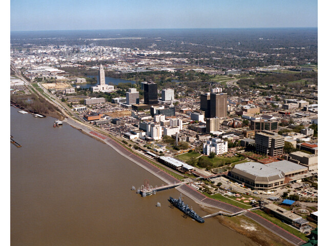
#2 Baton Rouge
The capital of Louisiana.
| Population | 219,052 |
| Coordinates | 30.4433200, -91.1874700 |
| Altitude | 14 |
| Country | United States |
End: Government Street (-91.18751, 30.443332)
Estimated Travel Time
Distance: 48 km by road
| Speed | Time |
|---|---|
| 30 mph (48.3 km/h) | 00h 59m |
| 40 mph (64.37 km/h) | 00h 44m |
| 50 mph (80.47 km/h) | 00h 35m |
| 60 mph (96.56 km/h) | 00h 29m |
| 70 mph (112.65 km/h) | 00h 25m |
| 80 mph (129 km/h) | 00h 22m |
Fuel, Round Trip and CO2
Estimated fuel cost and emissions for this route.
| Fuel | $/gal | One way | Round trip |
|---|---|---|---|
| Regular gas | $3.79 | $3.98 | $7.95 |
| Mid-grade | $4.26 | $4.47 | $8.94 |
| Premium | $4.63 | $4.86 | $9.71 |
| Diesel | $5.42 | $5.69 | $11.37 |
Assumes 8.3 L/100 km (about 28.3 MPG). CO2 is an estimate and varies by vehicle, fuel blend, traffic, and terrain.
Prices in Louisiana · Jul 01, 2026
Distance to Other Cities
Planning a road trip? See the full trip guide on Trip.ovh — stops, fuel costs, weather, and departure timing.