How far is Slidell, LA from Breaux Bridge, LA?
The driving distance from Slidell, LA to Breaux Bridge, LA is about 137.3 miles (221 km), with a travel time of about 02h 37m by car.
- The straight-line flight distance is about 126.4 miles (203.4 km).
- For a round trip, plan for roughly 05h 14m of driving time before adding stops, traffic, or weather delays.
- A comfortable departure window is usually 8:00 AM to 10:00 AM CDT.
Reverse, save, or send this route
This route works well as a day trip with time at the destination. Copy the route link, send it to another device, or print a clean version before you head out.
This route works well as a day trip with time at the destination.
Flight Distance
Driving Distance
Gas Cost Calculator
Leave and Arrive Planner
Pick a departure time to see your estimated arrival and same-day return window.
Drive time stays fixed at 02h 37m.
A morning start gives you useful time at the destination and keeps the return out of the late evening.
You are leaving earlier than the recommended window, which gives you extra margin for breaks and traffic.
Halfway Point
A useful midpoint for breaks, coffee, or meeting in the middle.
Parish seat of Livingston Parish, Louisiana
Route Weather Snapshot
Check the forecast at both ends before you head out.
Partly Cloudy
Driving Route Map
The map below follows the saved road route between Slidell and Breaux Bridge.
Turn-by-Turn Driving Directions
Step-by-step road directions between Slidell and Breaux Bridge.
-
1
Start on Bouscaren Street
67 m · 15 sec · Bouscaren Street
-
2
Turn left onto 3rd Street
845 ft · 24 sec · 3rd Street
-
3
Turn left onto Fremaux Avenue
723 ft · 21 sec · Fremaux Avenue
-
4
Turn right onto Front Street
1 km · 1 min · Front Street
-
5
Turn left onto Gause Boulevard West
3 mi · 5 min · Gause Boulevard West
-
6
Turn right onto Northshore Boulevard
1.1 km · 1 min · Northshore Boulevard
-
7
Continue on Airport Road
1520 ft · 29 sec · Airport Road
-
8
Take the ramp left
1862 ft · 45 sec
-
9
Merge slight left onto West Florida Republic Parkway
80.3 mi · 1 hr 27 min · West Florida Republic Parkway
-
10
Merge slight right
3.6 mi · 4 min
-
11
Keep slight left
45.8 mi · 53 min
-
12
Take the exit slight right toward LA 328: Breaux Bridge
1495 ft · 44 sec
-
13
Turn left onto Anse Broussard Highway
639 ft · 13 sec · Anse Broussard Highway
-
14
Continue on Rees Street
1.7 mi · 3 min · Rees Street
-
15
At the end of the road, turn right onto East Bridge Street
1262 ft · 43 sec · East Bridge Street
-
16
Turn left onto Main Highway
12 m · 1 sec · Main Highway
-
17
Arrive at your destination
0 m · 1 sec · Main Highway
Car Route Details
A richer read on the saved driving route between Slidell and Breaux Bridge.
Highway-focused drive
Most of the mileage stays on named highways, so the important moments are ramps, exits, merges, and the final local approach.
West Florida Republic Parkway
Merge slight left onto West Florida Republic Parkway
80.3 mi · 01h 27m
Route Summary
A quick read on whether this route feels easy, ambitious, or worth planning around.
A comfortable day-trip route
This route works well as a day trip. You can leave in the morning, spend meaningful time at the destination, and still return the same day.
Mostly Sunny leaving Slidell and Partly Cloudy near Breaux Bridge.
Trip Questions
Direct answers travelers usually want before committing to the drive.
How long does it take to drive from Slidell to Breaux Bridge?
The road trip is about 137.3 miles (221 km) and usually takes 02h 37m in normal driving conditions.
Is this a same-day trip or an overnight route?
This route works well as a day trip. You can leave in the morning, spend meaningful time at the destination, and still return the same day.
What is the halfway point on this route?
Livingston is a useful midpoint, sitting about 68.5 miles from Slidell and 68.7 miles from Breaux Bridge.
How much longer is the road route than the straight-line distance?
The direct path is about 126.4 miles (203.4 km), while the road route adds roughly 10.9 extra miles because roads do not follow the straight air line.
When is the best time to leave for this route?
A good departure window is usually 8:00 AM to 10:00 AM CDT. If you want a more comfortable same-day return, try to leave by 1:16 PM CDT.
How much will gas cost for this route?
Using about 28.3 MPG, regular gas is estimated at $18.33 one way or $36.66 round trip. Estimated CO2 is about 43 kg one way.
What should you check before leaving?
Before you leave, expect Mostly Sunny around Slidell and Partly Cloudy near Breaux Bridge.
Stop Ideas Near Livingston
Useful break, food, and waypoint ideas within about 15 miles of the route midpoint.

Port Vincent Clerks Office
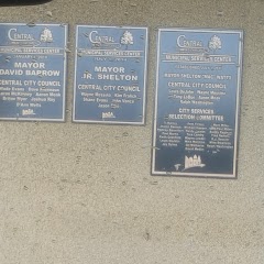
Central City Municipal Services
Transit and Meeting Points
Useful pickup, handoff, or rendezvous points close to Livingston.
Hammond
Baton Rouge, Louisiana
Schriever
McComb
Flight Path Map
This map shows the direct air route between Slidell and Breaux Bridge. Straight-line distance: 126.39 mi (203.4 km).

#1 Slidell
City in Louisiana
| Population | 27,541 |
| Coordinates | 30.2751900, -89.7811700 |
| Altitude | 1 |
| Country | United States |

#2 Breaux Bridge
City in Saint Martin Parish, Louisiana, United States
| Population | 8,047 |
| Coordinates | 30.2735300, -91.8992800 |
| Altitude | 7 |
| Country | United States |
End: Breaux Bridge (-91.89928, 30.27353)
Estimated Travel Time
Distance: 221 km by road
| Speed | Time |
|---|---|
| 30 mph (48.3 km/h) | 04h 34m |
| 40 mph (64.37 km/h) | 03h 25m |
| 50 mph (80.47 km/h) | 02h 44m |
| 60 mph (96.56 km/h) | 02h 17m |
| 70 mph (112.65 km/h) | 01h 57m |
| 80 mph (129 km/h) | 01h 42m |
Fuel, Round Trip and CO2
Estimated fuel cost and emissions for this route.
| Fuel | $/gal | One way | Round trip |
|---|---|---|---|
| Regular gas | $3.79 | $18.33 | $36.66 |
| Mid-grade | $4.26 | $20.61 | $41.23 |
| Premium | $4.63 | $22.38 | $44.77 |
| Diesel | $5.42 | $26.21 | $52.42 |
Assumes 8.3 L/100 km (about 28.3 MPG). CO2 is an estimate and varies by vehicle, fuel blend, traffic, and terrain.
Prices in Louisiana · Jul 17, 2026
Distance to Other Cities
Planning a road trip? See the full trip guide on Trip.ovh — stops, fuel costs, weather, and departure timing.