How far is Sherman, CT from East Norwalk, CT?
The driving distance from Sherman, CT to East Norwalk, CT is about 38.6 miles (62.2 km), with a travel time of about 01h 06m by car.
- The straight-line flight distance is about 33.1 miles (53.3 km).
- For a round trip, plan for roughly 02h 13m of driving time before adding stops, traffic, or weather delays.
- A comfortable departure window is usually 8:00 AM to 10:00 AM EDT.
Reverse, save, or send this route
This route works well as a day trip with time at the destination. Copy the route link, send it to another device, or print a clean version before you head out.
This route works well as a day trip with time at the destination.
Flight Distance
Driving Distance
Gas Cost Calculator
Leave and Arrive Planner
Pick a departure time to see your estimated arrival and same-day return window.
Drive time stays fixed at 01h 06m.
A morning start gives you useful time at the destination and keeps the return out of the late evening.
This departure sits inside the recommended comfort window for the route.
Halfway Point
A useful midpoint for breaks, coffee, or meeting in the middle.
City in Alaska, USA
Route Weather Snapshot
Check the forecast at both ends before you head out.
Mostly Sunny
Driving Route Map
The map below follows the saved road route between Sherman and East Norwalk.
Turn-by-Turn Driving Directions
Step-by-step road directions between Sherman and East Norwalk.
-
1
Start on Route 37 East
75 m · 8 sec · Route 37 East
-
2
Continue on Route 37 Center
2422 ft · 1 min · Route 37 Center
-
3
Turn slight left onto Route 39
8.4 mi · 15 min · Route 39
-
4
Continue on Brush Hill Road
1814 ft · 47 sec · Brush Hill Road
-
5
Turn left onto Pembroke Road
3.1 mi · 6 min · Pembroke Road
-
6
Continue on Padanaram Road
1.2 km · 1 min · Padanaram Road
-
7
Turn right onto Golden Hill Road
1.5 km · 2 min · Golden Hill Road
-
8
Take the ramp slight right toward I 84 West, US 7 South: Newburgh, Norwalk
980 ft · 15 sec
-
9
Merge slight left
1.1 mi · 1 min
-
10
Continue straight
1975 ft · 34 sec
-
11
Keep slight left to continue on US 7 South: Norwalk
15.5 mi · 28 min
-
12
Keep slight right to continue on Danbury Road
1.4 mi · 2 min · Danbury Road
-
13
Continue on Main Avenue
1569 ft · 50 sec · Main Avenue
-
14
Turn left onto West Rocks Road
2.4 mi · 4 min · West Rocks Road
-
15
Continue on France Street
1654 ft · 38 sec · France Street
-
16
Turn left onto North Avenue
157 m · 18 sec · North Avenue
-
17
Continue on East Avenue
1387 ft · 26 sec · East Avenue
-
18
Continue on East Avenue
1 mi · 2 min · East Avenue
-
19
Turn left onto Winfield Street
1784 ft · 38 sec · Winfield Street
-
20
Arrive at your destination
0 m · 1 sec · Winfield Street
Car Route Details
A richer read on the saved driving route between Sherman and East Norwalk.
Turn-heavy local drive
The route has frequent decision points for its length, so lane choice and turn timing will matter more than cruising speed.
US 7 South
Keep slight left to continue on US 7 South: Norwalk
15.5 mi · 00h 28m
Route Summary
A quick read on whether this route feels easy, ambitious, or worth planning around.
A comfortable day-trip route
This route works well as a day trip. You can leave in the morning, spend meaningful time at the destination, and still return the same day.
Mostly Sunny leaving Sherman and Mostly Sunny near East Norwalk.
Trip Questions
Direct answers travelers usually want before committing to the drive.
How long does it take to drive from Sherman to East Norwalk?
The road trip is about 38.6 miles (62.2 km) and usually takes 01h 06m in normal driving conditions.
Is this a same-day trip or an overnight route?
This route works well as a day trip. You can leave in the morning, spend meaningful time at the destination, and still return the same day.
What is the halfway point on this route?
Bethel is a useful midpoint, sitting about 18.7 miles from Sherman and 19.9 miles from East Norwalk.
How much longer is the road route than the straight-line distance?
The direct path is about 33.1 miles (53.3 km), while the road route adds roughly 5.5 extra miles because roads do not follow the straight air line.
When is the best time to leave for this route?
A good departure window is usually 8:00 AM to 10:00 AM EDT. If you want a more comfortable same-day return, try to leave by 4:16 PM EDT.
How much will gas cost for this route?
Using about 28.3 MPG, regular gas is estimated at $5.37 one way or $10.73 round trip. Estimated CO2 is about 12.1 kg one way.
What should you check before leaving?
Before you leave, expect Mostly Sunny around Sherman and Mostly Sunny near East Norwalk.
Stop Ideas Near Bethel
Useful break, food, and waypoint ideas within about 15 miles of the route midpoint.

Danbury Fair
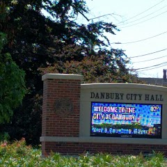
Danbury City Hall
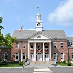
Edmond Town Hall
Transit and Meeting Points
Useful pickup, handoff, or rendezvous points close to Bethel.
Bridgeport
Stamford Transportation Center
Union Station
Croton–Harmon station
Flight Path Map
This map shows the direct air route between Sherman and East Norwalk. Straight-line distance: 33.11 mi (53.28 km).

#1 Sherman
Town in Fairfield County, Connecticut, United States
| Population | 3,610 |
| Coordinates | 41.5792600, -73.4956800 |
| Altitude | 141 |
| Country | United States |

#2 East Norwalk
A census-designated place in Norwalk, Connecticut.
| Population | 84,530 |
| Coordinates | 41.1056500, -73.3984500 |
| Altitude | 10 |
| Country | United States |
End: Winfield Street (-73.398332, 41.105494)
Estimated Travel Time
Distance: 62 km by road
| Speed | Time |
|---|---|
| 30 mph (48.3 km/h) | 01h 17m |
| 40 mph (64.37 km/h) | 00h 57m |
| 50 mph (80.47 km/h) | 00h 46m |
| 60 mph (96.56 km/h) | 00h 38m |
| 70 mph (112.65 km/h) | 00h 33m |
| 80 mph (129 km/h) | 00h 28m |
Fuel, Round Trip and CO2
Estimated fuel cost and emissions for this route.
| Fuel | $/gal | One way | Round trip |
|---|---|---|---|
| Regular gas | $3.95 | $5.37 | $10.73 |
| Mid-grade | $4.46 | $6.06 | $12.12 |
| Premium | $4.86 | $6.61 | $13.21 |
| Diesel | $6.00 | $8.16 | $16.31 |
Assumes 8.3 L/100 km (about 28.3 MPG). CO2 is an estimate and varies by vehicle, fuel blend, traffic, and terrain.
Prices in Connecticut · Jun 19, 2026
Distance to Other Cities
Planning a road trip? See the full trip guide on Trip.ovh — stops, fuel costs, weather, and departure timing.