How far is Rochester, MN from Saint Cloud, MN?
The driving distance from Rochester, MN to Saint Cloud, MN is about 152.3 miles (245.1 km), with a travel time of about 03h 03m by car.
- The straight-line flight distance is about 134.9 miles (217.1 km).
- For a round trip, plan for roughly 06h 07m of driving time before adding stops, traffic, or weather delays.
- A comfortable departure window is usually 6:00 AM to 8:00 AM CDT.
Reverse, save, or send this route
This drive is better planned with a longer stop or an overnight stay. Copy the route link, send it to another device, or print a clean version before you head out.
This drive is better planned with a longer stop or an overnight stay.
Flight Distance
Driving Distance
Gas Cost Calculator
Leave and Arrive Planner
Pick a departure time to see your estimated arrival and same-day return window.
Drive time stays fixed at 03h 03m.
An early departure helps you fit a real stop into the day without turning the return into a late-night drive.
You are leaving earlier than the recommended window, which gives you extra margin for breaks and traffic.
Halfway Point
A useful midpoint for breaks, coffee, or meeting in the middle.
The second most populous city in Minnesota and the center of the Minneapolis-Saint Paul metropolitan area.
Route Weather Snapshot
Check the forecast at both ends before you head out.
Sunny
Driving Route Map
The map below follows the saved road route between Rochester and Saint Cloud.
Turn-by-Turn Driving Directions
Step-by-step road directions between Rochester and Saint Cloud.
-
1
Start on 5th Avenue Southwest
123 m · 16 sec · 5th Avenue Southwest
-
2
Turn right onto 3rd Street Southwest
869 ft · 27 sec · 3rd Street Southwest
-
3
Turn right onto 7th Avenue Southwest
123 m · 14 sec · 7th Avenue Southwest
-
4
Turn left onto 2nd Street Southwest
1.2 km · 2 min · 2nd Street Southwest
-
5
Turn right onto 17th Avenue Southwest
46 m · 4 sec · 17th Avenue Southwest
-
6
Keep slight left to continue on US 52 North, US 63 North, US 14 West
1042 ft · 25 sec
-
7
Merge slight left
1719 ft · 25 sec
-
8
Continue straight
16.5 mi · 19 min
-
9
Continue straight
9.1 mi · 11 min
-
10
Continue straight
39.8 mi · 46 min
-
11
Keep slight right to continue on US 52 North: Saint Paul
9.4 mi · 12 min
-
12
Keep slight right
2755 ft · 1 min
-
13
Merge slight left
1000 ft · 15 sec
-
14
Take the exit slight right toward I 35E North, US 10 West
5.1 mi · 7 min
-
15
Keep slight right to continue on US 10 West, I 694 West, I 694 East
1620 ft · 20 sec
-
16
Continue on I 694 West, US 10 West
18.5 mi · 23 min
-
17
Continue on I-94 W
17.1 mi · 19 min · I-94 W
-
18
Keep slight right to continue on MnRoad Mainline
28.6 mi · 31 min · MnRoad Mainline
-
19
Take the exit slight right toward CR 7, CR 75: Saint Augusta, Saint Cloud
1752 ft · 43 sec
-
20
Keep slight left
67 m · 6 sec
-
21
Turn right onto Roosevelt Road
3.1 mi · 5 min · Roosevelt Road
-
22
Turn right onto 22nd Street South
39 m · 7 sec · 22nd Street South
-
23
Turn left onto 11th Avenue South
2729 ft · 1 min · 11th Avenue South
-
24
Turn right onto 15th Street South
630 ft · 22 sec · 15th Street South
-
25
At the end of the road, turn left onto 9th Avenue South
1.4 km · 2 min · 9th Avenue South
-
26
Continue on 10th Avenue South
1530 ft · 50 sec · 10th Avenue South
-
27
Turn right onto 1st Street North
541 ft · 29 sec · 1st Street North
-
28
At the end of the road, turn left onto Courthouse Square
82 m · 12 sec · Courthouse Square
-
29
Arrive at your destination
0 m · 1 sec · Courthouse Square
Car Route Details
A richer read on the saved driving route between Rochester and Saint Cloud.
Highway-focused drive
Most of the mileage stays on named highways, so the important moments are ramps, exits, merges, and the final local approach.
US 52 North
Continue straight
39.8 mi · 00h 46m
Route Summary
A quick read on whether this route feels easy, ambitious, or worth planning around.
A longer out-and-back drive
This is still possible in one day, but it becomes a long driving day. Leaving early and planning your stop window matters more here.
Sunny leaving Rochester and Sunny near Saint Cloud.
Trip Questions
Direct answers travelers usually want before committing to the drive.
How long does it take to drive from Rochester to Saint Cloud?
The road trip is about 152.3 miles (245.1 km) and usually takes 03h 03m in normal driving conditions.
Is this a same-day trip or an overnight route?
This is still possible in one day, but it becomes a long driving day. Leaving early and planning your stop window matters more here.
What is the halfway point on this route?
Saint Paul is a useful midpoint, sitting about 76.1 miles from Rochester and 76.2 miles from Saint Cloud.
How much longer is the road route than the straight-line distance?
The direct path is about 134.9 miles (217.1 km), while the road route adds roughly 17.4 extra miles because roads do not follow the straight air line.
When is the best time to leave for this route?
A good departure window is usually 6:00 AM to 8:00 AM CDT. If you want a more comfortable same-day return, try to leave by 10:52 AM CDT.
How much will gas cost for this route?
Using about 28.3 MPG, regular gas is estimated at $19.17 one way or $38.33 round trip. Estimated CO2 is about 47.7 kg one way.
What should you check before leaving?
Before you leave, expect Sunny around Rochester and Sunny near Saint Cloud.
Stop Ideas Near Saint Paul
Useful break, food, and waypoint ideas within about 15 miles of the route midpoint.

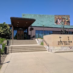
Minneapolis City Hall
City of Bloomington
Mall of America®
Transit and Meeting Points
Useful pickup, handoff, or rendezvous points close to Saint Paul.
Saint Paul Union Depot
Red Wing station
Menomonie, WI
St. Cloud
Flight Path Map
This map shows the direct air route between Rochester and Saint Cloud. Straight-line distance: 134.89 mi (217.09 km).

#1 Rochester
City in Minnesota, United States of America
| Population | 1,909 |
| Coordinates | 44.0216300, -92.4699000 |
| Altitude | 312 |
| Country | United States |
#2 Saint Cloud
City in Minnesota
| Population | 68,510 |
| Coordinates | 45.5608000, -94.1624900 |
| Altitude | 314 |
| Country | United States |
End: Saint Cloud (-94.16249, 45.5608)
Estimated Travel Time
Distance: 245 km by road
| Speed | Time |
|---|---|
| 30 mph (48.3 km/h) | 05h 04m |
| 40 mph (64.37 km/h) | 03h 48m |
| 50 mph (80.47 km/h) | 03h 02m |
| 60 mph (96.56 km/h) | 02h 32m |
| 70 mph (112.65 km/h) | 02h 10m |
| 80 mph (129 km/h) | 01h 54m |
Fuel, Round Trip and CO2
Estimated fuel cost and emissions for this route.
| Fuel | $/gal | One way | Round trip |
|---|---|---|---|
| Regular gas | $3.57 | $19.17 | $38.33 |
| Mid-grade | $3.92 | $21.06 | $42.11 |
| Premium | $4.39 | $23.59 | $47.17 |
| Diesel | $4.86 | $26.12 | $52.24 |
Assumes 8.3 L/100 km (about 28.3 MPG). CO2 is an estimate and varies by vehicle, fuel blend, traffic, and terrain.
Prices in Minnesota · Jul 14, 2026
Distance to Other Cities
Planning a road trip? See the full trip guide on Trip.ovh — stops, fuel costs, weather, and departure timing.