How far is Rayville, LA from Baton Rouge, LA?
The driving distance from Rayville, LA to Baton Rouge, LA is about 167 miles (268.7 km), with a travel time of about 02h 57m by car.
- The straight-line flight distance is about 144.5 miles (232.5 km).
- For a round trip, plan for roughly 05h 54m of driving time before adding stops, traffic, or weather delays.
- A comfortable departure window is usually 8:00 AM to 10:00 AM CDT.
Reverse, save, or send this route
This route works well as a day trip with time at the destination. Copy the route link, send it to another device, or print a clean version before you head out.
This route works well as a day trip with time at the destination.
Flight Distance
Driving Distance
Gas Cost Calculator
Leave and Arrive Planner
Pick a departure time to see your estimated arrival and same-day return window.
Drive time stays fixed at 02h 57m.
A morning start gives you useful time at the destination and keeps the return out of the late evening.
You are leaving earlier than the recommended window, which gives you extra margin for breaks and traffic.
Halfway Point
A useful midpoint for breaks, coffee, or meeting in the middle.
Largest city and the parish seat of Concordia Parish, Louisiana, United States
Route Weather Snapshot
Check the forecast at both ends before you head out.
Chance Showers And Thunderstorms
Chance Showers And Thunderstorms then Showers And Thunderstorms Likely
Driving Route Map
The map below follows the saved road route between Rayville and Baton Rouge.
Turn-by-Turn Driving Directions
Step-by-step road directions between Rayville and Baton Rouge.
-
1
Start on Harrison Street
1174 ft · 29 sec · Harrison Street
-
2
Turn left onto North Julia Street
1.2 mi · 2 min · North Julia Street
-
3
Enter the roundabout and take exit 2 toward South Julia Street
48 m · 3 sec · South Julia Street
-
4
Exit the roundabout onto South Julia Street
45.2 mi · 53 min · South Julia Street
-
5
Continue on State Rte 15
18.2 mi · 21 min · State Rte 15
-
6
Continue on East Wallace Boulevard
1.6 mi · 2 min · East Wallace Boulevard
-
7
Continue straight
11.5 mi · 13 min
-
8
Keep slight right
526 ft · 14 sec
-
9
Merge slight left onto Seargent Prentiss Drive
79.3 mi · 1 hr 34 min · Seargent Prentiss Drive
-
10
Take the exit straight toward I 110 South: Baton Rouge
2467 ft · 48 sec
-
11
Continue on Martin Luther King, Jr. Memorial Freeway
2.5 mi · 3 min · Martin Luther King, Jr. Memorial Freeway
-
12
Continue on Martin Luther King Jr Memorial Freeway
5.4 mi · 7 min · Martin Luther King Jr Memorial Freeway
-
13
Take the exit slight left toward LA 73: Government Street, River Center, Downtown
1124 ft · 30 sec
-
14
Turn right onto Government Street
2602 ft · 1 min · Government Street
-
15
Arrive at your destination
0 m · 1 sec · Government Street
Car Route Details
A richer read on the saved driving route between Rayville and Baton Rouge.
Interchange-aware route
The drive includes several ramps, exits, or merges, so checking the next few maneuvers before busy interchanges is useful.
Seargent Prentiss Drive
Merge slight left onto Seargent Prentiss Drive
79.3 mi · 01h 34m
Route Summary
A quick read on whether this route feels easy, ambitious, or worth planning around.
A comfortable day-trip route
This route works well as a day trip. You can leave in the morning, spend meaningful time at the destination, and still return the same day.
Chance Showers And Thunderstorms leaving Rayville and Chance Showers And Thunderstorms then Showers And Thunderstorms Likely near Baton Rouge.
Trip Questions
Direct answers travelers usually want before committing to the drive.
How long does it take to drive from Rayville to Baton Rouge?
The road trip is about 167 miles (268.7 km) and usually takes 02h 57m in normal driving conditions.
Is this a same-day trip or an overnight route?
This route works well as a day trip. You can leave in the morning, spend meaningful time at the destination, and still return the same day.
What is the halfway point on this route?
Vidalia is a useful midpoint, sitting about 83.4 miles from Rayville and 83.6 miles from Baton Rouge.
How much longer is the road route than the straight-line distance?
The direct path is about 144.5 miles (232.5 km), while the road route adds roughly 22.5 extra miles because roads do not follow the straight air line.
When is the best time to leave for this route?
A good departure window is usually 8:00 AM to 10:00 AM CDT. If you want a more comfortable same-day return, try to leave by 12:36 PM CDT.
How much will gas cost for this route?
Using about 28.3 MPG, regular gas is estimated at $22.31 one way or $44.61 round trip. Estimated CO2 is about 52.3 kg one way.
What should you check before leaving?
Before you leave, expect Chance Showers And Thunderstorms around Rayville and Chance Showers And Thunderstorms then Showers And Thunderstorms Likely near Baton Rouge.
Stop Ideas Near Vidalia
Useful break, food, and waypoint ideas within about 15 miles of the route midpoint.
Transit and Meeting Points
Useful pickup, handoff, or rendezvous points close to Vidalia.
Brookhaven
Vicksburg, MS
McComb
Hazlehurst station
Flight Path Map
This map shows the direct air route between Rayville and Baton Rouge. Straight-line distance: 144.46 mi (232.49 km).

#1 Rayville
City in Louisiana, United States of America
| Population | 3,436 |
| Coordinates | 32.4773600, -91.7548500 |
| Altitude | 25 |
| Country | United States |
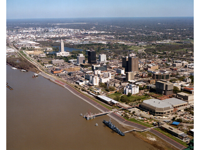
#2 Baton Rouge
The capital of Louisiana.
| Population | 219,052 |
| Coordinates | 30.4433200, -91.1874700 |
| Altitude | 14 |
| Country | United States |
End: Government Street (-91.18751, 30.443332)
Estimated Travel Time
Distance: 269 km by road
| Speed | Time |
|---|---|
| 30 mph (48.3 km/h) | 05h 33m |
| 40 mph (64.37 km/h) | 04h 10m |
| 50 mph (80.47 km/h) | 03h 20m |
| 60 mph (96.56 km/h) | 02h 46m |
| 70 mph (112.65 km/h) | 02h 23m |
| 80 mph (129 km/h) | 02h 04m |
Fuel, Round Trip and CO2
Estimated fuel cost and emissions for this route.
| Fuel | $/gal | One way | Round trip |
|---|---|---|---|
| Regular gas | $3.79 | $22.31 | $44.61 |
| Mid-grade | $4.26 | $25.09 | $50.17 |
| Premium | $4.63 | $27.24 | $54.48 |
| Diesel | $5.42 | $31.89 | $63.79 |
Assumes 8.3 L/100 km (about 28.3 MPG). CO2 is an estimate and varies by vehicle, fuel blend, traffic, and terrain.
Prices in Louisiana · Jul 14, 2026
Distance to Other Cities
Planning a road trip? See the full trip guide on Trip.ovh — stops, fuel costs, weather, and departure timing.