How far is Olympia, WA from Kent, WA?
Fastest route
The distance between Olympia, Washington and Kent, Washington is approximately 48.9 miles (78.7 kilometers). The fastest route is via I-5 N and WA-167 N, with a travel time of about 53 minutes.
Directions
To travel from Olympia to Kent, follow these directions:
- Head north on Capitol Way S toward 11th Ave SW.
- Turn right onto Union Ave SE.
- Use the 2nd lane from the right to turn right onto Plum St SE.
- Keep left to stay on Plum St SE.
- Continue on I-5 N.
- Take the WA-512 E exit toward Puyallup.
- Merge onto WA-512 E.
- Use any lane to merge onto WA-167 N toward WA-410 E/Seattle/Yakima.
- Take the WA-516/Willis St exit toward Des Moines.
- Continue on Willis St.
- Take 4th Ave S to W Smith St.
- Turn right onto Willis St.
- Keep left to stay on Willis St.
- At the traffic circle, take the 3rd exit.
- Turn right onto W Smith St.
Tips & Suggestions
- 🚗 Plan your trip during off-peak hours to avoid heavy traffic.
- ⛽ Make sure to fuel up your vehicle before starting the journey.
- 📱 Use a navigation app or GPS device to help you stay on the correct route.
- 🚧 Stay alert for any road construction or detours along the way.
- 🍴 Pack some snacks and water for the journey to stay refreshed.
Reverse, save, or send this route
This route works well as a day trip with time at the destination. Copy the route link, send it to another device, or print a clean version before you head out.
This route works well as a day trip with time at the destination.
Flight Distance
Driving Distance
Gas Cost Calculator
Leave and Arrive Planner
Pick a departure time to see your estimated arrival and same-day return window.
Drive time stays fixed at 00h 54m.
A morning start gives you useful time at the destination and keeps the return out of the late evening.
You are leaving earlier than the recommended window, which gives you extra margin for breaks and traffic.
Halfway Point
A useful midpoint for breaks, coffee, or meeting in the middle.
The most populous city in Pierce County, Washington.
Route Weather Snapshot
Check the forecast at both ends before you head out.
Showers And Thunderstorms Likely
Chance Showers And Thunderstorms
Driving Route Map
The map below follows the saved road route between Olympia and Kent.
Turn-by-Turn Driving Directions
Step-by-step road directions between Olympia and Kent.
-
1
Start on Capitol Way South
121 m · 12 sec · Capitol Way South
-
2
Turn right onto Union Avenue Southeast
2292 ft · 1 min · Union Avenue Southeast
-
3
Turn right onto Plum Street Southeast
835 ft · 19 sec · Plum Street Southeast
-
4
Take the ramp straight
1.1 km · 1 min
-
5
Merge slight left
27.3 mi · 34 min
-
6
Keep slight right
8.2 mi · 10 min
-
7
Take the exit slight right toward WA 18 East: Auburn, Muckleshoot Reservation
2644 ft · 1 min
-
8
Merge slight left onto State Route 18
2.4 mi · 3 min · State Route 18
-
9
Take the exit slight right toward WA 167 North: Kent, Renton
988 ft · 24 sec
-
10
Keep slight right to continue on WA 167 North: Kent, Renton
2850 ft · 1 min
-
11
Merge slight left onto Valley Freeway
4.8 mi · 6 min · Valley Freeway
-
12
Take the exit slight right toward WA 516: Des Moines, Willis Street
1449 ft · 45 sec
-
13
Turn right onto West Willis Street
1314 ft · 30 sec · West Willis Street
-
14
Enter the roundabout and take exit 3 toward 4th Avenue South
73 m · 5 sec · 4th Avenue South
-
15
Exit the roundabout onto 4th Avenue South
984 ft · 32 sec · 4th Avenue South
-
16
Turn right onto West Gowe Street
643 ft · 25 sec · West Gowe Street
-
17
Turn left onto 2nd Avenue South
3 m · 1 sec · 2nd Avenue South
-
18
Arrive at your destination
0 m · 1 sec · 2nd Avenue South
Car Route Details
A richer read on the saved driving route between Olympia and Kent.
Turn-heavy local drive
The route has frequent decision points for its length, so lane choice and turn timing will matter more than cruising speed.
Plum Street Southeast
Merge slight left
27.3 mi · 00h 34m
Route Summary
A quick read on whether this route feels easy, ambitious, or worth planning around.
A comfortable day-trip route
This route works well as a day trip. You can leave in the morning, spend meaningful time at the destination, and still return the same day.
Showers And Thunderstorms Likely leaving Olympia and Chance Showers And Thunderstorms near Kent.
Trip Questions
Direct answers travelers usually want before committing to the drive.
How long does it take to drive from Olympia to Kent?
The road trip is about 48.8 miles (78.5 km) and usually takes 00h 54m in normal driving conditions.
Is this a same-day trip or an overnight route?
This route works well as a day trip. You can leave in the morning, spend meaningful time at the destination, and still return the same day.
What is the halfway point on this route?
Lakewood is a useful midpoint, sitting about 23.1 miles from Olympia and 25.7 miles from Kent.
How much longer is the road route than the straight-line distance?
The direct path is about 39.2 miles (63.1 km), while the road route adds roughly 9.6 extra miles because roads do not follow the straight air line.
When is the best time to leave for this route?
A good departure window is usually 8:00 AM to 10:00 AM PDT. If you want a more comfortable same-day return, try to leave by 4:42 PM PDT.
How much will gas cost for this route?
Using about 28.3 MPG, regular gas is estimated at $9.00 one way or $18.00 round trip. Estimated CO2 is about 15.3 kg one way.
What should you check before leaving?
Before you leave, expect Showers And Thunderstorms Likely around Olympia and Chance Showers And Thunderstorms near Kent.
Stop Ideas Near Lakewood
Useful break, food, and waypoint ideas within about 15 miles of the route midpoint.
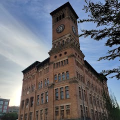
Old City Hall Tacoma

City of Puyallup
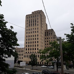
Tacoma City Hall
Transit and Meeting Points
Useful pickup, handoff, or rendezvous points close to Lakewood.
Tacoma Dome Station
Centennial Station
Tukwila station
King Street Station
Flight Path Map
This map shows the direct air route between Olympia and Kent. Straight-line distance: 39.23 mi (63.13 km).

#1 Olympia
The capital of Washington state.
| Population | 53,620 |
| Coordinates | 47.0378700, -122.9007000 |
| Altitude | 29 |
| Country | United States |

#2 Kent
The fourth most populous city in King County, Washington.
| Population | 130,676 |
| Coordinates | 47.3809300, -122.2348400 |
| Altitude | 13 |
| Country | United States |
End: West Gowe Street (-122.234827, 47.380901)
Estimated Travel Time
Distance: 78 km by road
| Speed | Time |
|---|---|
| 30 mph (48.3 km/h) | 01h 37m |
| 40 mph (64.37 km/h) | 01h 13m |
| 50 mph (80.47 km/h) | 00h 58m |
| 60 mph (96.56 km/h) | 00h 48m |
| 70 mph (112.65 km/h) | 00h 41m |
| 80 mph (129 km/h) | 00h 36m |
Fuel, Round Trip and CO2
Estimated fuel cost and emissions for this route.
| Fuel | $/gal | One way | Round trip |
|---|---|---|---|
| Regular gas | $5.23 | $9.00 | $18.00 |
| Mid-grade | $5.57 | $9.58 | $19.15 |
| Premium | $5.77 | $9.93 | $19.85 |
| Diesel | $5.47 | $9.40 | $18.81 |
Assumes 8.3 L/100 km (about 28.3 MPG). CO2 is an estimate and varies by vehicle, fuel blend, traffic, and terrain.
Prices in Washington · Jun 10, 2026
Distance to Other Cities
Planning a road trip? See the full trip guide on Trip.ovh — stops, fuel costs, weather, and departure timing.