How far is Oakland, CA from Pacheco, CA?
The driving distance from Oakland, CA to Pacheco, CA is about 22.4 miles (36 km), with a travel time of about 00h 29m by car.
- The straight-line flight distance is about 16.3 miles (26.3 km).
- For a round trip, plan for roughly 00h 59m of driving time before adding stops, traffic, or weather delays.
- A comfortable departure window is usually 7:00 AM to 7:00 PM PDT.
Reverse, save, or send this route
This is an easy same-day return drive. Copy the route link, send it to another device, or print a clean version before you head out.
This is an easy same-day return drive.
Flight Distance
Driving Distance
Gas Cost Calculator
Leave and Arrive Planner
Pick a departure time to see your estimated arrival and same-day return window.
Drive time stays fixed at 00h 29m.
This is a short drive, so your comfort window is wide. Traffic and current weather matter more than the clock.
This departure sits inside the recommended comfort window for the route.
Halfway Point
A useful midpoint for breaks, coffee, or meeting in the middle.
City in California
Route Weather Snapshot
Check the forecast at both ends before you head out.
Sunny
Driving Route Map
The map below follows the saved road route between Oakland and Pacheco.
Turn-by-Turn Driving Directions
Step-by-step road directions between Oakland and Pacheco.
-
1
Start on 14th Street
2014 ft · 1 min · 14th Street
-
2
Turn right onto Castro Street
1078 ft · 35 sec · Castro Street
-
3
Take the ramp straight toward I 980 East, CA 24: Walnut Creek, San Francisco, Hayward
1047 ft · 26 sec
-
4
Merge slight left onto John B. Williams Freeway
1975 ft · 26 sec · John B. Williams Freeway
-
5
Continue on Grove Shafter Freeway
4.5 mi · 5 min · Grove Shafter Freeway
-
6
Keep slight left to continue on Grove Shafter Freeway
874 ft · 13 sec · Grove Shafter Freeway
-
7
Continue on Caldecott Tunnel
9.8 mi · 11 min · Caldecott Tunnel
-
8
Merge slight right onto Senator Daniel E Boatwright Highway
3.8 mi · 4 min · Senator Daniel E Boatwright Highway
-
9
Keep slight left to continue on Senator Daniel E Boatwright Highway
1.3 mi · 1 min · Senator Daniel E Boatwright Highway
-
10
Take the exit slight right toward Concord Avenue, Burnett Avenue
978 ft · 24 sec
-
11
Continue on Burnett Avenue
752 ft · 20 sec · Burnett Avenue
-
12
Turn left onto Diamond Boulevard
701 ft · 29 sec · Diamond Boulevard
-
13
At the end of the road, turn left onto Concord Avenue
605 ft · 21 sec · Concord Avenue
-
14
Continue on Concord Avenue
573 ft · 11 sec · Concord Avenue
-
15
Turn right onto Contra Costa Boulevard
2364 ft · 1 min · Contra Costa Boulevard
-
16
Continue on Pacheco Boulevard
610 ft · 20 sec · Pacheco Boulevard
-
17
Turn left onto Center Avenue
2284 ft · 1 min · Center Avenue
-
18
Turn right onto Temple Drive
9 m · 1 sec · Temple Drive
-
19
Arrive at your destination
0 m · 1 sec · Temple Drive
Car Route Details
A richer read on the saved driving route between Oakland and Pacheco.
Turn-heavy local drive
The route has frequent decision points for its length, so lane choice and turn timing will matter more than cruising speed.
Caldecott Tunnel
Continue on Caldecott Tunnel
9.82 mi · 00h 11m
Route Summary
A quick read on whether this route feels easy, ambitious, or worth planning around.
A short regional drive
This route is short enough to handle as a quick errand, commute, or easy same-day return without much planning overhead.
Sunny leaving Oakland and Sunny near Pacheco.
Trip Questions
Direct answers travelers usually want before committing to the drive.
How long does it take to drive from Oakland to Pacheco?
The road trip is about 22.4 miles (36 km) and usually takes 00h 29m in normal driving conditions.
Is this a same-day trip or an overnight route?
This route is short enough to handle as a quick errand, commute, or easy same-day return without much planning overhead.
What is the halfway point on this route?
Lafayette is a useful midpoint, sitting about 11.2 miles from Oakland and 11.2 miles from Pacheco.
How much longer is the road route than the straight-line distance?
The direct path is about 16.3 miles (26.3 km), while the road route adds roughly 6.1 extra miles because roads do not follow the straight air line.
When is the best time to leave for this route?
A good departure window is usually 7:00 AM to 7:00 PM PDT. If you want a more comfortable same-day return, try to leave by 7:30 PM PDT.
How much will gas cost for this route?
Using about 28.3 MPG, regular gas is estimated at $4.56 one way or $9.12 round trip. Estimated CO2 is about 7 kg one way.
What should you check before leaving?
Before you leave, expect Sunny around Oakland and Sunny near Pacheco.
Stop Ideas Near Lafayette
Useful break, food, and waypoint ideas within about 15 miles of the route midpoint.
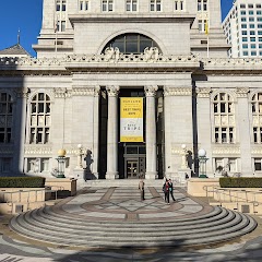
Frank H. Ogawa Plaza

Alameda City Clerk's Office
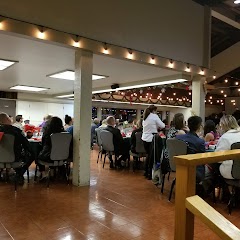
Old Maple Hall
Transit and Meeting Points
Useful pickup, handoff, or rendezvous points close to Lafayette.
Martinez station
Emeryville station
Oakland Coliseum station
Berkeley station
Flight Path Map
This map shows the direct air route between Oakland and Pacheco. Straight-line distance: 16.34 mi (26.29 km).

#1 Oakland
The third most populous city in California, Oakland is a major center for business, manufacturing, and culture.
| Population | 424,891 |
| Coordinates | 37.8043700, -122.2708000 |
| Altitude | 13 |
| Country | United States |
#2 Pacheco
Census-designated place in Contra Costa County, California
| Population | 3,685 |
| Coordinates | 37.9835300, -122.0752400 |
| Altitude | 21 |
| Country | United States |
End: Pacheco (-122.07524, 37.98353)
Estimated Travel Time
Distance: 36 km by road
| Speed | Time |
|---|---|
| 30 mph (48.3 km/h) | 00h 44m |
| 40 mph (64.37 km/h) | 00h 33m |
| 50 mph (80.47 km/h) | 00h 26m |
| 60 mph (96.56 km/h) | 00h 22m |
| 70 mph (112.65 km/h) | 00h 19m |
| 80 mph (129 km/h) | 00h 16m |
Fuel, Round Trip and CO2
Estimated fuel cost and emissions for this route.
| Fuel | $/gal | One way | Round trip |
|---|---|---|---|
| Regular gas | $5.77 | $4.56 | $9.12 |
| Mid-grade | $6.07 | $4.79 | $9.58 |
| Premium | $6.24 | $4.93 | $9.86 |
| Diesel | $7.57 | $5.98 | $11.96 |
Assumes 8.3 L/100 km (about 28.3 MPG). CO2 is an estimate and varies by vehicle, fuel blend, traffic, and terrain.
Prices in California · Jul 23, 2026
Distance to Other Cities
Planning a road trip? See the full trip guide on Trip.ovh — stops, fuel costs, weather, and departure timing.