How far is McMinnville, OR from Keizer, OR?
Fastest route
The distance between McMinnville, Oregon (97128) and Keizer, Oregon is approximately 29.0 miles (46.7 kilometers), and it takes around 39 minutes to travel there.
Directions
- Head south on NE Evans St toward NE 3rd St.
- Turn left at the 3rd cross street onto SE 1st St.
- Turn right onto SE 3 Mile Lane, Southeast Three Mile Ln.
- Continue onto NE Three Mile Ln.
- Turn right onto Hopewell Rd NW.
- Follow OR-221 S to Front St NE in Salem.
- Use the left lane to merge onto OR-22 E/Center St Bridge via the ramp to Salem.
- Use the left lane to continue on Center St NE.
- Use the left lane to take the OR-99E BUS ramp to Keizer/Portland.
- Turn right onto OR-99EBUS N/Front St NE.
- Follow Front St NE to Liberty St NE.
- Turn left onto Front St NE.
- Turn right onto Tryon Ave NE.
- Take River Rd N to Dietz Ave NE in Keizer.
- Turn left onto Liberty St NE.
- Liberty St NE turns right and becomes River Rd N.
- Use any lane to turn right onto Broadway St/River Rd N.
- Continue to follow River Rd N.
- Pass by Domino's Pizza (on the right in 1.1 mi).
- Turn right onto Dietz Ave NE.
Tips & Suggestions
- 🚗 Be sure to check the traffic conditions before starting your journey to find the fastest route.
- 🍴 Consider packing some snacks or stopping for a meal along the way to make the trip more enjoyable.
- ⛽ Don't forget to fill up your gas tank before leaving, especially if it's a long journey.
- 📱 Use a reliable navigation app or GPS device to help you navigate the route smoothly.
- 🕑 Plan ahead and allow some extra time for unexpected delays or rest breaks during the trip.
Reverse, save, or send this route
This route works well as a day trip with time at the destination. Copy the route link, send it to another device, or print a clean version before you head out.
This route works well as a day trip with time at the destination.
Flight Distance
Driving Distance
Gas Cost Calculator
Leave and Arrive Planner
Pick a departure time to see your estimated arrival and same-day return window.
Drive time stays fixed at 00h 45m.
A morning start gives you useful time at the destination and keeps the return out of the late evening.
This departure sits inside the recommended comfort window for the route.
Halfway Point
A useful midpoint for breaks, coffee, or meeting in the middle.
City in Oregon, USA
Route Weather Snapshot
Check the forecast at both ends before you head out.
Slight Chance Rain Showers then Mostly Sunny
Partly Sunny
Driving Route Map
The map below follows the saved road route between McMinnville and Keizer.
Turn-by-Turn Driving Directions
Step-by-step road directions between McMinnville and Keizer.
-
1
Start on Northeast 3rd Street
32 m · 10 sec · Northeast 3rd Street
-
2
Turn left onto Northeast Adams Street
158 m · 17 sec · Northeast Adams Street
-
3
Turn left onto Northeast 1st Street
1.1 km · 1 min · Northeast 1st Street
-
4
Turn right onto Southeast Three Mile Lane
2665 ft · 45 sec · Southeast Three Mile Lane
-
5
Take the ramp straight
14 m · 1 sec
-
6
Keep slight left
1961 ft · 54 sec
-
7
Merge slight left onto Southeast Three Mile Lane
2.2 mi · 3 min · Southeast Three Mile Lane
-
8
Continue on Southeast Dayton Bypass
2.6 mi · 4 min · Southeast Dayton Bypass
-
9
Take the exit slight right
1199 ft · 33 sec
-
10
Turn straight onto 3rd Street
2189 ft · 37 sec · 3rd Street
-
11
Turn straight onto Southeast Dayton Highway
8.7 mi · 13 min · Southeast Dayton Highway
-
12
Continue on Southeast Salem-Dayton Highway
1554 ft · 31 sec · Southeast Salem-Dayton Highway
-
13
Turn left onto Wheatland Road Northwest
1.1 mi · 2 min · Wheatland Road Northwest
-
14
Continue on Wheatland Ferry
152 m · 2 min · Wheatland Ferry
-
15
Continue on Matheny Road North
2745 ft · 55 sec · Matheny Road North
-
16
Turn right onto Wheatland Road North
6 mi · 10 min · Wheatland Road North
-
17
Turn slight right
65 m · 5 sec
-
18
Turn right onto River Road North
1.6 mi · 3 min · River Road North
-
19
Turn left
38 m · 9 sec
-
20
Keep slight left
63 m · 15 sec
-
21
Arrive at your destination
0 m · 1 sec
Car Route Details
A richer read on the saved driving route between McMinnville and Keizer.
Turn-heavy local drive
The route has frequent decision points for its length, so lane choice and turn timing will matter more than cruising speed.
Southeast Dayton Highway
Turn straight onto Southeast Dayton Highway
8.65 mi · 00h 13m
Route Summary
A quick read on whether this route feels easy, ambitious, or worth planning around.
A comfortable day-trip route
This route works well as a day trip. You can leave in the morning, spend meaningful time at the destination, and still return the same day.
Slight Chance Rain Showers then Mostly Sunny leaving McMinnville and Partly Sunny near Keizer.
Trip Questions
Direct answers travelers usually want before committing to the drive.
How long does it take to drive from McMinnville to Keizer?
The road trip is about 33.1 miles (53.2 km) and usually takes 00h 45m in normal driving conditions.
Is this a same-day trip or an overnight route?
This route works well as a day trip. You can leave in the morning, spend meaningful time at the destination, and still return the same day.
What is the halfway point on this route?
Dayton is a useful midpoint, sitting about 12.8 miles from McMinnville and 20.3 miles from Keizer.
How much longer is the road route than the straight-line distance?
The direct path is about 17.4 miles (28 km), while the road route adds roughly 15.7 extra miles because roads do not follow the straight air line.
When is the best time to leave for this route?
A good departure window is usually 8:00 AM to 10:00 AM PDT. If you want a more comfortable same-day return, try to leave by 4:58 PM PDT.
How much will gas cost for this route?
Using about 28.3 MPG, regular gas is estimated at $5.74 one way or $11.49 round trip. Estimated CO2 is about 10.3 kg one way.
What should you check before leaving?
Before you leave, expect Slight Chance Rain Showers then Mostly Sunny around McMinnville and Partly Sunny near Keizer.
Stop Ideas Near Dayton
Useful break, food, and waypoint ideas within about 15 miles of the route midpoint.
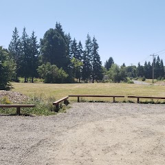
Salem city park
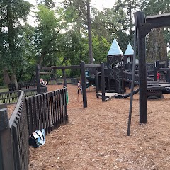
McMinnville Parks and Recreation Department
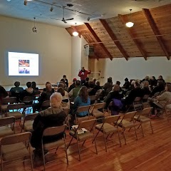
Palmer Creek Lodge Community Event Center
Transit and Meeting Points
Useful pickup, handoff, or rendezvous points close to Dayton.
Woodburn, OR
Salem station
Oregon City station
Portland, OR
Flight Path Map
This map shows the direct air route between McMinnville and Keizer. Straight-line distance: 17.37 mi (27.96 km).

#1 McMinnville
City in Oregon, USA
| Population | 35,185 |
| Coordinates | 45.2101200, -123.1987200 |
| Altitude | 47 |
| Country | United States |

#2 Keizer
City in Oregon, USA
| Population | 39,593 |
| Coordinates | 44.9901200, -123.0262100 |
| Altitude | 42 |
| Country | United States |
End: Dietz Avenue Northeast (-123.026207, 44.990264)
Estimated Travel Time
Distance: 53 km by road
| Speed | Time |
|---|---|
| 30 mph (48.3 km/h) | 01h 06m |
| 40 mph (64.37 km/h) | 00h 49m |
| 50 mph (80.47 km/h) | 00h 39m |
| 60 mph (96.56 km/h) | 00h 33m |
| 70 mph (112.65 km/h) | 00h 28m |
| 80 mph (129 km/h) | 00h 24m |
Fuel, Round Trip and CO2
Estimated fuel cost and emissions for this route.
| Fuel | $/gal | One way | Round trip |
|---|---|---|---|
| Regular gas | $4.95 | $5.74 | $11.49 |
| Mid-grade | $5.34 | $6.19 | $12.38 |
| Premium | $5.57 | $6.46 | $12.91 |
| Diesel | $6.37 | $7.38 | $14.77 |
Assumes 8.3 L/100 km (about 28.3 MPG). CO2 is an estimate and varies by vehicle, fuel blend, traffic, and terrain.
Prices in Oregon · Aug 01, 2026
Distance to Other Cities
Planning a road trip? See the full trip guide on Trip.ovh — stops, fuel costs, weather, and departure timing.