How far is Lewiston, ME from Guilford, ME?
The driving distance from Lewiston, ME to Guilford, ME is about 103.8 miles (167 km), with a travel time of about 02h 09m by car.
- The straight-line flight distance is about 84.4 miles (135.8 km).
- For a round trip, plan for roughly 04h 18m of driving time before adding stops, traffic, or weather delays.
- A comfortable departure window is usually 8:00 AM to 10:00 AM EDT.
Reverse, save, or send this route
This route works well as a day trip with time at the destination. Copy the route link, send it to another device, or print a clean version before you head out.
This route works well as a day trip with time at the destination.
Flight Distance
Driving Distance
Gas Cost Calculator
Leave and Arrive Planner
Pick a departure time to see your estimated arrival and same-day return window.
Drive time stays fixed at 02h 09m.
A morning start gives you useful time at the destination and keeps the return out of the late evening.
You are leaving earlier than the recommended window, which gives you extra margin for breaks and traffic.
Halfway Point
A useful midpoint for breaks, coffee, or meeting in the middle.
Town in Somerset County, Maine, United States
Route Weather Snapshot
Check the forecast at both ends before you head out.
Slight Chance Showers And Thunderstorms then Mostly Sunny
Sunny then Isolated Showers And Thunderstorms
Driving Route Map
The map below follows the saved road route between Lewiston and Guilford.
Turn-by-Turn Driving Directions
Step-by-step road directions between Lewiston and Guilford.
-
1
Start on the route
21 m · 10 sec
-
2
Turn sharp left onto Sabattus Street
38 m · 6 sec · Sabattus Street
-
3
Turn right onto Main Street
4.4 mi · 5 min · Main Street
-
4
Continue on Route 202
3.8 mi · 4 min · Route 202
-
5
Continue on US Route 202
1 km · 43 sec · US Route 202
-
6
Continue on Route 202
2.7 mi · 3 min · Route 202
-
7
Continue on US Route 202
1.5 km · 1 min · US Route 202
-
8
Continue on US 202
12.8 mi · 15 min · US 202
-
9
Continue on Western Avenue
2.5 mi · 3 min · Western Avenue
-
10
Turn left
127 m · 8 sec
-
11
Turn straight onto Old Winthrop Road
2906 ft · 1 min · Old Winthrop Road
-
12
Turn right onto Macomber Avenue
1194 ft · 54 sec · Macomber Avenue
-
13
Turn left onto Western Avenue
145 m · 9 sec · Western Avenue
-
14
Take the exit slight right toward I 95: Portland, Waterville, Bangor
1829 ft · 44 sec
-
15
Keep slight right to continue on I-95 North: Waterville, Bangor
805 ft · 20 sec
-
16
Merge slight left
46.9 mi · 51 min
-
17
Take the exit slight right toward ME 11, ME 100: Newport, Dexter
1611 ft · 46 sec
-
18
Keep slight left
34 m · 7 sec
-
19
Turn left onto Ox Bow Road
2725 ft · 1 min · Ox Bow Road
-
20
Enter the roundabout and take exit 2 toward Moosehead Trail
37 m · 2 sec · Moosehead Trail
-
21
Exit the roundabout onto Moosehead Trail
4.7 mi · 7 min · Moosehead Trail
-
22
Continue on Newport Road
1.4 mi · 2 min · Newport Road
-
23
Continue on Dexter Road
5.9 mi · 9 min · Dexter Road
-
24
Continue on Corinna Road
1.2 mi · 2 min · Corinna Road
-
25
Continue on Spring Street
1 mi · 2 min · Spring Street
-
26
Continue on Church Street
1027 ft · 22 sec · Church Street
-
27
Turn left onto Dam Street
89 m · 5 sec · Dam Street
-
28
Continue on Grove Street
3106 ft · 53 sec · Grove Street
-
29
Continue on Crockett Road
128 m · 7 sec · Crockett Road
-
30
Turn straight onto North Dexter Road
9.4 mi · 14 min · North Dexter Road
-
31
Continue on Main Street
1.4 km · 1 min · Main Street
-
32
Continue on Bridge Street
626 ft · 19 sec · Bridge Street
-
33
Turn left onto Water Street
1.2 mi · 2 min · Water Street
-
34
Arrive at your destination
0 m · 1 sec · Water Street
Car Route Details
A richer read on the saved driving route between Lewiston and Guilford.
Highway-focused drive
Most of the mileage stays on named highways, so the important moments are ramps, exits, merges, and the final local approach.
I-95 North
Merge slight left
46.9 mi · 00h 51m
Route Summary
A quick read on whether this route feels easy, ambitious, or worth planning around.
A comfortable day-trip route
This route works well as a day trip. You can leave in the morning, spend meaningful time at the destination, and still return the same day.
Slight Chance Showers And Thunderstorms then Mostly Sunny leaving Lewiston and Sunny then Isolated Showers And Thunderstorms near Guilford.
Trip Questions
Direct answers travelers usually want before committing to the drive.
How long does it take to drive from Lewiston to Guilford?
The road trip is about 103.8 miles (167 km) and usually takes 02h 09m in normal driving conditions.
Is this a same-day trip or an overnight route?
This route works well as a day trip. You can leave in the morning, spend meaningful time at the destination, and still return the same day.
What is the halfway point on this route?
Fairfield is a useful midpoint, sitting about 51.9 miles from Lewiston and 51.9 miles from Guilford.
How much longer is the road route than the straight-line distance?
The direct path is about 84.4 miles (135.8 km), while the road route adds roughly 19.4 extra miles because roads do not follow the straight air line.
When is the best time to leave for this route?
A good departure window is usually 8:00 AM to 10:00 AM EDT. If you want a more comfortable same-day return, try to leave by 2:12 PM EDT.
How much will gas cost for this route?
Using about 28.3 MPG, regular gas is estimated at $14.44 one way or $28.88 round trip. Estimated CO2 is about 32.5 kg one way.
What should you check before leaving?
Before you leave, expect Slight Chance Showers And Thunderstorms then Mostly Sunny around Lewiston and Sunny then Isolated Showers And Thunderstorms near Guilford.
Stop Ideas Near Fairfield
Useful break, food, and waypoint ideas within about 15 miles of the route midpoint.

Waterville Opera House
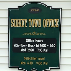
Sidney Town Hall
Transit and Meeting Points
Useful pickup, handoff, or rendezvous points close to Fairfield.
Augusta, ME
Belfast, Maine
Searsport, Maine
Waldoboro, Maine
Flight Path Map
This map shows the direct air route between Lewiston and Guilford. Straight-line distance: 84.36 mi (135.77 km).

#1 Lewiston
City in Androscoggin County, Maine, United States
| Population | 36,226 |
| Coordinates | 44.1003500, -70.2147800 |
| Altitude | 66 |
| Country | United States |

#2 Guilford
Town in Maine, United States
| Population | 1,468 |
| Coordinates | 45.1689400, -69.3844900 |
| Altitude | 115 |
| Country | United States |
End: Guilford (-69.38449, 45.16894)
Estimated Travel Time
Distance: 167 km by road
| Speed | Time |
|---|---|
| 30 mph (48.3 km/h) | 03h 27m |
| 40 mph (64.37 km/h) | 02h 35m |
| 50 mph (80.47 km/h) | 02h 04m |
| 60 mph (96.56 km/h) | 01h 43m |
| 70 mph (112.65 km/h) | 01h 28m |
| 80 mph (129 km/h) | 01h 17m |
Fuel, Round Trip and CO2
Estimated fuel cost and emissions for this route.
| Fuel | $/gal | One way | Round trip |
|---|---|---|---|
| Regular gas | $3.95 | $14.44 | $28.88 |
| Mid-grade | $4.46 | $16.31 | $32.63 |
| Premium | $4.86 | $17.78 | $35.56 |
| Diesel | $6.00 | $21.95 | $43.90 |
Assumes 8.3 L/100 km (about 28.3 MPG). CO2 is an estimate and varies by vehicle, fuel blend, traffic, and terrain.
Prices in Maine · Jul 15, 2026
Distance to Other Cities
Planning a road trip? See the full trip guide on Trip.ovh — stops, fuel costs, weather, and departure timing.